|
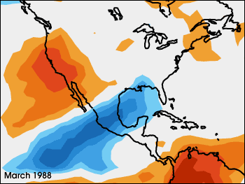
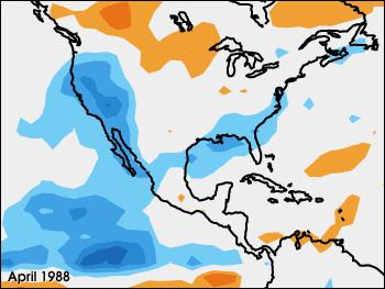
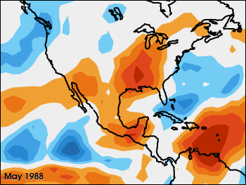
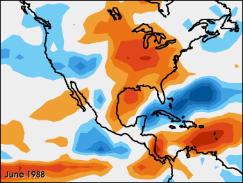
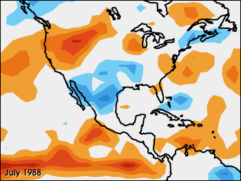
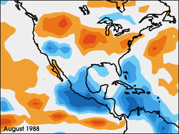
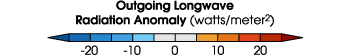
This Earth Radiation Budget Experiment (ERBE) satellite image, representing a composite for the months of March through August 1988, shows where more or less heat is escaping from the top of the atmosphere relative to average values for that month. Called "outgoing longwave radiation anomaly," the red pixels show where more than usual heat is escaping and blue pixels show where less than usual heat is escaping. The blue regions correspond to areas of thick cloud cover (cloud tops are much colder than the surface), whereas red areas correspond to where there was very little cloud cover. The higher values in these regions is due to the heat radiating off the warm surface. In 16 of the last 19 dry events in North America, there were "negative" (blue) anomalies in the eastern Pacific off the west coast of Central America, and "positive" (red) anomalies in the Gulf of Mexico that preceded the onset of drought in the Great Plains by about 10 days. (Images courtesy Takmeng Wong, NASA LaRC) |
alert message