The Earth Observatory has published its last Image of the Day on this website. Please join us on our new home at science.nasa.gov/earth/earth-observatory.
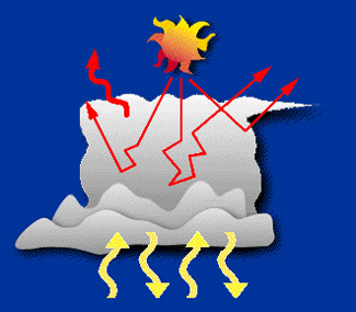 In contrast to both of the cloud categories previously discussed are deep convective clouds, typified by cumulonimbus clouds. A cumulonimbus cloud can be many kilometers thick, with a base near the Earth's surface and a top frequently reaching an altitude of 10 km (33,000 feet), and sometimes much higher. Because cumulonimbus cloud tops are high and cold, the energy radiated to outer space is lower than it would be without the cloud (the cloud greenhouse forcing is large). But because they also are very thick, they reflect much of the solar energy back to space (their cloud albedo forcing is also large); hence, with the reduced shortwave radiation to be absorbed, there is essentially no excess radiation to be trapped. As a consequence, overall, the cloud greenhouse and albedo forcings almost balance, and the overall effect of cumulonimbus clouds is neutral-neither warming nor cooling. | |
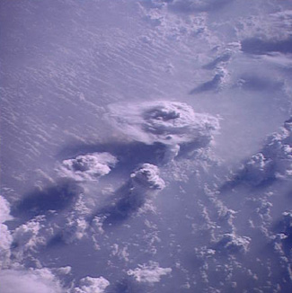 Image from the Space Shuttle Challenger on April 7, 1983 showing cumulonimbus clouds. | |
|
next: Radiation
return: Clouds & Radiation |
