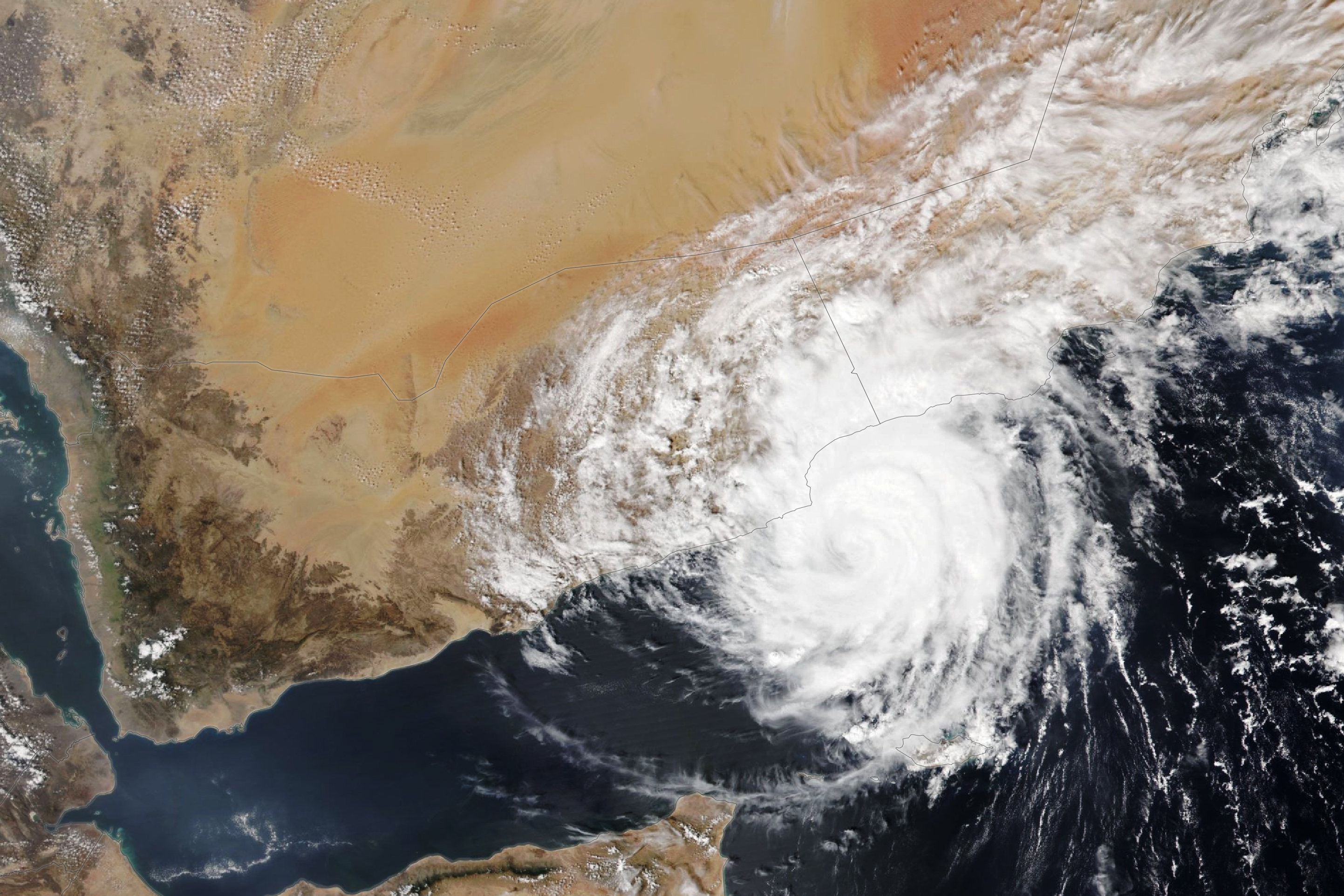
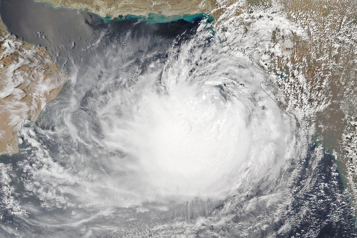
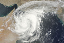
Tropical Cyclone Tej approached the Arabian Peninsula on October 23, 2023, where it was expected to produce heavy rain in desert regions of eastern Yemen and western Oman. The VIIRS (Visible Infrared Imaging Radiometer Suite) sensor on the NOAA-20 satellite acquired this image of the storm at approximately 10:00 Universal Time on October 23 as it began to move over land.
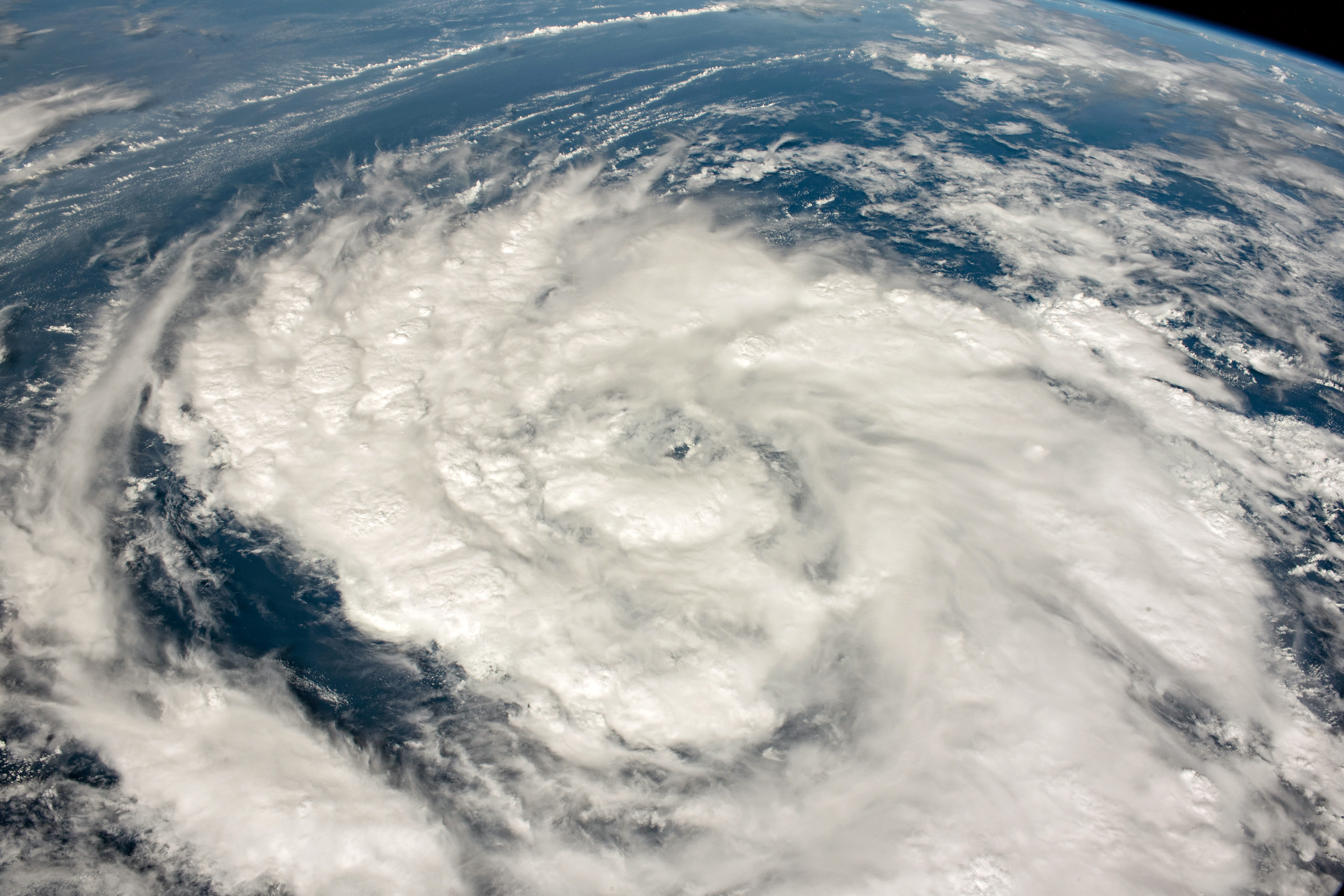
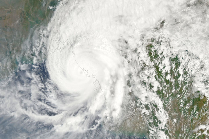
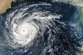
Around the time of this image, wind speeds measured 135 kilometers (85 miles) per hour, making it the equivalent of a category 1 hurricane. The cyclone reached its peak intensity as a category 3-equivalent storm on October 22, before progressively weakening as it neared land. An astronaut aboard the International Space Station captured a photo (below) of Typhoon Tej as it spun across the Arabian Sea on October 20.
The storm is forecast to weaken rapidly upon making landfall and meeting the cool, dry air over the peninsula. Still, it threatens to drop up to 500 millimeters (20 inches) of rain in some locations. In a region that receives less than 100 millimeters (4 inches) on average in an entire year, intense rains can cause damaging flash floods. In southern Yemen, authorities declared a state of emergency and suspended schools. In Salalah, Oman, the port was temporarily shut down and a hospital evacuated because of the storm, according to news reports.
Until recently, cyclones in the Arabian Sea have been relatively infrequent, but warming sea surface temperatures are likely contributing to an increase in intense cyclonic storms there. In the past decade, several cyclones with hurricane-like intensity have made landfall on the Arabian Peninsula, including Hikaa (2019), Mekunu (2018), and Chapala (2015).
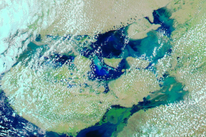
The UN Food and Agriculture Organization has indicated that Cyclone Tej could leave in its wake favorable breeding conditions for desert locusts. The agricultural pests thrive after periods of rainfall produce ephemeral lakes and bursts of vegetation in otherwise arid environments. Recent outbreaks of locusts in eastern Africa and the Arabian Peninsula have suspected links to cyclones in that region.
NASA Earth Observatory image by Lauren Dauphin, using VIIRS data from NASA EOSDIS LANCE, GIBS/Worldview, and the Joint Polar Satellite System (JPSS). Astronaut photograph ISS070-E-7632 was acquired on October 20, 2023, with a Nikon D5 digital camera using an 28 millimeter lens and is provided by the ISS Crew Earth Observations Facility and the Earth Science and Remote Sensing Unit, Johnson Space Center. The image was taken by a member of the Expedition 70 crew. The image has been cropped and enhanced to improve contrast, and lens artifacts have been removed. The International Space Station Program supports the laboratory as part of the ISS National Lab to help astronauts take pictures of Earth that will be of the greatest value to scientists and the public, and to make those images freely available on the Internet. Additional images taken by astronauts and cosmonauts can be viewed at the NASA/JSC Gateway to Astronaut Photography of Earth. Story by Lindsey Doermann.


