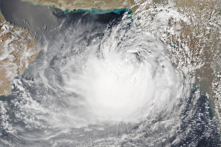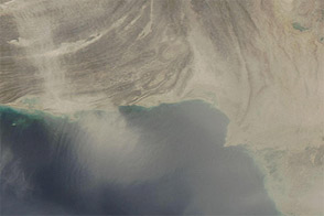
After stirring in the Arabian Sea for over a week, Cyclone Biparjoy neared the coastline of western India and southern Pakistan in June 2023. The Visible Infrared Imaging Radiometer Suite (VIIRS) on the NOAA-20 satellite acquired this natural-color image of the storm on June 14, a day before it was forecast to make landfall.
The long-lived cyclone had wind speeds of 129 kilometers (80 miles) per hour on June 14, making it a category 1 storm on the Saffir-Simpson Wind Scale. The storm had spent eight days in the Arabian Sea, generally moving slowly north, until it took a turn to the east on June 14.
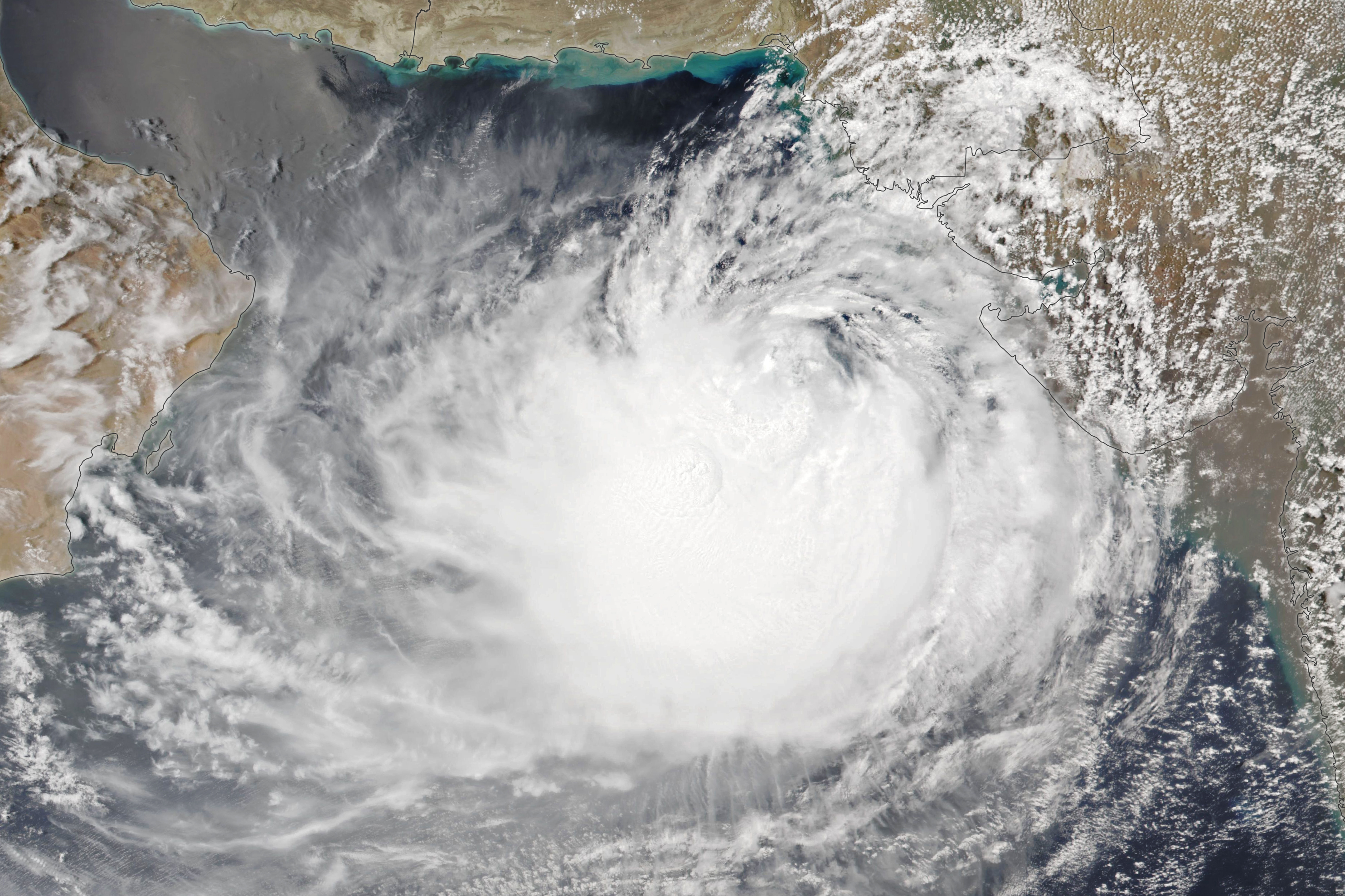
Biparjoy was forecast to make landfall around 5:30 p.m. local time on June 15 as a “very severe cyclonic storm” with a sustained wind speed of 125 to 135 kilometers per hour, impacting India’s western state of Gujarat and the densely populated city of Karachi in Pakistan. In preparation for landfall, more than 30,000 people and 200,000 animals had reportedly been evacuated to higher ground.
Strong winds, rain, and high tides from the cyclone have already lashed several regions in western India. Multiple deaths have been reported, including drownings off the coast of Mumbai.
Biparjoy developed into a cyclone in the early morning hours of June 6. According to Roxy Mathew Koll, a climate scientist at the Indian Institute of Tropical Meteorology, sea surface temperatures in the Arabian Sea were 31°C to 32°C in early June, which was 2°C to 4°C above the climatological mean. A rule of thumb among scientists is that ocean temperatures should be above 27°C to sustain a tropical cyclone.
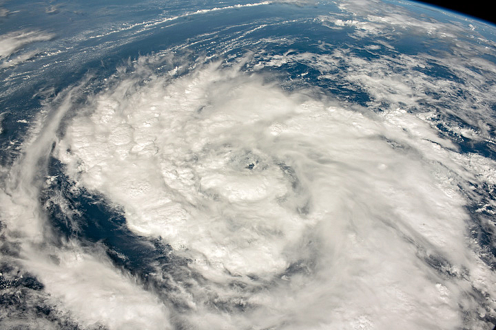
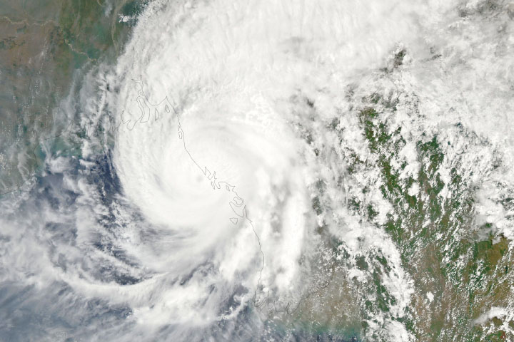
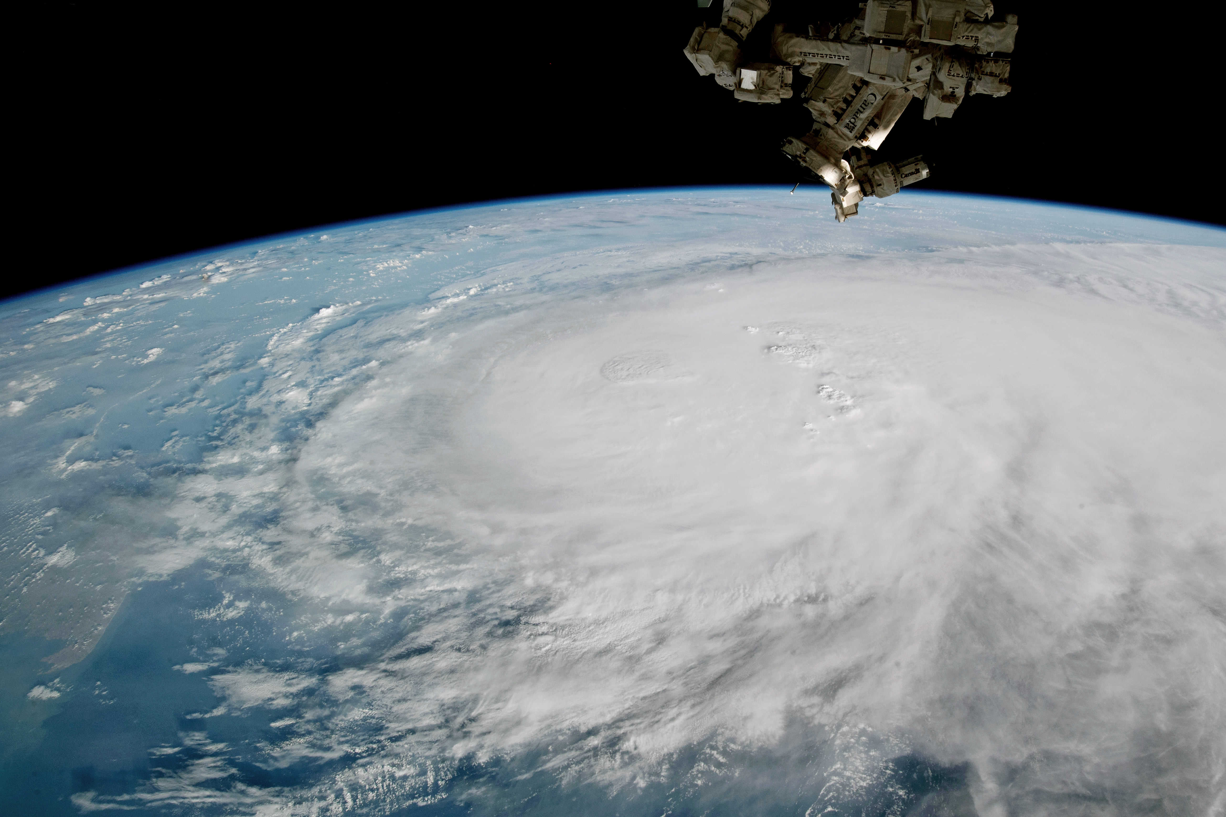
Unusually warm waters helped fuel Biparjoy’s rapid intensification twice in its lifetime. Between June 6 and 7, Biparjoy’s wind speed increased from 55 to 139 kilometers per hour (34 to 86 miles per hour), according to the Joint Typhoon Warning Center (JTWC). The cyclone intensified again between June 9 and 10, when its wind speed increased from 120 to 196 kilometers per hour (75 to 122 miles per hour)—making it a category 3 storm. This windspeed was sustained into June 11, when an astronaut aboard the International Space Station took the photo below.
Warm sea surface temperatures have contributed to the cyclone’s unusually long lifespan. According to India’s Meteorological Department, Biparjoy may become the longest-lived cyclone in the Arabian Sea, overtaking Kyarr in 2019, which lasted nine days and 15 hours. As of June 14, the Arabian Sea sustained Biparjoy for over eight days.
“The reason why Biparjoy has lasted so long is that it is feeding on warm waters in the Arabian Sea,” said Raghu Murtugudde, a visiting professor at the Indian Institute of Technology Bombay, who studies the role of oceans in tropical climate variability. “Biparjoy is an example of how climate change—especially warming in the upper ocean—is contributing to cyclones moving slower and lasting longer.”
Cyclones in the Arabian Sea are relatively rare, although they are becoming more frequent with rising sea surface temperatures. A 2021 study led by researchers in India found that cyclones over the last four decades have become more frequent and have lasted longer. The researchers found that ocean temperatures were linked to this change.
NASA Earth Observatory image by Lauren Dauphin, using VIIRS data from NASA EOSDIS LANCE, GIBS/Worldview, and the Joint Polar Satellite System (JPSS). Astronaut photograph ISS069-E-20036 was acquired on June 11, 2023, with a Nikon D4 digital camera using an 20 millimeter lens and is provided by the ISS Crew Earth Observations Facility and the Earth Science and Remote Sensing Unit, Johnson Space Center. The image was taken by a member of the Expedition 69 crew. The image has been cropped and enhanced to improve contrast, and lens artifacts have been removed. The International Space Station Program supports the laboratory as part of the ISS National Lab to help astronauts take pictures of Earth that will be of the greatest value to scientists and the public, and to make those images freely available on the Internet. Additional images taken by astronauts and cosmonauts can be viewed at the NASA/JSC Gateway to Astronaut Photography of Earth. Story by Emily Cassidy.