


May 25, 2024
Some 25 of us were up before 6 a.m. to head out on the bus from the hotel to Burlington International Airport to catch the C-130 aircraft, a military transport plane repurposed for NASA fieldwork, to begin our 7-hour flight to Pituffik.
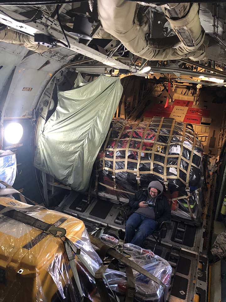
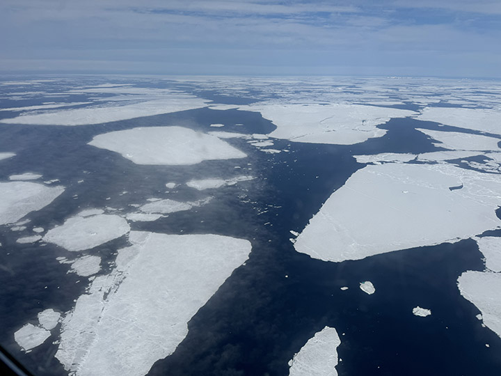
Several mountains of baggage, including scientific instruments and personal luggage, separate us from the less-well-heated economy cabin, which was probably reserved for graduate students, though we are far too collegial a group to check seat assignments. As we head north and east, the landscape out the window is vast, entirely gray-scale, and unforgiving: sea ice with streaks and patches of open water as far as one can see in every direction.
About halfway through the flight, we cross the Arctic Circle. Here the scene is often reduced to pure gray, and one cannot tell what is sea ice, snow, or cloud. This is the challenge we have long faced when attempting to interpret our remote sensing imagery; now, as an early gift of the expedition, I experience it directly.

May 26, 2024
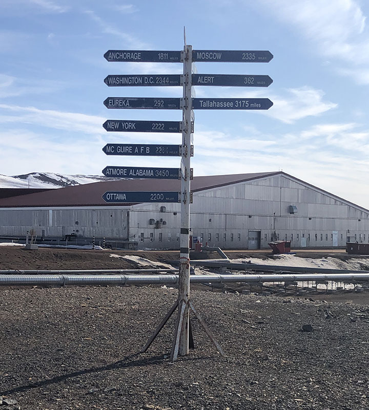
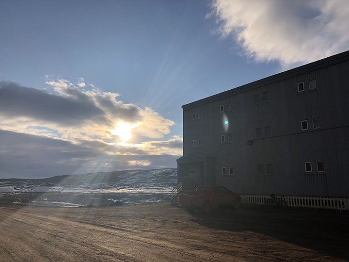
The site is halfway between Washington and Moscow. Most or all of the buildings were prefabricated, brought here by ship in the summer, and mounted on stilts due to the permafrost. Some rough grasses are the only apparent vegetation.
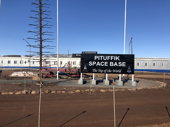
In some ways, the base is well appointed. There is a sports center with an abundance of every conceivable exercise machine, also a tanning machine and a perpetual pool, a huge gym, and a yoga room. There is a recreation center with a movie theater, a lounge area with free apples, tea, and coffee, a game room that is more like an arcade with multiple video machines, and a craft center that has sewing machines (including a state-of-the-art Serger), rock cutting and polishing machines, computer graphics, and printers.
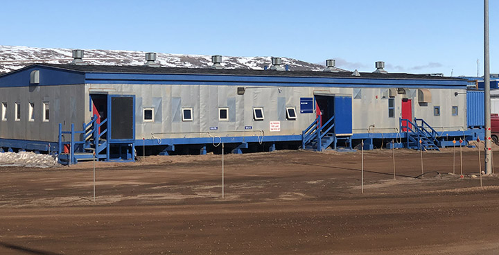
This is a remote place. The site is protected by a thousand kilometers of ice in nearly all directions, and the only ways to get here are by air or by boat for a couple of months of the year, when the sea is not frozen. With full daylight all day and “night,” the times-of-day are marked only by artificial clocks; the natural ones are essentially absent.
May 27, 2024
This was mostly a flight-planning day, getting ready for the first science flight of the campaign. It turned cold, windy, and snow fell today. This was more like what I expected but didn’t experience during the first two days. But now it is sunny again, around 6 p.m., and near-freezing, so there is still standing water on the roadways, and we are past the season when it is safe to walk on the ice-bound bay. The severe environment calls for some specific adaptations.
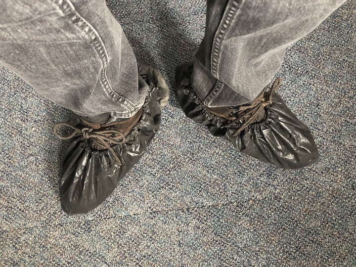
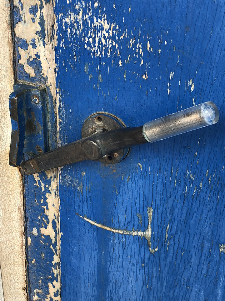
For example, the outer doors have latches that seal upward, so a bear pushing down on the handle will be unable to open the door. The walkways are made of open steel grids, so snow and mud will drip through. Boots are to be brushed before entering buildings, and plastic boot covers are provided in an effort to limit the amount of dirt that is tracked in.
I took a late-night walk. It’s daylight anyway, though overcast, windy, cold, and flurrying. Pretty much what I expected here.
The power went out twice today. Everything goes down, including the internet. I’m trying to keep everything charged, in case it happens again. Today’s weather represents “Condition Alpha” for storm warnings. That means just be on alert, in case things change. Condition Bravo means you cannot go outdoors without a buddy, or drive alone without a radio. Condition Charlie means you can’t walk out at all; there is a base taxi for urgent movement. Condition Delta: shelter in place.
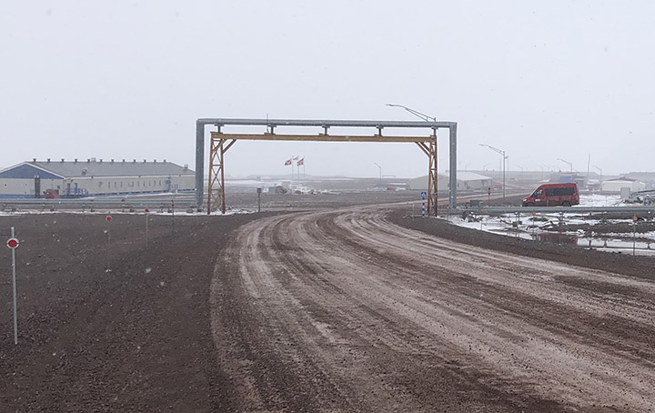
The pipes are all above-ground because of the freeze-thaw cycle that would destroy the pipes. I guess they must be heated and insulated. They cross the road by going overhead.
Car and truck engines must be heated to avoid freezing and cracking. So, many of the buildings have power cords hanging out in front to run electric engine-block heaters. I didn’t take the last picture quite at midnight, but the scene doesn’t change much during the night.
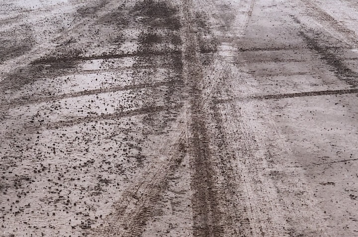
I think I mentioned that it is mud season here. This is no joke. The place has a very industrial feel, and the only place to walk is on the mud roads. I’ve heard it will get worse as the mud deepens, and mosquitoes come out. Something to look forward to…
May 28, 2024
We had our first flight with the P3 today, and it was far better than I had expected. There was a rare case of cloud-free atmosphere over sea ice in one area north of Greenland where some buoys had been deployed, which allowed for both surface ice and aerosol characterization. Also, a nearly 3-hour run at ~500 feet captured aerosol properties over open water along the northern part of Baffin Bay. Among our objectives are learning the sources and properties of aerosols in the Arctic, their evolution as they age, and their impact on clouds. Others are especially interested in the properties of sea ice as it melts. So, this gives us a start on those objectives.
May 29, 2024
The wind is a force of nature. Today it has been blowing at something like 40 miles per hour, with gusts considerably higher. It literally takes your breath away—and this is just Condition Alpha.
Gusts create the sensation of blowing you away. All this under a relatively clear sky, bright sun, just a few clouds. It is somewhat other-worldly to one who has lived a life at lower latitudes. The temperature is only a few degrees below freezing, but the weather today gives new meaning to the term “wind chill.”
June 1, 2024
Today was an official day off, and in particular, a mental health day for the forecasters. Several of the military folks on the base arranged to take a group of us on a hike over the Greenland Ice Cap. There were 15 of us in five trucks. The trip involved a fair amount of driving on gravel roads in trucks—about half the time driving, half hiking – 5 hours total. The hike itself was about 5 or 6 miles, and we walked around and then on the glacier, though we never did find the Starbucks.

In addition to the stark beauty of the rock fields and ice, the sky is unlike anything we normally see at lower latitudes. The surface is cold, and the atmosphere is no colder (and sometimes is even warmer) than the surface, i.e., it is stably stratified—the “warm” air is already up, so there is not a lot of warm air rising and mixing that typically happens when the surface is heated directly by the Sun.

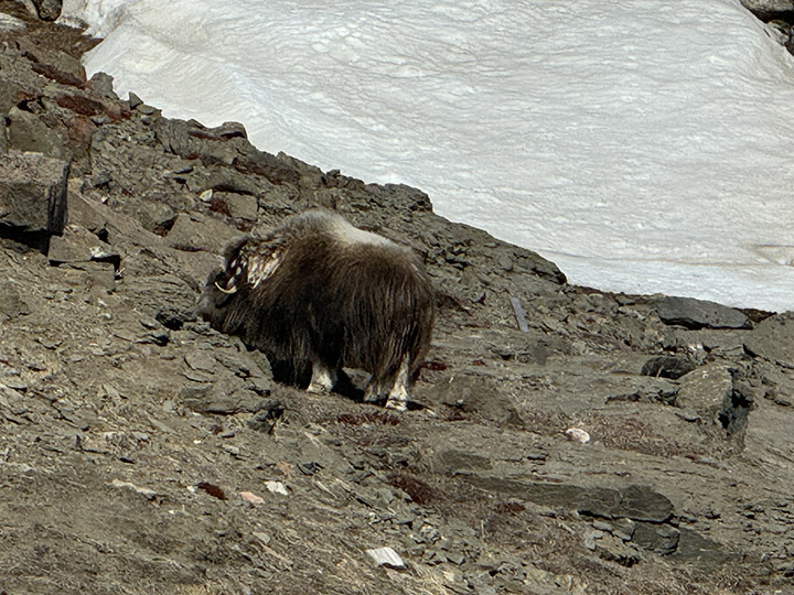
The glaciers have brought an enormous diversity of stones that litter the ground, and every piece of wood here was carried in from somewhere else. There are little clumps of vegetation, just enough to satisfy the appetites of musk oxen.
So far, I’ve seen Arctic fox (no pictures—they disappeared too quickly), musk ox in the distance, Arctic hare, and snow goose. No polar bears—and no complaints about that.
June 7, 2024
This evening I took a long walk out to the ice-bound pier… AND I SAW AN OTTER!!!

June 4, 2024
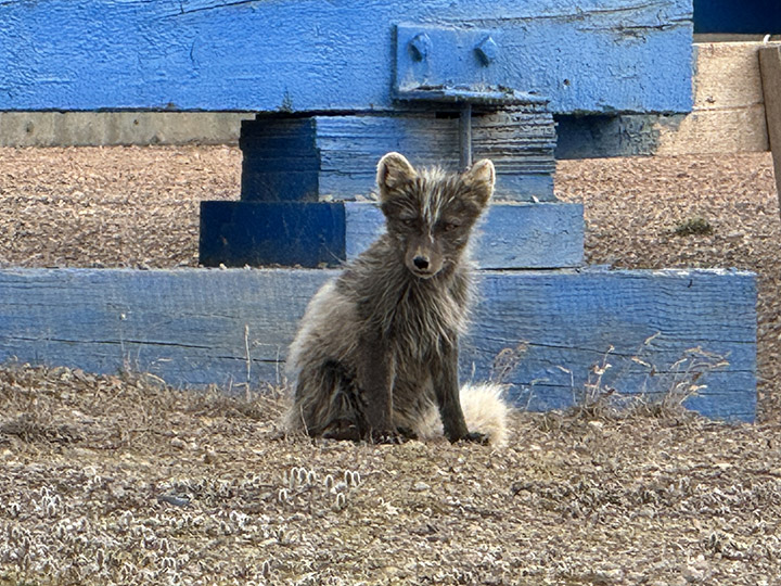
The Arctic foxes are molting. They were very cute when their coats were all white. Now they are losing their winter coats and turning brown. I did see a couple of full white coats, but was too slow to get a photo.
June 8, 2024
The project rented a van, and ten of us went off to climb the Dundas, that imposing rock feature not far from the base, though to get there without walking on thin ice (here the term is not merely a metaphor), one has to drive about 30 minutes over rocky and sometimes quite steep roads around the frozen bay.

The angle of repose is the angle a pile of dry sand (or salt) will make if you dump a bucket of it on the ground. It is generally steep (depends in part on the grain size and shape of the sand particles). Dundas is about 725 feet high; it appears to be the remnant of a glacial moraine—rock pushed here by an advancing ice sheet at least that high, that remained after the ice melted away. It is loose sand and rock, mostly gravel and cobble-sized. The climb up was, frankly, arduous, as there are not a lot of footholds.

The first part was steep enough that going on all fours was necessary in places, and the sand and small rocks would slip easily down the slope as one persevered upward. The final part was up a sheer rock wall that was graced, mercifully, with a sturdy rope. My pictures are lacking for the entire traverse, as all my effort went into the climb itself. I did stop part way up the rock wall to check my life insurance policy.

The view from the top was spectacular, but truthfully, there are so many great vistas in this rugged place that the main reward was accomplishing the ascent itself.
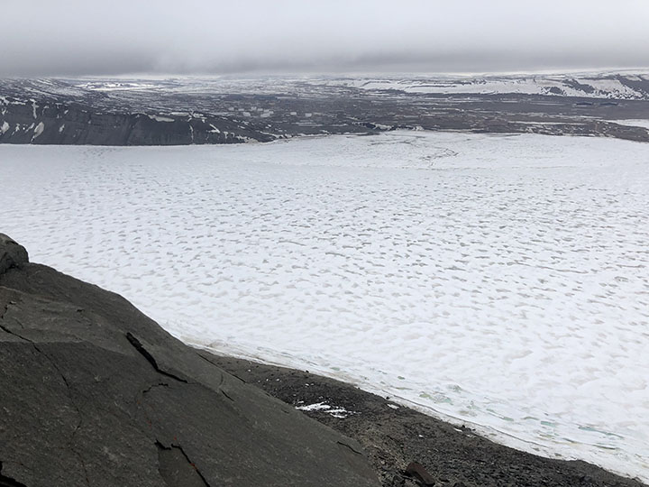
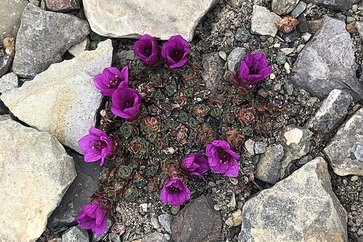
The way down was similarly fraught, except that below the rock wall, I had pretty much no choice but to slide down bit by bit—the loose surface material would give way at every step. So, on my back, lift up my rear, slide a few feet using my boots to stop, and repeat. There was some interesting vegetation on the slope—tiny plants and lichen, which I did photograph. I’m told that some of these plants can be hundreds of years old.
In the distance, we saw some dark spots that the binoculars suggested were seals. (Oh, yes—someone here said that my otter from last night was actually a ring seal; not sure that is authoritative, but…).
June 9, 2024
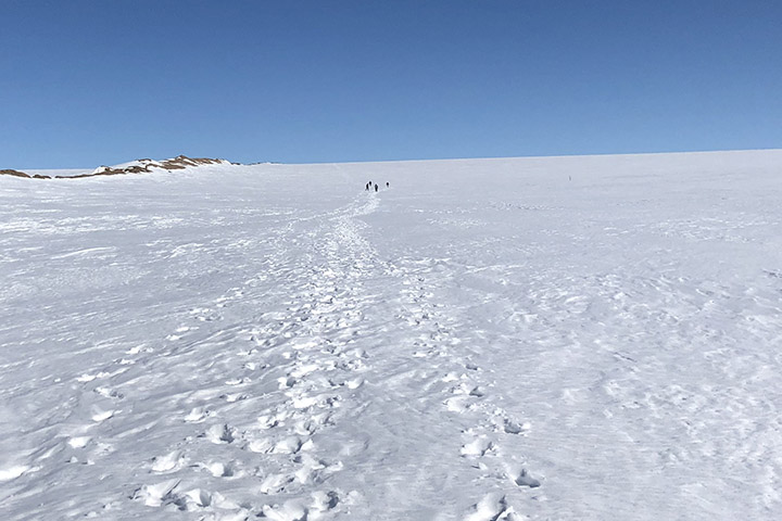
I agreed to join this afternoon’s walk up the edge of the Greenland Ice Sheet.
The slope is moderate by Dundas standards, and the path is completely snow-covered. The walk up is of course uphill, and a steady wind of 30–40 mph (the katabatic wind), with significantly higher gusts, blows off the ice. This guaranteed that however far we got up the ice sheet, we would certainly be able to make it down, either on foot or airborne.

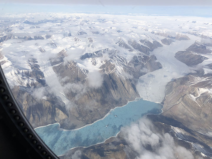
There were pools of water within ice basins at the base. They look a beautiful shade of blue. We saw this in Alaska as well. I think it must be that ice either absorbs all the longer wavelengths, or it preferentially scatters blue, or both. The optics here are stunning, at least to me. Probably because they are unfamiliar.
One way painters provide a sense of distance in a painting is with “atmospherics,” that is, they increasingly blur the edges of more distant objects to account for light scattering by atmospheric gas and aerosols. Mountain climbers experience the opposite, in the thinner atmosphere, remote objects are sharper than they would in everyday experience, so more distant objects appear closer than they actually are. This is true here in Greenland as well, though we are not at a very high elevation along the coast. I expect the phenomenon in this case is due to a very clean atmosphere.
June 11, 2024
Today I got to fly on the P-3. Every satellite scientist should be required to take at least one such flight to see what the Earth is really like. We flew across northern Greenland and over sea ice. In the two weeks since the campaign deployment began, the depth of the sea ice, and the snow upon it, both decreased at those buoys (where it was measured), and, of course, most everywhere else as well.
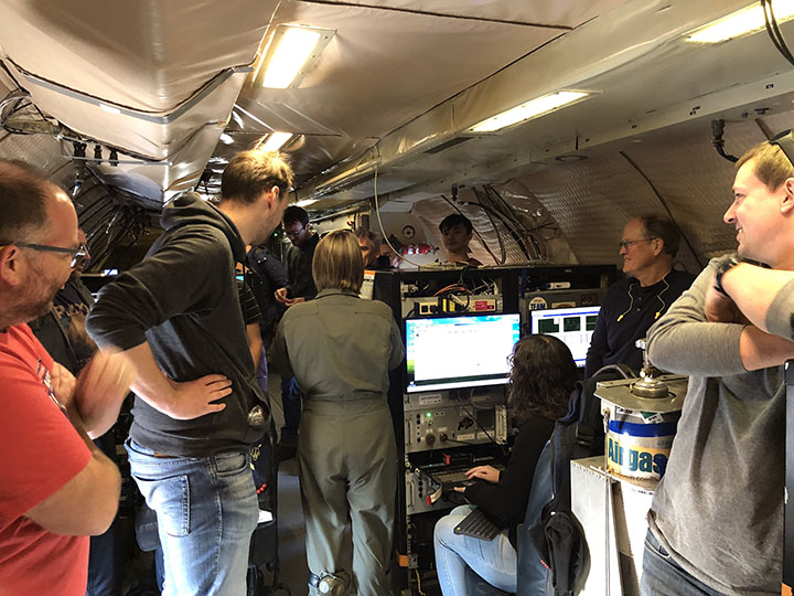
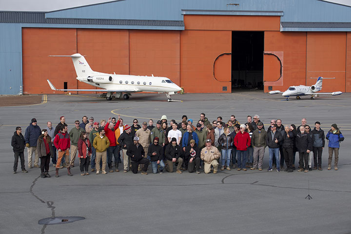
A field campaign is a layered operation. Aircraft flight scientists build, run, and maintain the twenty or so instruments that measure particle composition, gas concentration, cloud properties, surface reflectivity, and upwelling and downwelling energy. They are awake by 4 a.m. to prepare their instruments for flight, worry about power supplies and calibration, then sit on the plane for six or seven hours, noting what they see from their measurements and out the window.

The number of leads (i.e., openings in the ice) has increased in places. We flew at high elevation to survey the area, measure the overall surface topography and reflectance, and sample aerosol layers aloft, then descended to 300 feet above the ice to capture aerosols emanating from the surface. The photos tell an accessible part of the story. The rest must be teased out of the data in the coming months and years. But my ride is over for now—there is an aerosol forecast due tomorrow.
June 12, 2024
It was flurrying this evening, and my walk carried me down toward the pier. But you might be pleased to know, I did not go all the way; several seals have now been seen on the ice at the pier. My otter or seal in the water was the first anyone saw, and although they say it is relatively rare for bears to go near the base, seals are their primary food. I figured, after a long winter hibernation, a bear might not count me as even a light snack, but in consideration that I had already booked my flight home, I turned around before getting very near the water’s edge.
June 14, 2024
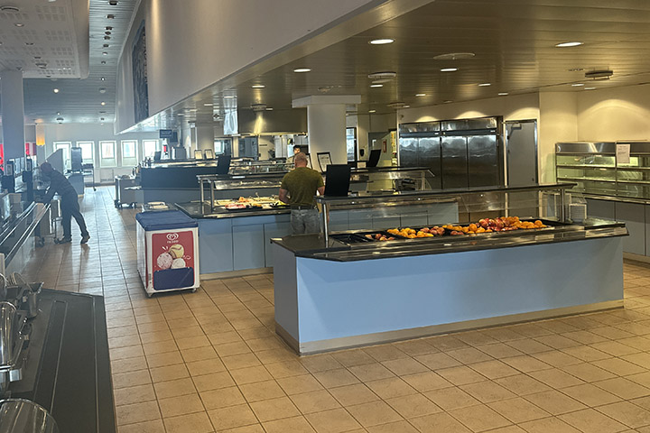
I should say that the food here is okay. Better than I expected. Of course, in such circumstances, it pays to begin with low expectations: hardtack, pemmican, and beef jerky. The cafeteria serves a lot of beef and pork, but there is also chicken, a reasonable salad bar, excellent, fresh bread (the highlight in my opinion), always two of THE three kinds of fruit (apples, oranges, and bananas—so yes, they mix apples and oranges), and of course, Danish, at least in the morning.
In the evening I took a walk, as usual, and ended up in one of the dozens of prefab buildings on the base, with the suggestive label “Heritage Hall.” The door was not locked, and the lights turned on as you entered each room. The place is a sort of museum, a repository for things discarded from the 1950s and 60s.
They have a computer punch-card machine, a vacuum-tube TV set, and a radar scope you will recognize from science-fiction movies. Also some notebooks with photos of the army’s Camp Tuto (now abandoned—only remnants of the airfield remain) and the presumptive city “Camp Century” they built into the ice in the 1950s. The walls flowed at glacial speed but ultimately collapsed.
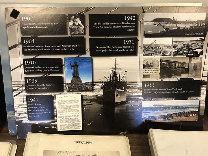
Thule base was established in 1951, succeeding three waves of Inuit who inhabited the area, apparently beginning 4,500 years ago. The most recent came around 900 CE, met the Norse about 100 years later, and were moved to a new village 60 miles to the north in 1953. There is even a Life Magazine cover showing ships delivering material to the base in September 1952.

Ralph Kahn, an emeritus research scientist at NASA’s Goddard Space Flight Center now at the Laboratory for Atmospheric and Space Physics at the University of Colorado Boulder, spent three weeks at Pituffik Space Base in northern Greenland in the summer of 2024. He was one of dozens of scientists who participated in ARCSIX (Arctic Radiation-Cloud Aerosol-Surface Interaction Experiment), a NASA-sponsored field campaign that made detailed observations of clouds and atmospheric particles to better understand the processes that affect the seasonal melting of Arctic sea ice. These excerpts from his emails home to family provide a glimpse of what life was like on one of the world’s most northern scientific outposts in the world. Photos were taken by Kahn or Gary Banzinger, a NASA videographer who also participated in the campaign. Kahn, an atmospheric scientist, worked with colleagues to provide daily aerosol forecasts that were used to help plan flights.
By Ludovic Brucker
After an unexpected phone call from the helicopter pilot on Easter Sunday, Ludo and Clem ended the second season of the Greenland aquifer campaign, with the support of Susan, Rick, Lora, Bear, the weather office, and many others. Thanks all for this Easter bunny.
We still wonder whether our campaign was successful, or fair. For sure, it was a mix of good and tough times.
The pluses, making our campaign a good time:
– We’re back from our field site, healthy and with all our fingers and toes!
– We set up an almost perfect camp, limiting drift considerably.
– Our two tents survived 65-knot winds!
– We had saucisson (dry cured sausage), and cheese for fondue!
– No polar bear smelled our food!
– We collected over 17 miles (28 kilometers) of high-frequency (400 MHz) radar data, including 12 mi (20 km) in one day (equivalent to half a marathon!)
– Along a 1.24-mi (2-km) segment of the 2011 Arctic Circle Traverse, we deployed 5 radars operating at 400, 200, 40, 10, and 5 MHz.
– We installed an intelligent weather station developed by the group at IMAU, in the Netherlands.
– We drilled down to 28 feet (8.5 meters) to record the density and stratigraphy of the ice layers.
– We have GPS taken positions during a week, which will help us calculate the velocity and flow direction of the ice in this basin.
The minuses, making our campaign “different”:
– Ten days of weather delays before the put-in flight to our ice camp location.
– Rick could not make it to the field with us.
– We never had three consecutive half days with weather suitable for work.
– Getting a sore throat from shouting to hear each other less than a meter apart.
– During the one day of great weather, we tried to drive down a pilot tube to install a piezometer in the aquifer. This technique is adapted for ground water found within rocky soils. It was the first attempt to do it in the Greenland firn. Driving the metal pipes in the snow through the ice layers was a nightmare, we had to pound on those pipes really hard to make them go through the thick ice layers and we ended up breaking them. At one point, we thought it was broken slightly deeper than 6 ft below the surface, so we dug a pit down to fix it. Well, it turned out that the broken piece was actually 13 ft down — we spent the only full day of great weather breaking our equipment.
– We ran out of cheese for fondue, and of saucisson.
– Sunscreen was completely useless this season.
The “funny” stuff:
– 30 m/s wind is brutal, though not necessarily hilarious.
– High-wind speed does not make the clock spin faster, only the anemometer.
– Supporting text messages and jokes from our family, colleagues, and office mates.
– Attempting a radar survey with a sled taking off every other gusts.
– Calling the Met Office for a weather forecast: “Hello! Since it’s windy here we are wondering what will happen in the next 36 hours.” “Yes, I can confirm that you are experiencing wind.” “Thanks so much for the confirmation, but there was no room for doubt.” “Oh, but it’s a nice spike on the computer screen! It won’t blow more, but it won’t stop soon. Be careful out there”. Patience with Mother Nature is the #1 fundamental.
– Coastal storms from the East might be our favorite storms on the ice sheet: wind stops, and temperatures increase, but it snows, snows, and snows.
– Sixteen feet of seasonal snow is deep, especially with the top 2 feet of fresh snow becoming harder and harder as they it gets compacted by the wind.
– Excavating 1765 cubic feet of snow between 8pm and 11:30pm (you got to use the weather window whenever you have it.)
– The frost all around our sleeping-bag head every morning.
– The 40 hours laying down in the sleeping bag.
– The melody of the wind on our tents and through the bamboo sticks we stuck around them.
– Using the sleeping bag to store hats, balaclavas, gloves, socks, boot insulation, contact lenses, tooth paste, sun screen (it was nice to dream about the day we would need it), batteries, head lamp, snacks, water bottles (ideally liquid and not spilling.)
– The pilot phone call at 8 am on Easter Sunday: “Good morning, happy Easter! Don’t go for a ski strip today, we will come pick you up in 3-4 hours!”
This was the synopsis of our 13-day adventure on the ice sheet. Even though we have been pulled out from the ice sheet, we still have some work to do, such as cleaning and drying our cargo and repackaging it for shipping to either Kanger, or the US.
Now, we would like you to enjoy some photos taken in the field. Thanks again for spending some times reading the blog and following us! Until the next campaign, enjoy each season and stay warm! As we say in French: “En Mai, fait ce qu’il te plaît!” In English, it translates to something like: “In May, do as you please!”. Yup, we’re heading back to the office and will hide behind a computer screen for the months to come.
All the best,
Ludo & Clem
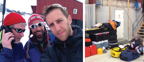
(Left) As weather-delay days continue to keep us in town, Rick calls the weather office to assess whether we can afford to spend more days waiting to be deployed on the ice sheet. (Right) The saddest moment of our campaign, when Rick had to remove his gear from our cargo because he wasn’t coming with us to the field.
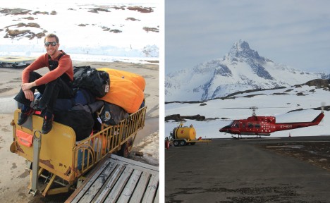
(Left) At the Tasiilaq heliport, Ludo waits for our put-in flight on the cargo. (Right) The Air Greenland B-212 helicopter with blue skies and high clouds. After 12 days of patiently waiting, it looks like it’s a go!
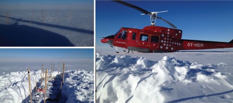
(Left) Our cargo, dropped almost two weeks ago, got buried under 2 feet of snow. But all the pieces were there! (Right) The B-212 landed near our cargo for a final move to the ice camp location.
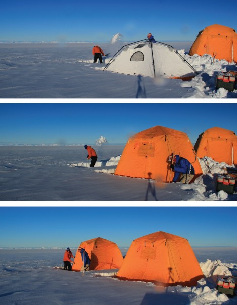
Minutes after the B-212 had left Clem and me on the ice sheet, we were already shoveling the fresh snow to install our cooking and sleeping tents before dark. This was no time for play, this was no time for fun, there was work to be done.
Shoveling, a typical activity at camp. Luckily this year we did not have to shovel too much to maintain our tents.
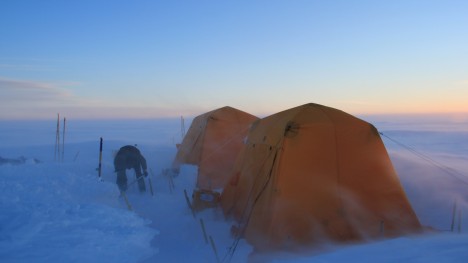
With the amount of fresh snow and the katabatic winds increasing, snow dunes were forming perpendicular to the direction of the wind — it was like being at sea! Half a day later, sastrugis developed along the wind direction and snow became hard and compact.
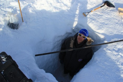
Ludo inside a 2-m-deep pit dug with the hope to repair a broken pilot pipe for installing a pressure transducer in the aquifer.
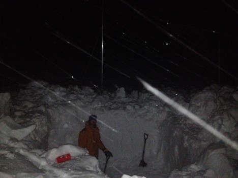
Ludo, inside a larger 2-meter-deep pit dug after dinner with easterly winds increasing as another coastal storm was coming bringing more snow. Our rationale was that the sooner we dug, the less snow we’d have to remove.
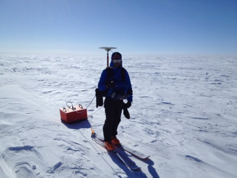
Two hours before being pulled out from the field, Clem was dragging the 200 MHz radar, and carrying a GPS unit.
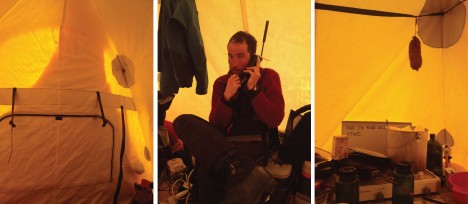
(Left) Snow accumulated on our tent entrance overnight. We monitored it carefully every half hours from 2 am to the late evening. We took care of it a couple of times! (Middle) Clem calling the weather service to find out what wind speeds would hit us during the night. (Right) Our last saucisson, hanging over the snow/water pot.
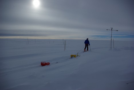
Clem uses an evening break in the weather to drag a low-frequency radar in the fresh snow deposited in the previous hours.
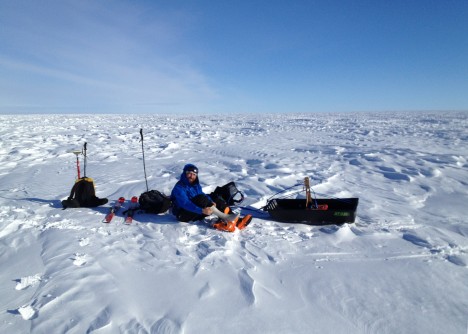
Weather was clement enough with Clément to allow him for a pit stop during our half-marathon radar day around camp.
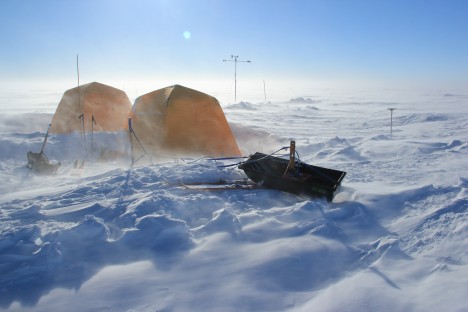
A new day, different weather, and another attempt to collect more radar data. Since we aimed at collecting surface-based radar data, not airborne radar data, we quickly had to stop because the wind would make the radar system take off with every other gust.
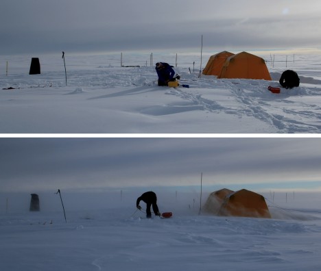
Pictures taken just one hour apart. In the top one, we were setting up a radar system. In the bottom one, we were actively wrapping it due to sudden katabatic winds that picked up in less than 10 minutes.
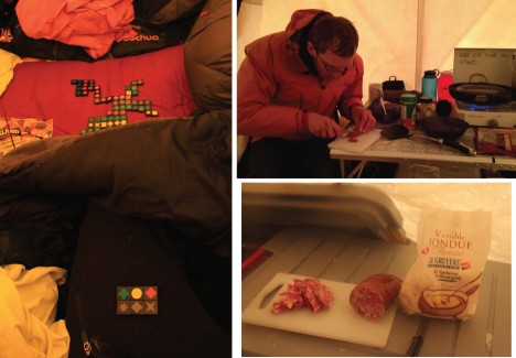
Indoor activities while the winds prevented us from working. (Left) Playing domino with mitts in a shaking tent, unforgettable times! (Right) Good food to keep us happy. Merci maman for thinking about us before leaving home.
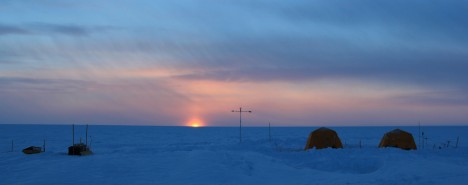
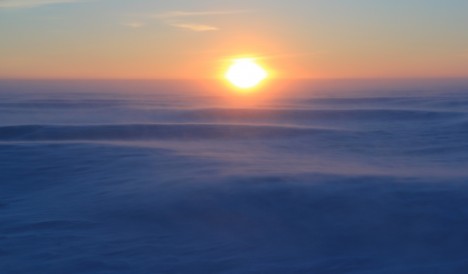
Our flight back had already been canceled twice. It turned out that this was our last evening at camp. We had a total of two pretty sunsets: one on the first day and the second 12 days later, on our last evening.
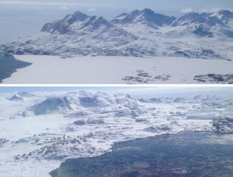
Forty minutes after leaving our camp, we see signs of life: a view of Tasiilaq (top) and Kulusuk (bottom), minutes before landing.
We’d like to finish with this quote from the French explorer Jean-Baptiste Charcot, who led the second French expedition in Antarctica around 1910:
“D’où vient l’étrange attirance de ces régions polaires, si puissantes, si tenaces, qu’après en être revenu ou oublie les fatigues, morales et physiques, pour ne songer qu’à retourner vers elles? D’où vient le charme inouï de ces contrées pourtant désertes et terrifiantes?” (“Where does the strange attraction of the polar regions come from, so powerful, so stubborn, that after returning from them we forget the fatigue, moral and physical, only to think of returning there? Where does the incredible charm of these lands come from, however deserted and terrifying?”) Jean-Baptiste Charcot, Le Pourquoi Pas?
By Rick Forster
Our team finally made it to the ice sheet on April 8, after being delayed for almost two weeks due a series of storms. That day, we awoke to patches of blue sky over the village of Tasiilaq and were eager to get to the heliport for our scheduled 11:40 AM flight to the ice sheet. Lingering clouds over the ice sheet delayed our departure about three hours.
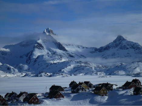
The village of Tasiilaq on the day of our flight to the ice sheet in SE Greenland where the Air Greenland B-212 helicopter is based. (Credit: Rick Forster.)
Once we saw the Air Greenland helicopter returning from its last trip to the local settlements for the day, we knew our flight was next. The trip to our research site on the ice sheet takes about 30 minutes.
The two-week weather delay meant I had to return to the University of Utah while Clem and Ludo would stay on the ice sheet for about 10 days to gather data and perform experiments on the Greenland aquifer. It was a hard decision to make, but I had commitments and if I stayed with the team on the ice sheet, we would all have to leave before all the science could be completed. Ludo and Clem’s schedules were more flexible so they will be able to extend their trip to spend extra time on the ice. I went with the team to the ice sheet to help unload the camp gear from the helicopter at the research site.
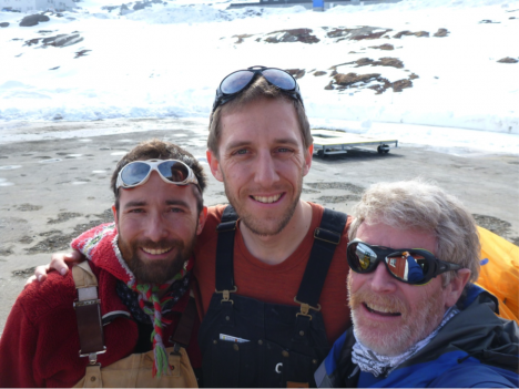
From left to right: Clément Miège, Ludovic Brucker, and Rick Forster happy to be finally boarding the helicopter for the flight to the ice sheet. (Credit: Rick Forster.)
The flight to the site was spectacular, going over sea ice chocked fjords and outlet glaciers draining the ice sheet.
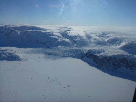
An outlet glacier draining the Greenland ice sheet into an ice covered fjord. The individual rough blocks of ice within the smooth surface of the frozen fjord are icebergs that calved off the glacier last summer and are now trapped in the winter fjord ice. (Credit: Rick Forster.)
Once at the research site, our team, including the pilot and flight engineer, quickly unloaded the cargo from the helicopter. The heaviest gear could be left closer to the helicopter, while the lighter pieces needed to be dragged farther away and held down by Ludo and Clem to keep them from being blown away from the winds generated by the helicopter taking off. The ice sheet surface was smooth and soft with knee-deep powder, great for skiing but not so good for moving cargo and setting up camp.
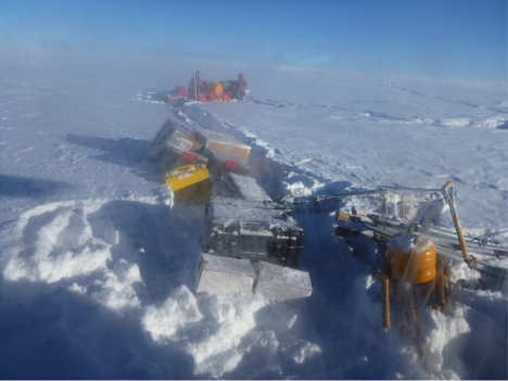
Clem, Ludo, and the science and camp cargo waiting for the helicopter to take off. (Credit: Rick Forster.)
Clem and Ludo will spend the next week and half gathering additional data on the Greenland aquifer from a variety of ice penetrating radar systems and installing an automated weather station for our colleagues at Institute for Marine and Atmospheric research Utrecht.
By Clément Miège
It might be hard to believe but yes, we are still in town! We have been delayed for a full week now, every day getting ready for a possible flight the next day, and every morning, we get the same message: “Unfortunately, there will be no flight to the ice cap today due to weather and bad visibility with low clouds, but tomorrow looks more promising.” Oh, no! Even if it is fully justified, it is always a bit disappointing the moment you hear that, but I think our team has a good experience already with this kind of delay and we are able to switch quite easily and still be happy and optimistic for a flight the next day.
The main helping factor that puts us back in a good mood comes from the weather forecast. Indeed, every day we are able to see a clear-sky window that makes us think that we will be able to fly the next day. Sometimes, this weather window can be very tiny, but it is always there! Good spirits!
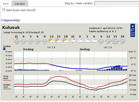
Tomorrow, again, it looks great, with a weather window in the afternoon (Forecast provided by the Danish Meteorological Institute .)
When you look at long-trend forecasts (beyond the following 48 hours), the weather is changing a lot in short spans of time. Often, there are significant changes from one forecast to its updated version a couple of hours later. For example, a 5-day storm, with heavy precipitation, appears in the forecast, but then it it is removed from the next update. So our moods shift quite a bit. For even longer trends, it becomes a different story. Rick shared with Ludo and me his experience with the so-called “Canadian Forecast”. It consists of making the last 5-6 days of a 14-day weather forecast always be nice and sunny, to keep people happy through the winter so they can anticipate the end of it. We can verify this “happy weather trend” in Greenland with our own Danish Forecast — the five last days of this forecast are always sunny. We are keeping a record of the forecast since we arrived two weeks ago, and we can say this is a regular pattern.
After checking weather forecast here, our daily duties are not done yet! Next, we take a look at the data from a weather station that is currently in the field, in our future camp site. We dropped the weather station as part of our cargo last week, but we did not have time to set it up. It is however transmitting data and our IMAU colleagues gave us access to the transmitted data. Unfortunately, the signal for diurnal temperature is getting weak, it’s almost nonexistent anymore, which means that the weather station is getting buried. More and more snow will need to be removed to access our equipment when we will get to camp (maybe tomorrow?) Next, we take a look at the Kulusuk airport’s flight schedule for the day. We can see for example that the Tiniteqilaaq flight is canceled (“aflyst”, in Danish) and that the Isortoq flight is delayed. Then, we do the same thing for the Tasiilaq heliport schedule and then we speculate (while drinking our coffee) where our flight fits in this schedule. We are getting quite good at this exercise! Our flight never fits and we are always rescheduled. But there are some events that are still out of our control. Three days ago, a domestic conflict in Kuummiut required the police Marshall to solve it. Since the Marshall is based in Tasiilaq, the helicopter had to fly him there. That day we had woken up at 5:30 am for a flight scheduled to leave at 7:05, which got rescheduled to 11 am, and after three additional hours waiting at the airport, it eventually became a cancelled flight. Needless to say, the helicopter never made it to the Kulusuk airport. We simply went back to the hotel in the pouring rain. As Ludo likes to say: “This is again craptastic; good times!”
Sunday (March 30) was a beautiful day though, but we were not on the flight schedule — the pilots had to catch up with the Saturday flights had been cancelled. We took advantage of the nice weather to further test our field equipment. As I mentioned in an earlier post we will be testing a low-frequency radar system in the aquifer region on the ice sheet. Laurent Mingo at Blue System, who develops the IceRadar is letting us test a beta version of one of his radar systems. The IceRadar is currently used by many research groups on alpine glaciers, ice caps and ice islands. As such, it has been deployed in many regions of the world (Yukon, Rocky Mountains, Himalaya, Bhutan, Iceland, the Andes, the European Alps…) to perform ice thickness measurements and bed mapping, but also to look at the glacier englacial properties. I believe this is the first trip for the IceRadar to the Greenland ice sheet. So we are quite honored to have this system with us to try it over the aquifer.
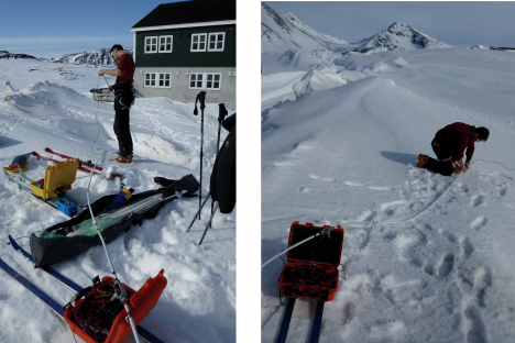
Setting up the IceRadar for the first time in Greenland, with the 5 MHz antennas. The lower the frequency used for the radar, the longer the antenna has to be. For a 5MHz system, the antenna length is 20 meters (about 70 feet), and there are two of them (receiving and transmitting). (Credit: Rick Foster)
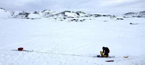
After the setup, we try our radar going from the seasonal snowpack to the relatively thin sea ice – that gives us important changes in terms of dielectric constant, which look quite obvious in the radar profile. The system total length is about 50 meters (164 feet), so no sharp turns are allowed! (Photo credit: Rick Foster.)
Getting the 40MHz IceRadar ready, you can see the difference of the antenna size — this is definitely easier to turn. (Photo credit: Rick Foster)
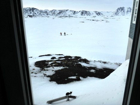
Rick watches Ludo and me maneuvering the IceRadar from the hotel. A new (feline) friend is also observing us, probably wondering what we are doing here! (Credit: Rick Foster.)
At the end of the day we have great news: the IceRadar is working well at the two frequencies tested, which is really promising toward our ice sheet measurements. YAY!
Finally, the hotel still does not have running water. As Ludo mentioned in an earlier blog post, the heating element in the water pipe supply line that prevents the water from freezing broke. And the road to get to the lake with fresh water is still being plowed, but the bad weather and drifting snow prevent the plow truck from making much progress. We are getting used to showering with a water bucket and becoming more and more efficient at conserving water.
Without water at the hotel, we are even more motivated for going to the ice sheet since we know we will not be missing a good hot shower anyway.
Our team has a really good feeling for tomorrow, so let’s hope for a “go” and keep our fingers crossed!
Cheers, Clément on the behalf of the aquifer team.
By Ludovic Brucker
Kulusuk, 31 March 2014 — When I started writing this post, my opening was: Greetings from (still) white-out and windy Kulusuk 🙁
Updated opening sentence: Greetings from now rainy Kulusuk 🙁 🙁
The nice thing about weather forecasts is that they change all the time, so you never get bored watching them. The bad thing about weather forecasts is that they change all the time. What we have been experiencing over the past days was bizarre. We had a storm with sustained high winds and some gusts. We then had temperatures high enough to work outside without a jacket. We also had calm periods alternating every half hour or so with sustained gusting events, so intense that it wasn’t advisable to get near the windows. Now, it is raining.
We spent the last couple of days patiently waiting a phone call or an email. During these days, we made sure to be able to arrive at the airport ready for a put-in flight within an hour notice, if necessary. So far, a good weather window coinciding with availability of the B-212 helicopter and its crew has not happened. We like to think that we will have a flight tomorrow morning. This might happen. As Daniel L. Reardon said: “In the long run the pessimist may be proven right, but the optimist has a better time on the trip.” We are optimists, despite the weather teaching us to be realists.
In the mean time, at the hotel… there is no (liquid) water available anymore since Friday. The pipes bringing the water from a nearby lake are frozen, due to an issue with the pipes’ insulation. This sounds typical here, but usually the hotel’s water tank can get refilled with a winter water truck (please, don’t ask for details, I tried to understand but couldn’t figure this story out completely). But now the road (the only one road) is buried under more than 2 meters of drifted snow. Hence, the winter water truck cannot resupply the hotel’s water tank. We were preparing to melt snow. As Rick thoughtfully mentioned it at breakfast this morning: “if you can’t get to the field, the field will come to you” © Rick Forster. However, the hotel employees went to pick up some big jugs of water for drinking, cooking and even showering at the village! Our record is less than 2 liters used per shower. The colder the water, the less you use of it.
Today, we moved the rest of our cargo up at the airport, including our personal bags. We are really hoping to go to the field soon (that is tomorrow early morning). Keep your fingers crossed for us! Signed: Ludo, one of the three optimists.