

The Eco-3D campaign has been supported by many people, including scientists, engineers, flight crew, students, professors and others. The biographies below are limited to members of the Ec0-3D Field and Aircraft Campaign 2011.
Charles Gatebe, Ph.D. Principal Investigator CAR 
Dr. Gatebe works at Goddard Space Flight Center as a scientist and group lead with the Universities Space Research Association (USRA). He earned his Ph.D from the University of the Witwatersrand, South Africa in 1999. Currently he is interested in conducting elaborate experiments and developing new methods to define important surface and atmosphere radiative transfer functions, and improve remote sensing retrievals of aerosols, clouds and vegetation using laboratory, ground-based, airborne and satellite remote sensing. He’s also interested in conceiving and developing new instruments and technologies for making measurements in support of Earth science missions.
Miguel Román, Ph.D. Co-Investigator CAR

Dr. Roman is a Research Physical Scientist working at NASA Goddard Space Flight Center. During the northern flights, he will be supporting satellite validations/ground measurements and coordination.
David Harding Principal Investigor SIMPL

Dr. David Harding works as a Geophysicist in the Planetary Geodynamics Laboratory at NASA Goddard Spaceflight Center. He conducts research in the measurement and analysis of neotectonic landforms, vegetation canopies and continental water storage and discharge, in particular by utilizing advanced airborne and space-based laser altimeter systems. He is principal investigator for a NASA Instrument Incubator Program project, and is working to develop an airborne instrument, the Swath Imaging Multi-polarization Photon-Counting Lidar (SIMPL), will demonstrate techniques enabling more capable spaceflight laser altimeters for future Earth science and planetary exploration missions.
Rafael Rincon Principal Investigator DBSAR

Rafael is a senior radar engineer at GSFC’s Microwave Instrument technology Branch. Dr. Rincon has been involved in the development of hardware and processing algorithms for the new generation of SAR systems. He is principle architect and systems engineer for the L-band Imaging Scatterometer and the Digital Beam Forming Synthetic Aperture Radar (DBSAR).
Lola Fatoyinbo Science Principal Investigator DBSAR

Dr. Fatoyinbo is an Environmental Scientist with a particular interest in 3D structure of forests. She received her PhD in Environmental Sciences at the University of Virginia in 2008 with a focus on mangrove forest ecology and remote sensing. She then started a NASA Postdoctoral Fellowship at the Caltech-Jet Propulsion laboratory in 2008 where she continued her research on the remote sensing of mangrove forests. In 2010 she moved back to the East Coast and began working as a research physical scientist at NASA GSFC. Lola is now involved in several science projects, including the DBSAR, the development of a new P-band radar called EcoSAR and the NASA Carbon Monitoring System biomass pilot.
Jon Ranson, Ph.D. Science Co-I DBSAR

Dr. Ranson is an earth scientist specializing in radar and remote sensing. He uses these tools for studying vegetation type and amount (biomass) in ecosystem research. He serves as the Head of NASA’s Goddard Space Flight Center’s Biospheric Sciences Branch in Greenbelt, Maryland. Under his guidance, the Branch is advancing the use of satellite technology to study the carbon cycle and ecosystem science. Dr. Ranson is the Principal Investigator of a project to utilize various types of satellite data for mapping forest type and biomass along the tundra-forest interface in the Arctic and served as the Terra Project Scientist for five years.
Guoqing Sun, Ph.D. Science Co-Investigator DBSAR

Dr. Sun is a research professor in the Department of Geography and Earth Science System Interdisciplinary Center, University of Maryland, College Park and is also affiliated with NASA GSFC’s Biospheric Sciences Branch. He is an expert in satellite data processing and analysis, remote-sensing modeling, land-cover use change and Geographic Information Systems (GIS). His specialty is developing and using remote-sensing models for forest canopies and sensor data fusion (combining lidar, radar and passive optical sensors). Dr. Sun has contributed to several NASA projects dealing with land cover mapping in northeast China, as well as collaborated on NASA GSFC Siberian research projects, including a Shuttle Radar Topographic Mapping project in Siberia.
Engineering and Data Staff:
Kurt Rush Engineer CAR

Kurt is an electrical engineer at NASA Goddard Space Flight Center in Greenbelt, Maryland. In addition to supporting CAR, he developed a key part of the SIMPL electronics and helped solve problems on the installation of the equipment aboard the P3.
Susan Valette Software Engineer SIMPL and DBSAR

Susan is a Computer Engineer at the NASA Goddard Space Flight Center, working in the Science Data Processing Branch. Since 2003 she has worked on various software components of Laser and Radar systems, including data systems, graphical user interfaces, instrument commanding and science data processing. Her current work includes the development of the 16 channel LIST airborne instrument data system, the maintenance of the Slope Imaging Multi-polarization Photo-Counting LIDAR (SIMPL) data system, the development of science products for SIMPL, the processing of SIMPL’s science data, and the enhancement of the Dual Band Synthetic Radar (DBSAR) Graphical User Interface, as well as supporting the integration testing of this instrument. She earned her B.S. from the University of Maryland, College Park.
Martin Perrine Instrument Engineer DBSAR

Martin is a senior radar engineer at NASA Goddard Space Flight Center in Greenbelt, Maryland, supporting radar and communication system and architecture development. Prior to joining NASA he worked on the regulation of radio systems for the Federal Communication Commission and developed radios systems for the Department of Defense. He received a B.S.E.E. from Michigan State University in 1984 and an M.S.E.E from Johns Hopkins University in 1987.
Quenton Bonds, Ph.D Instrument Engineer DBSAR

Dr. Bonds was born and raised in Montgomery Alabama. He received the B.S. degree in Mathematics from Alabama State University in Montgomery Alabama in 2001 and the M.S. degree in Electrical Engineering in 2006 from The University of South Florida (USF) in Tampa Florida and went on to attain the Ph.D. from USF in 2010. Dr. Bonds is currently a research electronics engineer in the Microwave Instruments and Technology Branch of the National Aeronautics and Space Administration (NASA) at the Goddard Space Flight Center (GSFC) in Greenbelt Maryland. Of his most notable achievements, Mr. Bonds was the recipient of the 2010 IEEE WAMICONN Best Student Poster Award, 2009 FEF Carl Crawford Award, 2009 IEEE MTTS Fellowship for Medical Applications, 2008 USF College of Engineering Best Poster Award just to name a few.
John Barrick Fight Data Technician

John works at Langley Research Center. His job on this mission is to provide data about the plane’s location and the outside atmospheric condition, and take down-looking video of ground as the airplane passes over. This video is time and date stamped, so it can be correlated with the data.
Rajesh Poudyal Data Analyst CAR

Rajesh works as Senior Programmer Analyst with the Sciences and Exploration Directorate at NASA Goddard Space Flight Center in Greenbelt, Maryland.
Phil Dabney Instrument Engineer SIMPL

Phil works in the Laser Remote Sensing Laboratory at NASA Goddard Space Flight Center, Greenbelt, Maryland.
Brantley Riley System Administrator DBSAR
Brantley is the primary computer system administrator that supports the DBSAR Linux boxes. She works on-base at GSFC and has supported Eco 3D in many ways. During the flights, she providing support via telephone and email and working closely with the DBSAR team with the instrument problems. She has been a system administrator (primarly Unix) at GSFC since 1997, first on the Hubble Space Telescope project and for the past 3 years as part of the team that supports AETD’s Software Engineering Division.
Field Crew, Howland, Maine
Wenjian Ni, Ph.D.

Dr. Ni works as an assistant research professor in Geography at the University of Maryland, College Park. His research interests include measuring and modeling the radar backscatter of vegetated surfaces, the description of 3D forest structure using terrestrial/airborne/spaceborne laser scanners, and algorithm exploration for the mapping of forests for aboveground biomass at a regional scale.
Wenli Huang

Wenli is a Ph.D. student from the University of Maryland, College Park majoring in Geography. Her research interests are data fusion of airborne lidar and radar for the mapping of biomass. The goal is to monitor and evaluate management effects on forest structure and the carbon cycle with ground measurements and remote sensing. Before coming to the United States, she earned her M.S. in Cartography and Geographic Information System from Beijing Normal University in 2006, and her B.S. in Cartography from Wuhan University in 2002.
Feng Zhao

Feng is a third year graduate student in the department of Geography at the University of Maryland, College Park. Her current work project is on North American Forest Dynamic (NAFD) and forest disturbance via satellite images. She earned her B.S. from Beijing Forestry University majoring in water and soil conservation in 2009.
Paul Montesano

Paul is a researcher working in the Biospheric Sciences branch at NASA Goddard Space Flight Center and a Ph.D. student in the Department of Geography at the University of Maryland College Park. He is interested in the combined application of active and passive remote sensing systems for mapping vegetation structure in ecological transition zones.
Flight Crew (no photos available)
Robert Harpold Navigation Rack Operator
Mike Singer Chief Pilot/Program Manager
Rich Rogers Aircraft Operations Manager
Bill McGrory Avionics Technician
Bryan Yates Flight Engineer/Mechanic
Pete Peyton Avionics Technician
John Doyle P3 Flight Engineer
Martin Nowicki Flight Mission Manager
Writer
Dr. Joanne Howl received her D.V.M from the University of Tennessee College of Veterinary Medicine, Knoxville, Tennessee in 1987. She has practiced clinical veterinary medicine, worked in veterinary emergency response and is a writer and editor in the pet health and science fields. Currently she is employed as a Technical Writer for Sigma Space. This is her fifth year blogging for the Earth Observatory in support of NASA field campaigns.
Maryland, 8:45 p.m.
From Rafael Rincon:
I’m back in Maryland, and calling in as we drive from Wallops, Virginia to Goddard in Maryland. It’s been a very long day, but rewarding. We’ve gathered a lot of data and learned more about our instruments, so we have to say this leg of the mission was exhausting – but successful.
We arrived this afternoon at Wallops after flying almost 8 hours today. We started early in the morning, and were able to fly over Bartlett Forest in New Hampshire. Then we returned to the Bangor area and took one more pass over the Howland site. Finally we flew to Quebec and spent a few hours acquiring data over the boreal forest site.

Today was really good for SIMPL. We finally had permission to turn the lidar on over Quebec, and so they had a very successful flight there. The flight was very good for lidar in New Hampshire, too. The areas we wanted to fly were available, and the lidar was very happy with the low altitude restrictions. So it was a great day for SIMPL – and that means it was a very good day for the Eco-3D mission, as well.
The radar, DBSAR, had challenges again today. First of all, we did fly it over New Hampshire and the data we gathered there looked pretty good. But we had to stay out of restricted airspace, which means that we had to fly below 9,000 feet. The radar really prefers to fly high, but we couldn’t do that. Now, we knew about this restriction and we’d planned to take low measurements with DBSAR here, so it’s no problem – it lets us learn more about how this particular instrument handles lower altitude. It just would have been nice to be able to fly higher as well.
The other issue is that we started to see some problems again with the RAID, so that issue has not been entirely solved yet. It appears that the computer stops saving the data for small intervals, and that really impacts the data collection. We do get data, but it makes it very hard and we may miss some data. Despite the RAID hiccups, we were able to gather radar data for New Hampshire and for Quebec, so this mission has been successful.
I want to add that part of the challenge with this field campaign is flying and understanding the aircraft. Our radar system has been fully tested in the lab. Before going to the campaign, we go through strict procedures to ensure that the instrument meets the engineering and science requirements. This includes lots of lab testing and anechoic measurements.
When we fly on the P3 aircraft, we are not in the lab environment anymore and anything can happen. We are currently dealing with vibration issues that seem to be affecting our computer data system. We flew DBSAR in 2008 for flight tests and did not experience these problems. This time around there are new things, like new aircraft racks, new mounts, new radar hardware and modes, etc. These might be causing some problems. We are working hard to identify and solve these issues.
For now, we plan to relocate the instrument rack to an area in the plane with less vibration. We are also thinking about beefing up the equipment mounts and RAID configuration. We’ll be airborne soon again.

We returned to Wallops late this afternoon, around 5 p.m. today. I wanted to get some pictures of the crew, so that we could recognize everyone that has worked so hard for us this time. Unfortunately when I got out of the plane, everyone was already gone. Everyone was in a hurry to get home after a long few days in the air.
The plan from here? Well, there won’t be a lot of rest. I am going to go to my office and trouble shoot the computer tomorrow, to get it ready for next week. So I am bringing the computer and the processor home with me.
Our current plan is to fly to fly to Florida next week and collect data over mangrove forests. There are other sites we’d like to look at, such a forest in North Carolina. But a lot depends on the weather, the availability of the airplane and the instrument health. Right now, with Hurricane Katia in the Atlantic and a tropical storm brewing in the Gulf of Mexico, weather seems to be the biggest question of all. I’m sure we’ll fly somewhere – either the southern route or locally in Maryland. But at this point, I don’t think we can be sure exactly what will work the best. We’ll meet tomorrow to evaluate the variables, and make a decision from there.
I do know my immediate plan. I have not gotten much sleep on this trip. I’ve been up until one or two in the morning, then wake up somewhere around five in the morning in order to board the aircraft. Then there is not a lot of down time on the flight – we are really hustling most of each day. I’m pretty tired, so when I get home I am planning on getting some good sleep.
Before I turn in for the evening, though, I want to mention all of this work is possible due to the great work of many people. In particular, for DBSAR – the instrument I work with – I want to recognize the efforts of Marin Perrine, Susan Vallet, Quenton Bonds, Brantley Ripley, John Bichell and the Wallops aircraft office, who have gone way beyond their duties to make this campaign possible.
___________________________________
It’s Jon Ranson back here, for a moment. I’ve been at Goddard this week, supporting the mission from the office. I have a thought that I wanted to share here, for our readers.

To someone who isn’t familiar with how these science missions work, it might look like we’re not doing very well here, with all the trouble with weather and with the instrument issues. But from where I stand, this mission looks quite successful. We are meeting challenges – some unexpected, like the weather. And some not unexpected – like issues cropping up with the instruments. We are learning a tremendous amount about the very new DBSAR instrument and we are collecting really good and valuable science data, too. I call this a success.
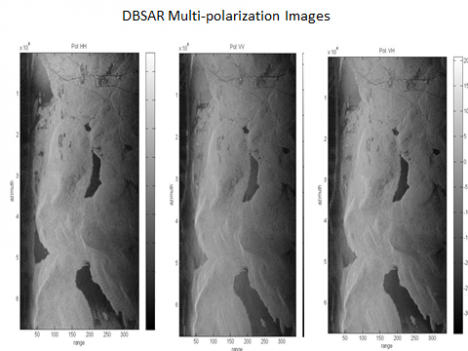
The DBSAR was first flown in 2008 and then it only had one polarization at that time. Those flights told us that the instrument worked well and held promise for three dimensional forest measurements. Since then, the instrument has been improved and we are trying new things with it. Since 2008, Rafael and his very talented team have added to the channels from which we can acquire data. Now it is what we call “fully polarimetric”. There are four polarizations, or channels now, rather than one, for data collection. So it is acquiring a lot more data now.
The DBSAR has not been tested in this mode in the air before, so this flight campaign is as much about finding out the limits and performance capabilities of this very new radar design as it is gathering data. It is no surprise to me that our testing has pushed DBSAR hard, and challenged its capabilities. That frustrates us, when problems crop up, because we’d love for our instruments – even experimental ones – to work perfectly first time out. But it’s not at all unexpected and not a failure of our instrument or design. Pushing the DBSAR to its capabilities lets us know where we need improvement, and allows us to make it more robust. It is working well – but it is also showing us where it needs improvement. This is a very good, and successful, test of a new instrument.
Despite all the challenges, we are getting extremely good data from all instruments, including the DBSAR. I think we are all pleased with our results.
This is how we learn. This is how we get better. This is, truly, science in action.
Bangor, ME 10:00 p.m.
From Rafael Rincon:
I’m pretty busy tonight, even though it’s already late. I’m in the hotel room after a long day, and I have had to bring the computer from the P3 to the room to do some trouble shooting tonight. I’ll be working very late again, it looks like, but that happens on these field campaigns a lot of the time.
We had a beautiful day for the flight, but unfortunately we had some trouble today. The DBSAR RAID is not keeping up with all the data that comes in. We know what is wrong, and I believe I can get it ready for tomorrow if I work on it tonight – and that’s what I’m doing now. We’ll be ready to go in the morning.
We were able to collect data from the DBSAR, but it kept me very, very busy trying to fix it when it would crash as it was collecting data. I think we have some good data, but how much the data was affected by the file problem, I’m not sure. I’ll know after I get a chance to look at some of the data, probably later tonight.
Basically the problem is that the RAID has too many files on the discs now. The more files on the disc, the longer it takes for a computer to write to it. The answer is to have less files, so I am transferring files from the RAID to an external hard drive – and then will delete the files so it can run well tomorrow. It’s hard work, and takes time, but it will get the instrument in shape again.
Today it was pretty decent weather for both SIMPL and for CAR. We were out early in the morning, and both SIMPL and CAR were able to gather great datasets over Howland. Their teams are really pleased with the data collected today.
Unfortunately at the very end of its last run, CAR developed a problem. Now the instrument is no longer responding. The good news is they did get a full day of data – it was good data, and they completed the science data they needed to collect over Howland. They think they know what is wrong, and it can be fixed, and that is good, too. The bad news is that they cannot fix it here, tonight. They need to go back to Wallops to fix it. So CAR is off line for the rest of our trip. But it will be ready for the southern flight campaign, which is supposed to start on Wednesday next week.
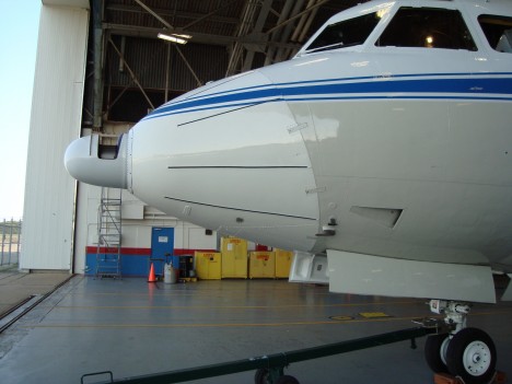
SIMPL had a better day, at least over Howland Forest. They gathered very good data over the sites we’ve measured in Howland and the instrument worked really well all day long. But SIMPL did have a problem of its own.
I think I told you yesterday that we needed to have authorization to turn the lidar on over Quebec. Well, when we left this morning, we had no authorization. We tried hard to get permission, but it never happened. We had it permission for last week, but someone had not thought to extend it for any additional time, in case we had trouble. Of course, we did have trouble. Now SIMPL has no trouble, and we have decent weather – but no permission. Without permission, we definitely would not turn the instrument on over Canada.
The radar was no trouble over Quebec. We had our permissions in place for that, so we flew the sites with the DBSAR. We collected plenty of data for DBSAR, although we were working to recover data each time the computer crashed. I think the data will be okay, but we just have to analyze it and see what was able to be captured. I certainly hustled all day long, and had no time to sight-see out the window today – there was too much going on with the RAID.
The sad thing was, late in the afternoon the SIMPL team heard that the authorization had been granted. But it was too late. We could not turn around and go back. It does open the door for tomorrow, though, and we hope to get back to Quebec and finish our work.
There is another site nearby which is very interesting, too. That is Bartlett Forest in New Hampshire. It’s an important site for us. It has been recently measured on the ground and with from the air with other instruments. We very much want to go there tomorrow, and we want to go back to Quebec tomorrow, too.
One challenge we have at Bartlett is that it is a military area, and there some restricted areas where we cannot fly. Some of those areas change every day, and we won’t know until the morning what areas will be open at what time.
We do know that we cannot fly high there, and that is difficult for the radar. We can make the lidar measurements with SIMPL easily, it likes being low. But the radar likes being high. With radar, the angle of incidence varies a whole lot when you are down low, from the near edge and the far edge of the image. The higher you can fly, the smaller the variation. From space, the variation is very, very small. But near the ground, you can get 40 or 50 degrees variation, depending on high you are flying. At Bartlett, we can’t fly over 2 km high because the airspace above is restricted. The lidar will do just fine at that altitude, so we will get good data from that, and we’ll squeeze the radar in at the highest altitude the pilot can give us.
So you see, it’s all very complicated. When the airspace will be open, what is restricted and what is not, and what the instrument likes for best data. It all has to be thought about and worked out, if we are to collect data.
It’s supposed to be a good day weather-wise. New Hampshire looks great in the morning. Quebec may have some scattered showers, but we should be able to get there when there is not much rain, at least we hope we can work it out that way. SIMPL has permission now, and we want that data. We also really do want to redo the DBSAR data as necessary, since we had some trouble. We’d also like to implement 2 interferometric passes offset by 60 meters with the DBSAR. We’ll do two of those measurements over the sites, then that is it. The two passes for DBSAR alone will take about an hour.
Our plan for tomorrow is to get up early and check to see when we can fly what areas in New Hampshire, and check on the weather in Quebec. We’ll then figure out which one we’ll fly first. After flying New Hampshire and Quebec, we transit to Wallops, arriving there late afternoon. And that will finish this leg of the field campaign.
Next week we’ll be flying south. We hope to fly over sites in Florida Wednesday morning and collect data from all three instruments. We are also discussing the possibility of leaving Wallops on Tuesday mid-day, and flying straight to Florida, making no measurements. This would get us there so we can start collecting data first thing in the morning. The weather is a lot better in the morning in Florida – the afternoons usually cloud up and have rain.
And speaking of weather – there’s another storm out in the Atlantic Ocean. We looked at this new storm – Katia – and it’s not supposed to hit Florida. If we have weather from the storm, well, we’ll take care of it. We do have some extra time built into our schedule, a contingency week, so if the storm begins to head towards where we are working, we have the ability to postpone the flight. Now, if we have more storms after that, then we are done. We don’t have use of the aircraft forever. September 16 is our last day. After that the aircraft has to get ready for the new mission.
Bangor, Maine 10:00 p.m. EDT
I’m Rafael Rincon, the principal investigator for DB-SAR, and I’m glad to tell you that things went very smoothly today. It was a good start to what should be a great week in the field.
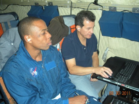
I flew on the P3 last week and will be working this set of flights, too. I’ll be the one telling you about our work this week. Each day I’ll get up very early, spend the day in the air working the DBSAR, and once we are on the ground I analyze some data and help plan flights for the next day. After that is all done, I call our team writer, Joanne Howl, and give her the details of the day so she can get it written down and posted in the blog.
As you know, we had some challenges on our first week of flights. There were instrument problems, an earthquake, and a hurricane. The, once we began a really data collection run, we were cut off and had to land right away because of bad weather. Finally, they called the P3 home a day early, to protect it from what looked like it would be a direct hit from Hurricane Irene.
All I can say is this is the challenge of science in the field. You can expect the unexpected – it happens. And you just move ahead and work around it.
We’re set to have a great week. The aircraft is back home from West Virginia, where it was sheltered from Hurricane Irene. Our facility at Wallops is sound – no hurricane damage to be seen, and it is running well. The weather forecast for the next several days where we want to fly – Maine, Quebec and New Hampshire – is wonderful, with low winds and lots of sunshine. And our instruments are working fine. We have everything we need for a good trip.
What are the chances something will go wrong? Just as good as always! Just because we have a lot of challenges behind us, it doesn’t mean that there are no challenges ahead! It’s science, and we’re in the field. Things happen. We’ll take what comes and we’ll do our work, and we will overcome any problem that comes up.
This morning, there were no problems at all. We got up very early, and took off from Wallops at 9:00 a.m., just as planned. Flying north to Maine, we looked for evidence of hurricane damage, but we were flying so high we couldn’t see if trees were down on the ground – just too high for details. But there was one amazing thing that we could see.
When we were in transit from Wallops to Maine, at one point where the Hudson River comes into the ocean, we could see that the Hudson was very muddy from all the sediment washed into it from all the rain in Irene. And there was a big layer of mud that separated the coastline from the ocean water. It was thick mud, and it was huge – all along the shoreline, through the river and out into the ocean. It was very thick and we could see it very clearly. It was a very impressive sight.
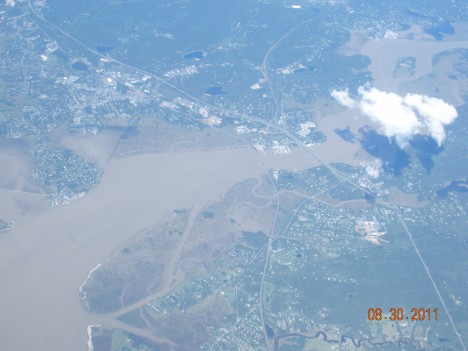
When we arrived in Maine, we had some broken clouds, and this wasn’t the best for SIMPL or CAR. Those instruments can measure clouds, but for this mission we want them to look at canopy height of the forest. So if you get a cloud between the forest and those instruments, it reflects back to the aircraft, interfering with canopy measurements.
There were some areas of open sky, with no or few clouds, so Dave Harding, with SIMPL, decided to do his measurements first. We were flying low, at about 1200 meters (1.2 meters), which is the altitude that this instrument likes. We got a pretty good radar set for this lidar instrument, and breaks in the cloud let us get measurements of forest height with it.
After SIMPLE completed its measurements, it was the time for CAR to have its allocated turn. CAR is even more sensitive to clouds, so the PI, Charles Gatebe, decided not to use the time making those measurements now, but to wait for clearer skies tomorrow or Thursday to make those measurements.
After that, we went to a high altitude-about 5,500 meters (5.5 km) and I resumed the DBSAR measurements right where they were cut off last Thursday, when we were asked to land immediately due to weather.
We operate the radar in a couple of different modes. First we have a side looking synthetic aperture radar mode. The other is a wide beam mode. In wide beam we capture a full field of view under the aircraft. From there, we can synthesize as many beams as we want on either side of the aircraft. Each beam is basically a field of view of different spots on the ground, and we can look at specific spots because of the beam forming technique. So with wide beam we illuminate a wide view and by synthesizing the beam, we can look at a more narrow field.
This is a new technique and we tested before, and it worked well. This time we have added a test with a fully polarimetric measurement. We are doing that test for the first time ever, starting with this trip. And I can see that, so far, we are getting very good results.

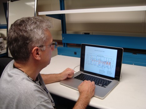
How do I know the results are so good, already, since the data doesn’t get fully analyzed until we get back to the lab? I have two ways to tell. First, when we are collecting the data, I am watching the raw signal on my laptop. I see the display in real time, and I can see the shape and the extent of the signal as it comes in. This gives me a real good idea if the data is good or not.
Also, after the flight is over, then I download the data into my laptop and can generate a quick view for a few samples, so I can make sure the radar operated right away. For instance today I just processed a file we generated during the data collection today. It takes about a half-hour to process a quick look – I did that, and it looks very good. Each file holds about a gigabyte of data, and that’s for about 30 seconds of actual data collection. This quick processing will give us an image of an area of about 6 km in length and 4 km in width.
Just to make sure everything is working fine for the next flight. I pretty much do this each night.
I wanted to mention, also that we do collect data from the same area with each instrument, but we don’t usually operate them at the same time. We could do that if we wanted to do so, but ideal data collection conditions for DBSAR and SIMPL are different. The radar (DBSAR) likes to fly high – at about 5.5 kilometers. It is imaging a large surface area, so it needs to be up high to gather the data. The Lidar likes to fly low, at around 1.2 kilometers. It is low powered so if you go up too high, you can’t get the return form the ground.
There is an experimental mode in which we operate the radar as an altimeter, so we look at a single line straight on and can get the height of the forest. I have collected data with the radar and the lidar simultaneously in that mode. In that way, we can compare the two side by side, and it gives us additional information.
The weather tomorrow looks very good – winds are low with very little cloud cover expected. As soon as we take off, we’ll have SIMPL and CAR finish their measurements in Maine, and then we will head for Quebec, one of the other main sites for this campaign. It’s important, because the forest ecosystem type is different here. We are looking at a northern hardwood transitional forest here, with some boreal forest features, but the site in Quebec is a boreal forest. It’s important for us to get data from diverse ecosystems, so Quebec is important.
The one issue have right now is permission to turn on the lidar in Quebec. When you fly over a country’s sovereign territory, you can’t just go turn on instruments and fly around. You need government permissions to fly, and also permission to run each instrument. We requested, and had received, permission to turn the lidar on at our sites for last week. But it was over last week, and this week we do not have permission to work yet this week. We are waiting for an extension of the original permit, or a new one, and hope we get it by tomorrow’s flight. The radar (the DBSAR) has all authorizations granted, so we can fly the radar for sure. So we will fly, no matter what. It’s just a question of if we can gather data from SIMPL or not tomorrow. We hope we can!
Bangor, ME 6 p.m. EDT
From Jon Ranson:
We had a great day and gathered fantastic data. It felt so good to be working and getting the data – finally. Unfortunately, our flight only lasted three hours. Then the Mission Manager, Martin Nowicki, came out of the cabin with a serious look on his face. He gave us bad news: there was bad weather threatening, and we had no choice but to cease collecting data immediately and return to the Bangor airport. What a disappointment to be reined in by bad weather!
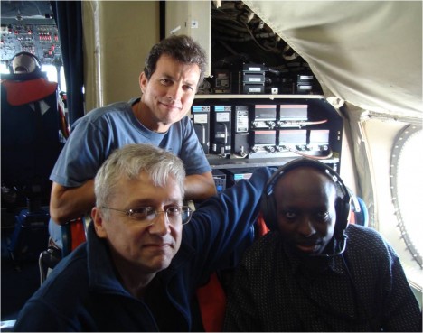
Well, field work is always risky, and science flights are always at high risk of running into problems. You need three things to do remote sensing from the air: a stable aircraft, functioning instruments, and good weather. The aircraft has been perfect from the beginning. The instruments are finally humming along perfectly. But now we don’t have the weather. Sometimes it’s just hard to get all three things working together. All you can do is your best, and persist despite difficulties.
And we’ve done that. I’m very gratified that we were able to get three hours of flying in today – it was excellent for the DBSAR, which can acquire accurate data even through dense clouds, like today’s conditions. We were able to fly many of the most critical lines and we were able to look at some of the data later in the day, and it looks just great.
So now we do know that the DBSAR works over the primary forests we wanted to look at on this part of the mission. We really wanted additional data, but what we were able to collect is very strong and I’m satisfied that it will be very valuable for our work.
Today’s emphasis was on the DBSAR, but we’d hoped to be able to run CAR and SIMPL as well. Unfortunately, there was enough cloud cover that they couldn’t gather much data over forests, but they did get to do measurements over cloud. Both instruments are used in other research for cloud cover, so they were able to take advantage of the situation to work on cloud reflectance. Not our current mission, but it’s better to gather some information than sit there unable to do anything useful.
With the DBSAR, were wanted to get data in multiple polarizations, so we made a run north to south and then a run south to north swaths over the same area. We then fly another set of lines in the same direction, to get additional looks at the same area to use for interferometry, which helps us understand the three dimensional structure of the forest. Then we cover the plot in a wide swath mode, taking measurements across a wide area that reaches out from both sides of the plane. We are experimenting with single pass interferometry in this mode, too.
Under ideal conditions, SIMPL would measure the forest height and vertical structure of the forest. The vertical structure is the way the branches and leaves are structured. Knowing the structure can help us understand how the canopy is put together, so it can help us understand forest type, stand density and biomass better. Our DBSAR will give us a broad swath of data, while SIMPL will take more limited spot samples of our swath area, but they should work together well.
The CAR will be used to assess the bidirectional reflectance of the forest canopy. Those measurements are related to the amount of leaf area in a canopy, whether the leaves are structured in clumps or are more uniformly distributed throughout, and also helps assess what type of forest we are looking at. So it’s a helpful addition to the DBSAR and SIMPL data.
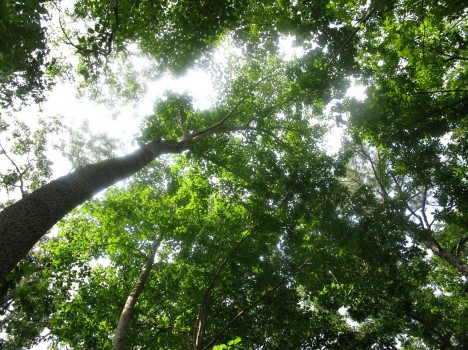
Despite the bad weather, the only problem I experienced was the inability to collect ground data with CAR and SIMPL. It was a cloudy day, but we didn’t see any rain until after we landed at the airport. We did get a thunderstorm then, but it didn’t seem like anything particularly severe to me. Inside the plane, we felt no turbulence to speak of, and the ride was smooth most of the day. That P3 is really a great plane, and the crew is top notch, so it’s no surprise we had a good flight, despite weather.
After we landed, I called Guoqing at Howland Forest to see how he was doing and what the weather was like there. He reported that the forest didn’t have any rain until the afternoon. That’s great news, and meant that we were taking our measurements in fair weather in the field, and they were able to measure at the same, time, too. That’s kind of nice to think that our colleagues were taking measurements in the forest as we flew overhead.
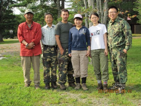
It was disappointing for the flight to be scrubbed this morning, but the weather news is even worse than that. Hurricane Irene is now predicted to come up the Delmarva peninsula, and the threat to Wallops is real. The experts at Wallops have decided that the P3 would not be safe weathering a direct hit of a Category 3 storm, which appears to be a possibility at this point. So they have called the plane home. They want to send it to a safe site in West Virginia before the end of the day tomorrow. So we go home in the morning.
The weather in Bangor is supposed to be beautiful tomorrow, with no rain and plenty of sun in the forecast. Now we’ve finally got the weather we need for a great day of data gathering. And our instruments are running perfectly. But now the third piece is missing – we don’t have an aircraft.
So, thanks to Irene’s approach, we head home tomorrow. We’ll be at Wallops by 10 a.m., and then I’ll join the coastal evacuation traffic heading west. All I can hope is that the Bay Bridge – a terrific traffic bottleneck for ordinary summer weekend beach traffic – isn’t jam-packed with evacuation traffic.
The Howland crew plans to work in the field all day tomorrow, then they try to get back to Maryland in time to make a few storm preparations. Most likely, they will drive all night long, from Maine to Greenbelt, swapping drivers to make the best time.
Despite our difficulties, the mission has really only just begun. We’ve got the Eco-3D South Flight to fly shortly, as well as flights over sites in Maryland. We’ve only just begun the blog, too – we’ll continue soon. Stay tuned!