
Thursday August 12, 2024: PACE-PAX Day 10 of 28
06:00 Local Time: Go/No-Go Meeting
We are in the field supporting PACE-PAX (Plankton, Aerosol, Cloud, ocean Ecosystem Postlaunch Airborne eXperiment), a multi-disciplinary mission that involves two aircraft—the NASA ER-2 and CIRPAS Twin Otter—and several mobile ocean assets, all helping to validate observations and data products from NASA’s new satellite observation platform, PACE. Our days typically start with an initial look at the weather in the area of operations and airport conditions during takeoff and landing. Both the ER-2 and Twin Otter will fly today since the weather is acceptable for launch, science, and landing.
07:45 Local Time: Tower Check-in
After breakfast at the hotel, our small team with a big name (LARGE, or the Langley Aerosol Research Group) heads to a semi-abandoned former control tower at the Marina Municipal Airport to check on a set of instrumentation operating 24/7 on the 7th floor. LARGE measures the properties of ambient aerosols, which are small particles in the atmosphere that can affect climate, seed clouds, and degrade air quality. Satellite observations quantify the sunlight scattered by particles to retrieve more complex properties like the particle concentration, size, and composition. For PACE-PAX, we are most interested in how those particles scatter and absorb light, making direct measurements—from the tower and on the Twin Otter aircraft—to provide a ground-truth for both the PACE satellite and for the satellite-proxy instrumentation on the ER-2.

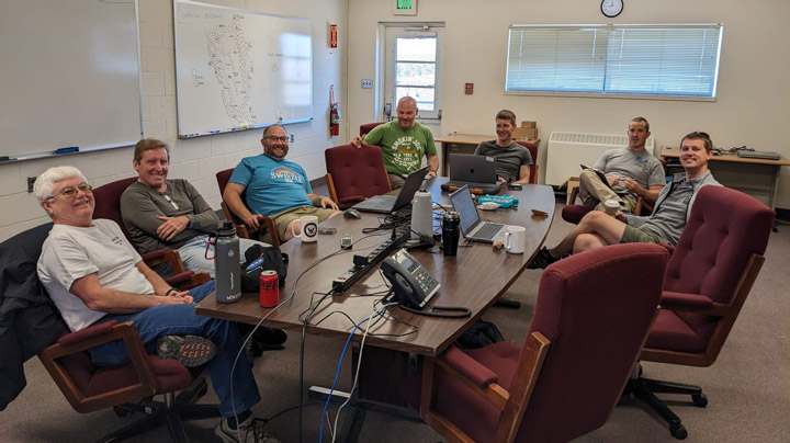
09:00 Local Time: Pilot Pre-flight Briefing
Three hours prior to takeoff, the science team meets with the two pilots for the CIRPAS (Center for Interdisciplinary Remotely Piloted Aircraft Studies) Twin Otter aircraft to discuss the day’s flight plan. The Twin Otter is operated by the Office of Naval Research and has been flying missions like PACE-PAX since 1998. Today’s plan will focus on satellite retrievals of aerosol properties over turbid, complex surface waters. The Sacramento-San Joaquin River delta and San Francisco Bay area will be our areas of operation due to their close proximity to Marina and their biologically active and heterogenous waterways. During this meeting, we describe our goals for the flight, the route, and key decision points to enable a successful mission. Our plan today will have three spiral maneuvers between an altitude of 10,000 feet (the functional ceiling for the Twin Otter during PACE-PAX) and our minimum safe flying altitude, a low-altitude transect of the San Francisco Bay, and a low approach at Moffett Field at NASA Ames Research Center.
11:00 Local Time: Pre-flight Instrument Maintenance
Following the pilot briefing, the team goes out to the aircraft to start up instrumentation and replace consumables for flight. The current instrument suite is specifically designed for PACE-PAX, with contributions from NASA, NOAA, and NPS. We sample aerosols by bringing air into the cabin via an inlet referred to on the Twin Otter as the “snorkel,” which looks a little like a large black football on a stick that protrudes just past the nose of the aircraft. We then route the air through a series of tubes towards each of the nine instruments in the cabin. Measurements are made in real-time, so the flight scientist on the plane can monitor each instrument during flight and use the measurements to inform decisions about the location and altitude of the aircraft. It takes us approximately 30 minutes to prepare for the flight and make any necessary last-minute trips to the bathroom (no lavatory is available on the aircraft during the three- to four-hour flight!)


11:59 Local Time: Twin Otter Takeoff
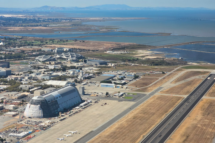
With an on-time departure from Marina, we did a counterclockwise circuit: 1) through the Central Valley of California and spiraling over a ground station at California State University Stanislaus; 2) spiraling over a site at the Sacramento-San Joaquin River delta; 3) spiraling over the San Pablo Bay just north of San Francisco; 4) flying at altitudes of 1,000 to 2,500 feet over the San Francisco Bay; and finally 5) completing a low approach at Moffett Field before returning to base. Just before landing, the Twin Otter did two more low-level passes over the runaway at Marina Municipal Airport at an altitude of 70 feet to confirm consistency with the ground-based tower measurements and to evaluate the transmission of the snorkel inlet.
We observed generally clean conditions throughout the flight, since most of the wildfire smoke emissions in the region were being transported to the east and outside our flight domain. Those conditions will be perfect, though, for testing satellite retrieval algorithms under the most difficult conditions when there is low aerosol ‘signal’ in the atmosphere. As a bonus, we got to view the Golden Gate Bridge and San Francisco skyline from a vantage point not often possible in airspace that is so congested with commercial traffic.


15:38 Local Time: Twin Otter Landing
After accomplishing our objectives in flight, our day concludes by downloading all of the data collected on that flight and summarizing the science highlights with project management during a post-flight briefing. These meetings are used to track mission progress and to communicate objectives and flight plans for the following day. A typical airborne mission will have two to six flights per week with a flight window of up to six weeks. During today’s meeting, we were briefed on a plan to fly to Southern California to test the other end of the aerosol ‘signal’ spectrum by sampling wildfire smoke from the Bridge, Line, and Airport fires. We were back at the hotel in plenty of time to enjoy a Buffalo Bills blowout win over their division-rival Miami Dolphins, and back on the aircraft the following day.
Our next steps are to process the data and share it with the rest of the science team. This helps other instrument teams analyze their own data and the project leadership evaluate how successfully we completed our objectives for the flight. Once we complete our calibrations during and after the mission, we can perform one last set of quality checks, and then the data will be shared with the public as well.
