Hurricane Otis hit Mexico’s Pacific Coast as a ferocious category 5 storm on October 25, 2023, breaking regional records for the strength and speed of its intensification. Storm surge, flooding, and mudslides, as well as damage to infrastructure and an airport, have been reported in the state of Guerrero.
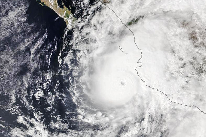
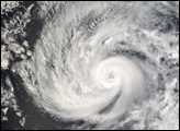
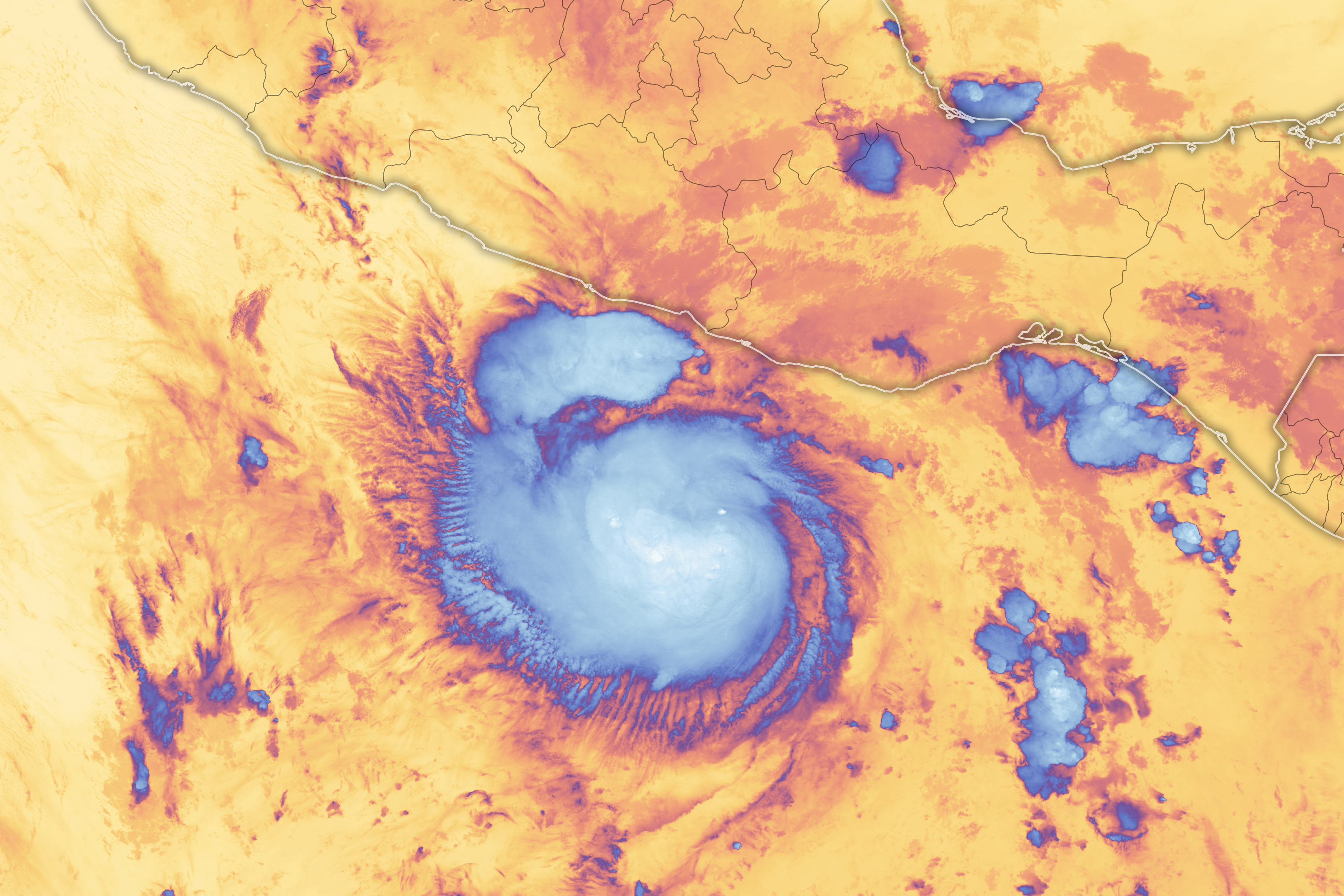
Prior to landfall, the VIIRS (Visible Infrared Imaging Radiometer Suite) sensor on the NOAA-20 satellite captured this false-color image of the storm at about 08:30 Universal Time (2:30 a.m. in Acapulco) on October 24, 2023.
When the image was acquired, Otis was still a tropical storm with sustained winds of 100 kilometers (65 miles) per hour, and was located about 335 kilometers (210 miles) south-southeast of Acapulco. The image shows infrared brightness temperature data, which is useful for distinguishing cooler cloud structures (white and blue) from warmer surfaces below (yellow). The coolest temperatures are associated with areas of tall clouds. Note, however, that the storm at this time did not yet have an eye.
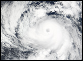
Otis remained a tropical storm until the afternoon of October 24. Then, in a matter of hours, it rapidly intensified into a major hurricane. By 06:25 Universal Time (12:25 a.m. in Acapulco) on October 25, Otis made landfall near the beach resort town with sustained winds of 270 kilometers (165 miles) per hour. According to news reports, Otis was the strongest hurricane on record to hit Mexico’s Pacific Coast, and the fastest-strengthening storm on record in the northeast Pacific.
Scott Braun, a research meteorologist at NASA’s Goddard Space Flight Center and project scientist for the TROPICS mission, said that Otis had “all the right ingredients” for rapid intensification. Those include elements such as warm sea surface temperatures, a deep layer of warm ocean water, lots of moisture, and relatively low vertical wind shear. “Conditions were present for rapid intensification, but it is hard to say at this time why the rate and magnitude of intensification were so great,” Braun said.
Forecast discussions from the National Hurricane Center pointed to some of these conditions and noted that statistical models showed a good probability for rapid intensification. “A key challenge for any forecaster is predicting the timing and magnitude of rapid intensification,” Braun said. “It’s extremely difficult to do.”
Data collected by TROPICS—short for Time-Resolved Observations of Precipitation structure and storm Intensity with a Constellation of Smallsats—will help weather researchers learn more about the environmental factors contributing the structure and intensity of storms similar to Otis. Such information could prove useful for NOAA, the U.S. Joint Typhoon Warning Center, and international agencies responsible for developing hurricane, typhoon, and cyclone forecasts.
NASA Earth Observatory image by Michala Garrison, using VIIRS data from NASA EOSDIS LANCE, GIBS/Worldview, and the Joint Polar Satellite System (JPSS). Story by Kathryn Hansen.