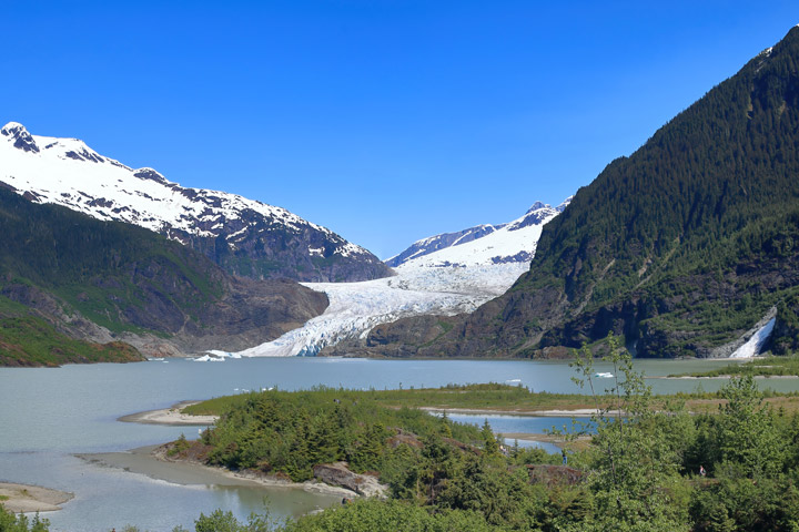
Each year, hundreds of thousands of people visit Mendenhall Glacier—an easily accessible glacier near Juneau in Southeast Alaska. But each year, there is less and less of the glacier to see.
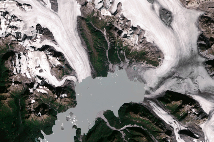
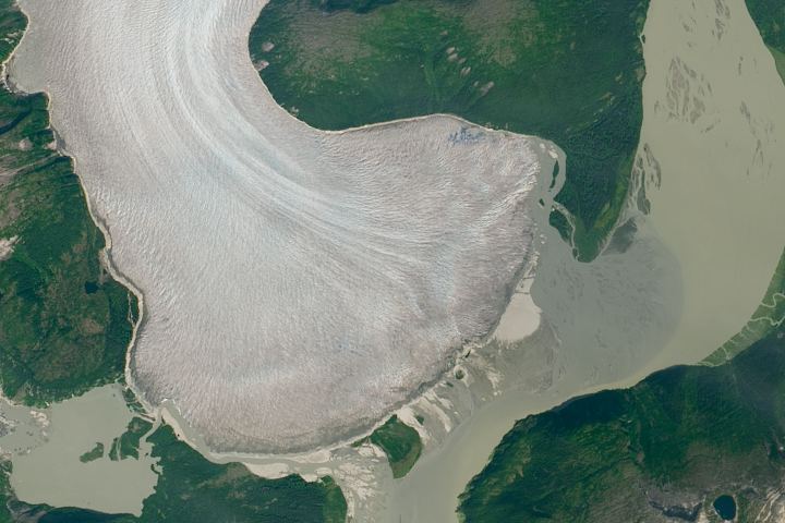
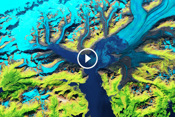
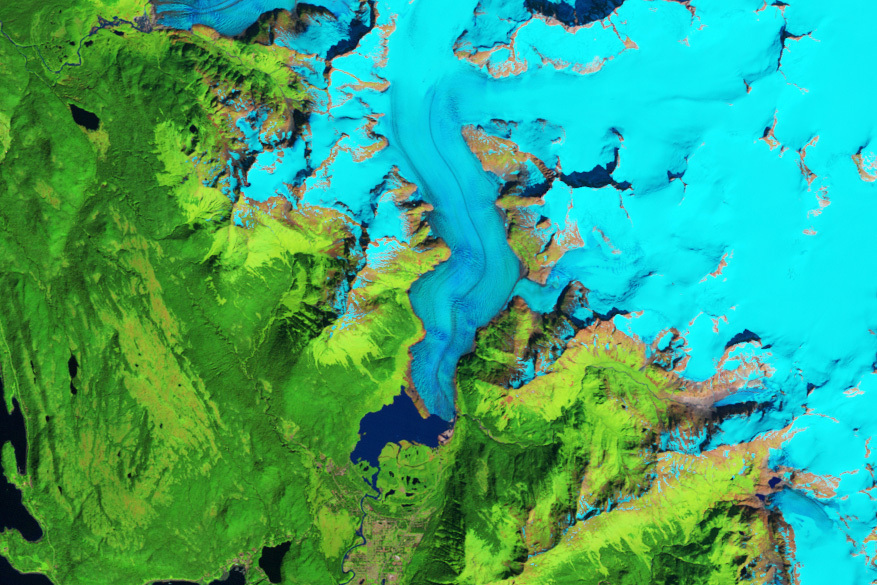
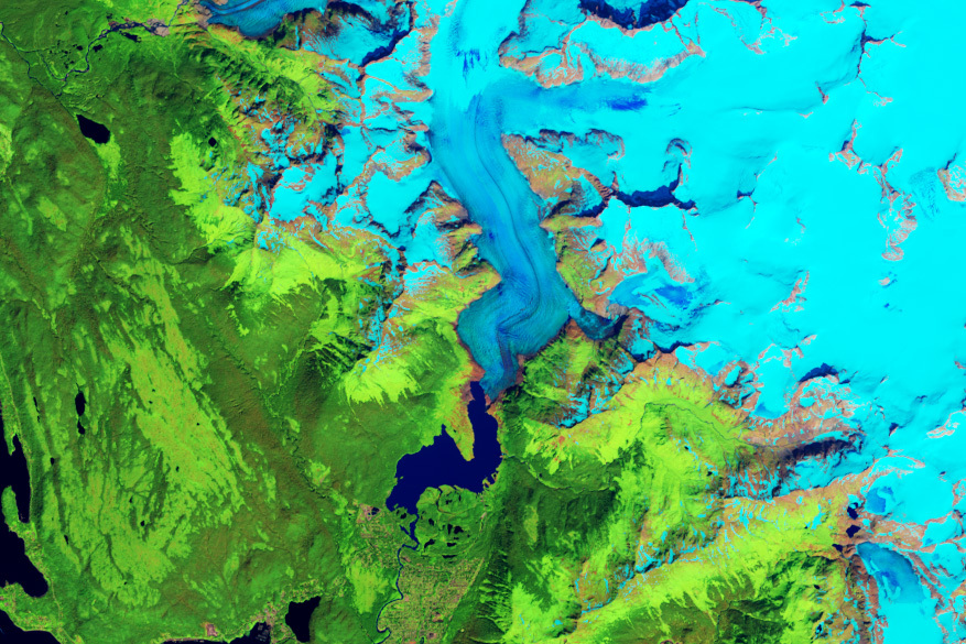
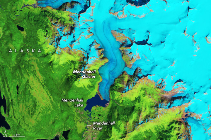
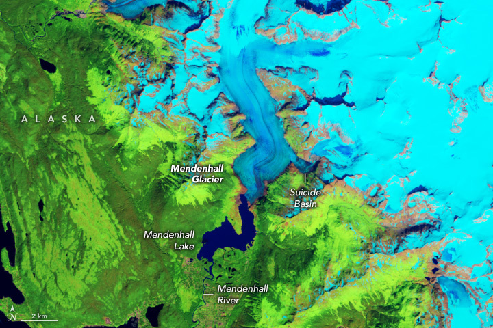
These satellite images show the glacier during summer in 1984 (left) and 2023 (right). Snow and ice are blue in these false-color images, which blend infrared and visible wavelengths to better differentiate areas of ice, rock, and vegetation. False-color also allows a better color match between the two images that were collected by different satellite sensors. The 1984 and 2023 images were acquired by the Thematic Mapper on Landsat 5 and the Operational Land Imager (OLI) on Landsat 8, respectively.
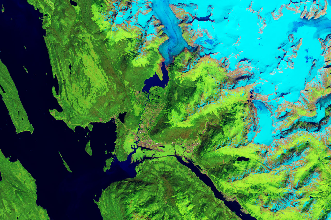
During the time spanned by the image pair, Mendenhall retreated by about 1 mile (1.6 kilometers). In the 1984 image, the glacier’s front ends at the tip of a prominent peninsula in Mendenhall Lake. This proglacial lake collects rain and meltwater and feeds the river flowing south through the Mendenhall Valley, a suburb of Juneau. In the 2023 image, however, much of the glacier terminates on land and only partially reaches the lake. Thinning has also taken a toll on the glacier during the past four decades, causing it to narrow by about 2,000 feet (600 meters) at the bend closest to its front.
Mendenhall Glacier started retreating in the mid-1700s following a period of glaciation that began 3,000 years ago. But in recent decades, Alaska has been warming twice as fast as the rest of the United States, helping to push the region’s glaciers into an especially steep decline. The Juneau Icefield, of which Mendenhall Glacier is a part, lost 63 out of 1,050 small glaciers inventoried between 2005 and 2019. During that same period, the icefield lost 10 percent of its glacier area.
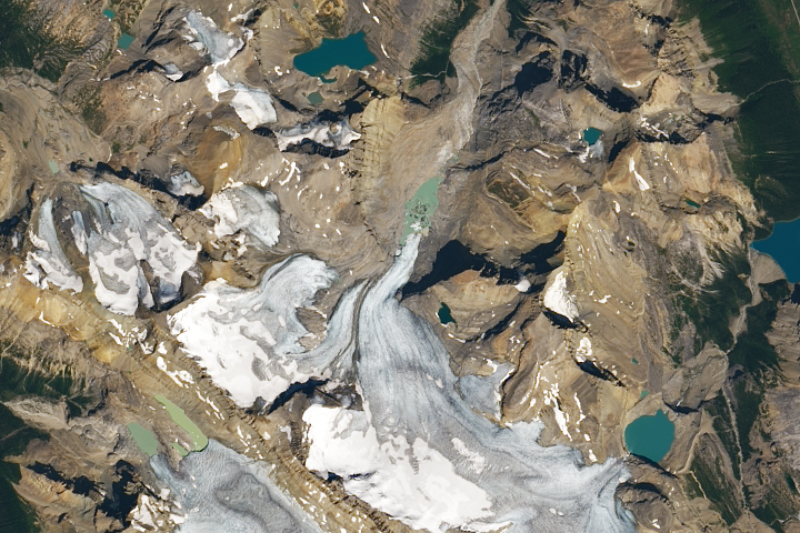
The 2023 satellite images, at the top of this page and the wide-view above, were acquired on July 28, one week before a glacial outburst flood. Meltwater collects in a basin where a tributary glacier once joined Mendenhall at the glacier’s edge. This basin can abruptly drain, inundating the lake and river. Outburst floods have been happening here annually since 2011. On August 5, 2023, gauge data showed record-high lake levels, producing a torrent of water that destroyed homes and displaced residents along the river.
NASA Earth Observatory images by Wanmei Liang, using Landsat data from the U.S. Geological Survey. Photo by Jeremy Bishop on Unsplash. Story by Kathryn Hansen with science review by Christopher Shuman/UMBC/NASA GSFC.