On February 19, 2023, torrential rain pounded São Paulo, a state in southeast Brazil. The water saturated soils and led to deadly flooding and landslides in the region.
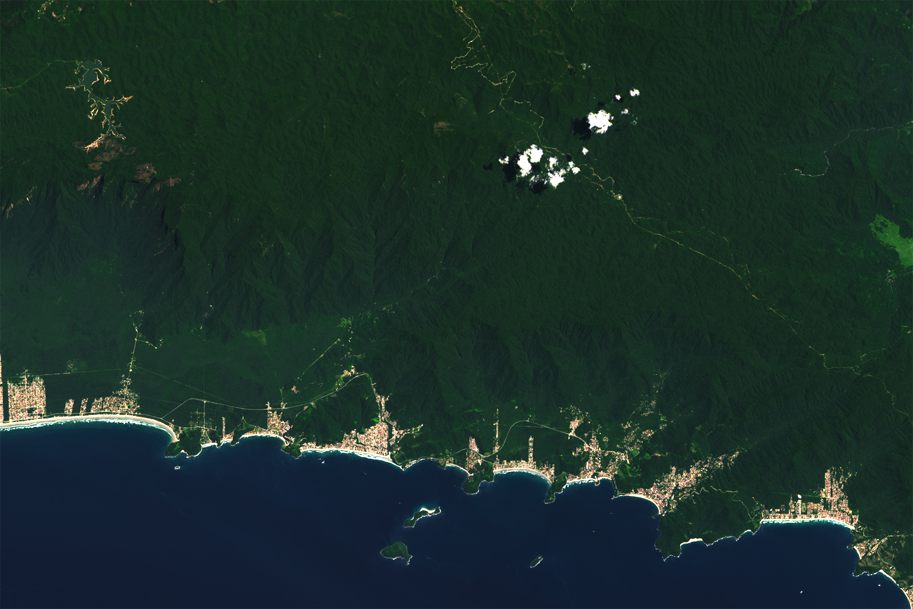
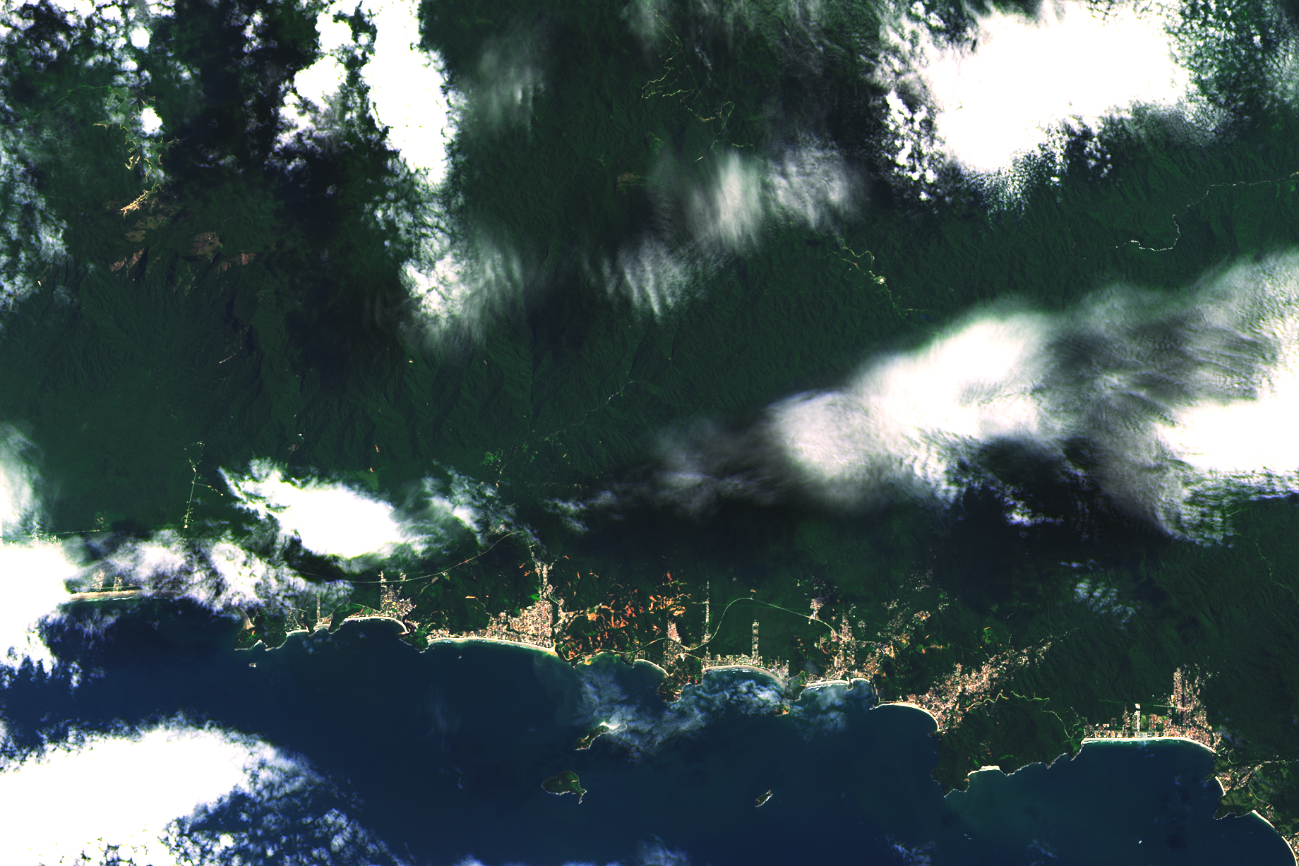
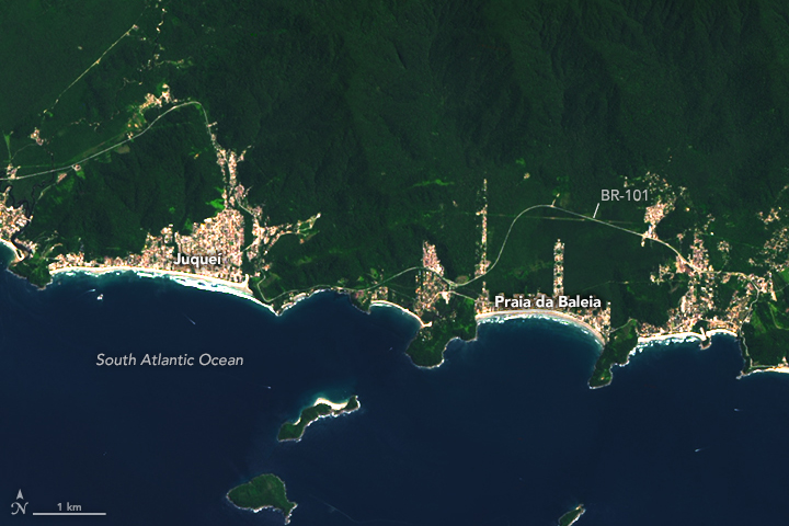
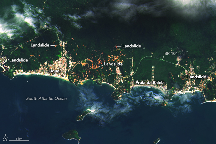
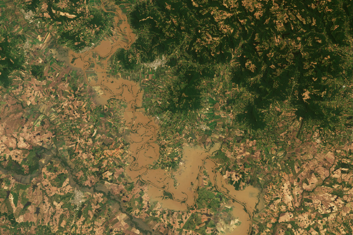
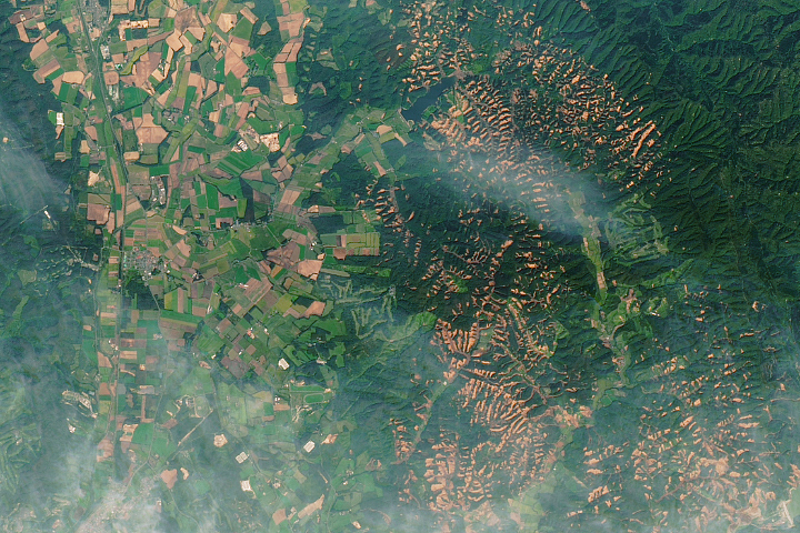
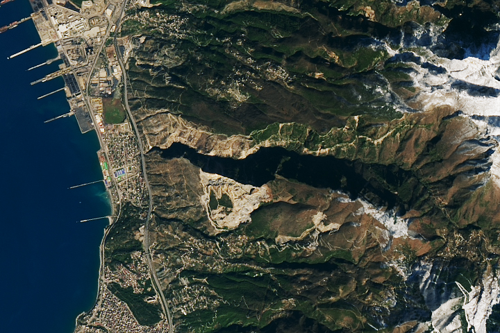
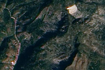
The coastal municipality of São Sebastião was among the hardest-hit areas. This image (right), acquired on February 26, 2023, with the Operational Land Imager (OLI) on Landsat 8, shows numerous landslides across the hilly landscape between São Sebastião’s beach communities of Jaqueí and Praia da Baleia. The other image (left), acquired with Operational Land Imager-2 on Landsat 9, shows a more typical view of the same area several months before the storm.
“Areas with very dense concentrations of landsliding, as seen here, are quite unusual but not unprecedented,” said Robert Emberson, a landslide expert with NASA’s Earth Applied Sciences Disasters program area. He added that landslide events of this extent require extremely intense localized rainfall.
That’s what happened in São Paulo when a storm delivered a huge amount of rain in a short amount of time. According to news reports, parts of the state saw more than 680 millimeters (26 inches) in a single day, exceeding the 24-hour rainfall record in some of the affected areas.
“South Brazil is a bit of a landslide hotspot at this time of year; high seasonal rainfall, combined with steep slopes, lead to characteristically high landslide hazards,” Emberson said. “This amount of rainfall will leave nearly all of the hillslopes saturated, destabilizing the soils and underlying bedrock. Unfortunately, these landslides have also impacted homes and infrastructure, leading to major loss of life.”
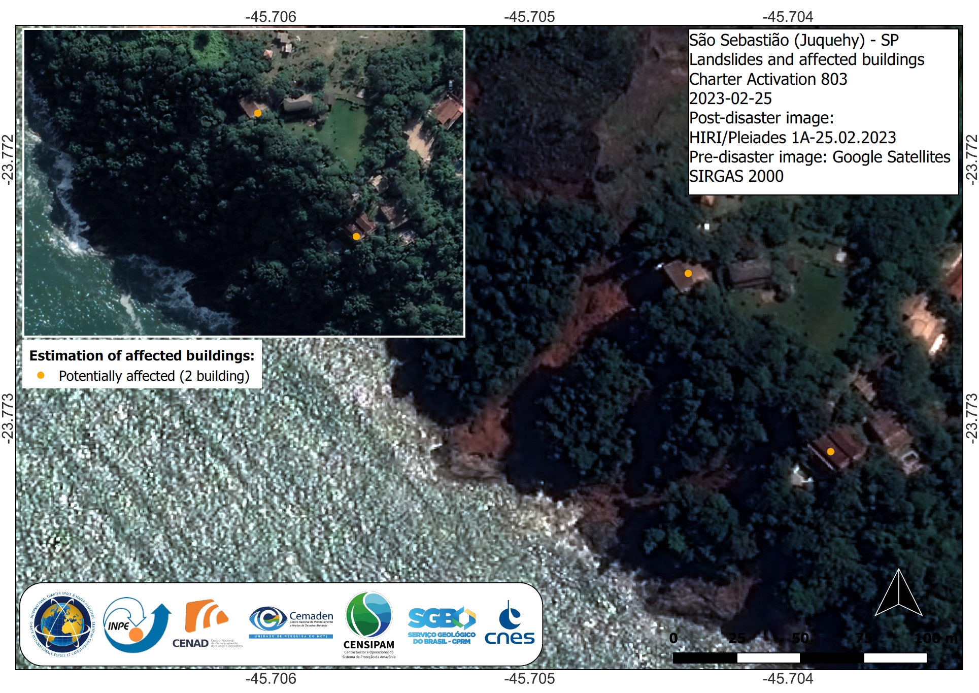
The landslides are most visible in the forested areas where the orange-red color of the soil contrasts with green forested areas. More detailed satellite images show the landslides affected urban areas as well. According to the International Charter Space and Major Disasters, landslides in this area likely destroyed several buildings and blocked parts highway SP-55 (BR-101).
In an effort led by Dalia Kirschbaum, Earth science director and landslides expert at NASA’s Goddard Space Flight Center, NASA scientists have worked closely for several years with the city government in Rio de Janeiro (northeast of São Paulo) to help put satellite data to use in warnings for flooding and landslides.
“São Paulo state sits outside of the area where we have conducted this work,” Emberson said. “But it shares much of the same geographic and climatic propensity for extensive landsliding.”
NASA Earth Observatory images by Allison Nussbaum, using Landsat data from the U.S. Geological Survey. Story by Kathryn Hansen.
alert message


