From late December 2022 into January 2023, a series of damaging storms delivered a tremendous amount of precipitation to California, helping to replenish mountain snowpack and reservoirs. Still, the abundance of water is unlikely to reverse the region’s decades-long decline in groundwater.
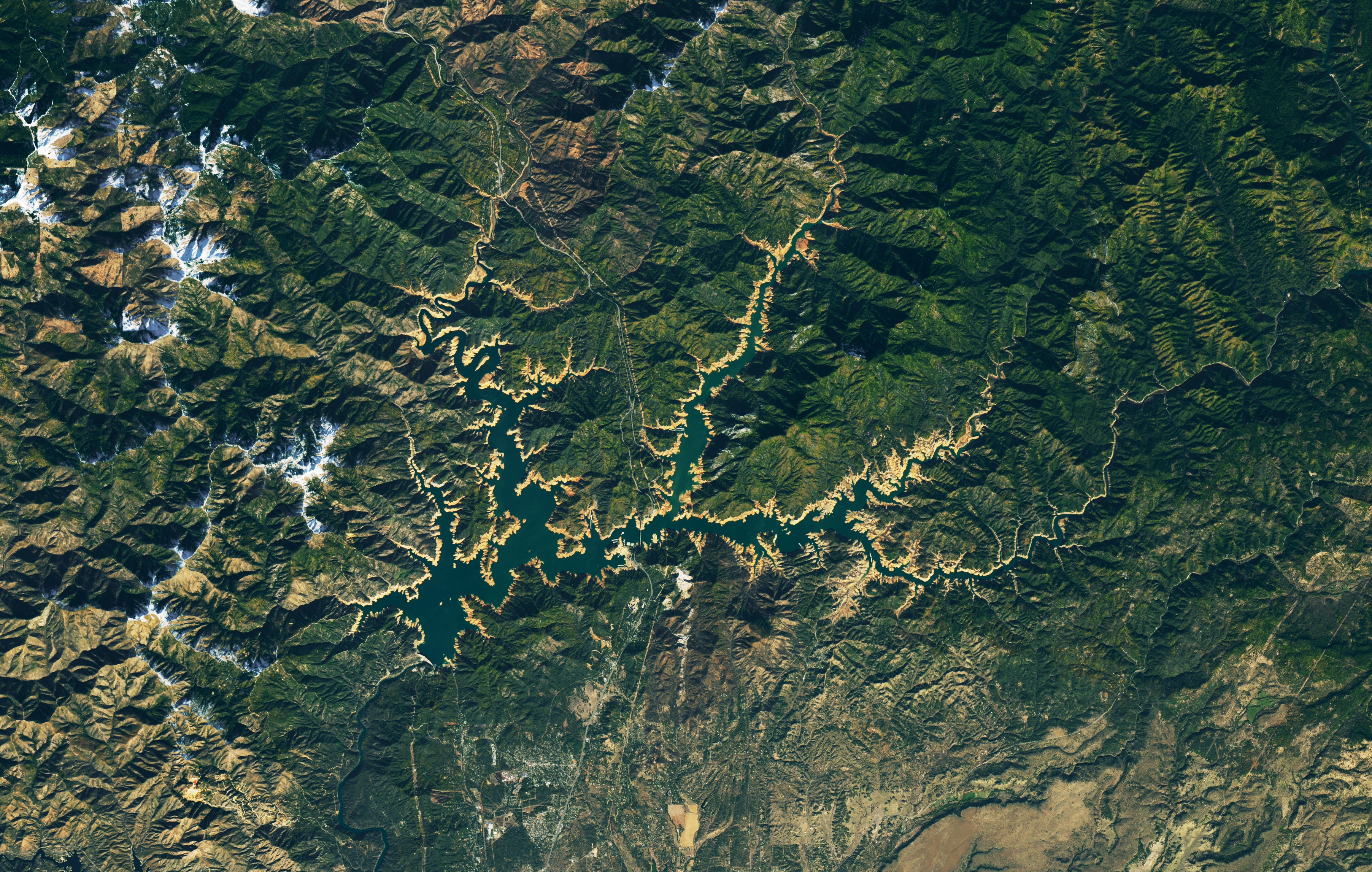
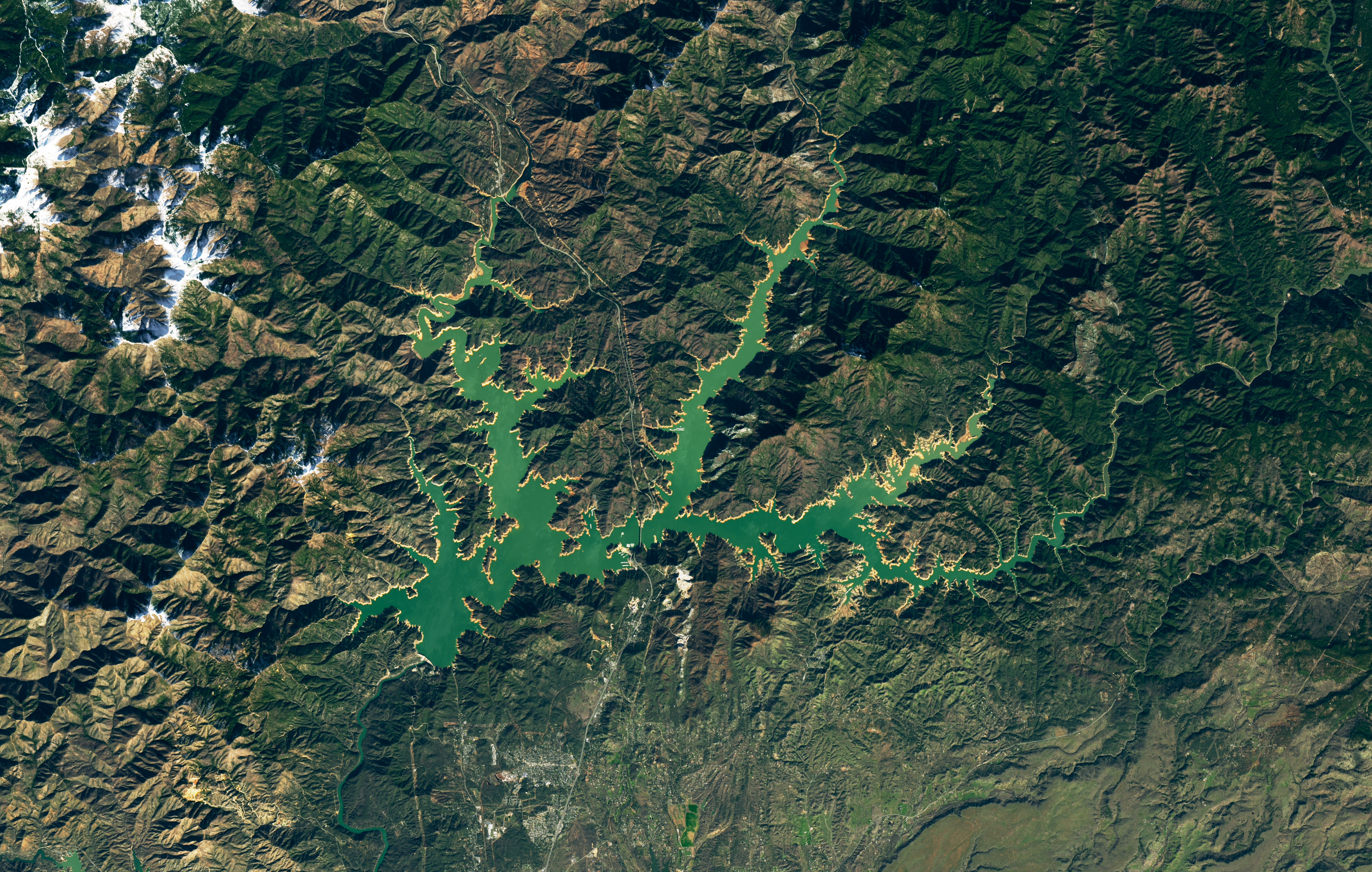
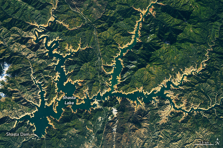
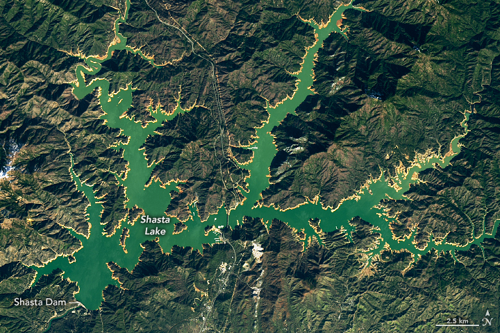
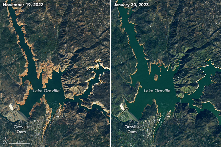
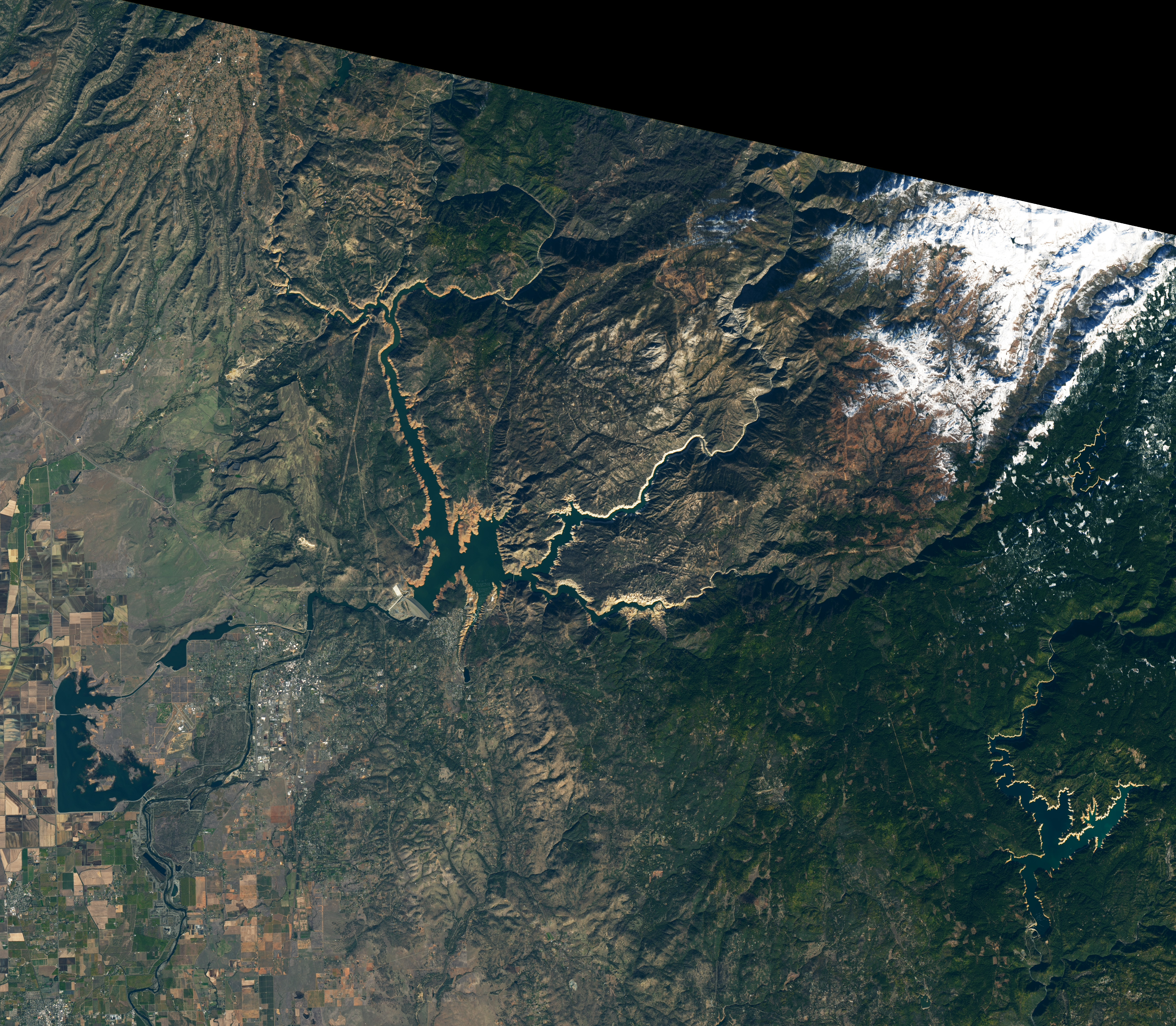
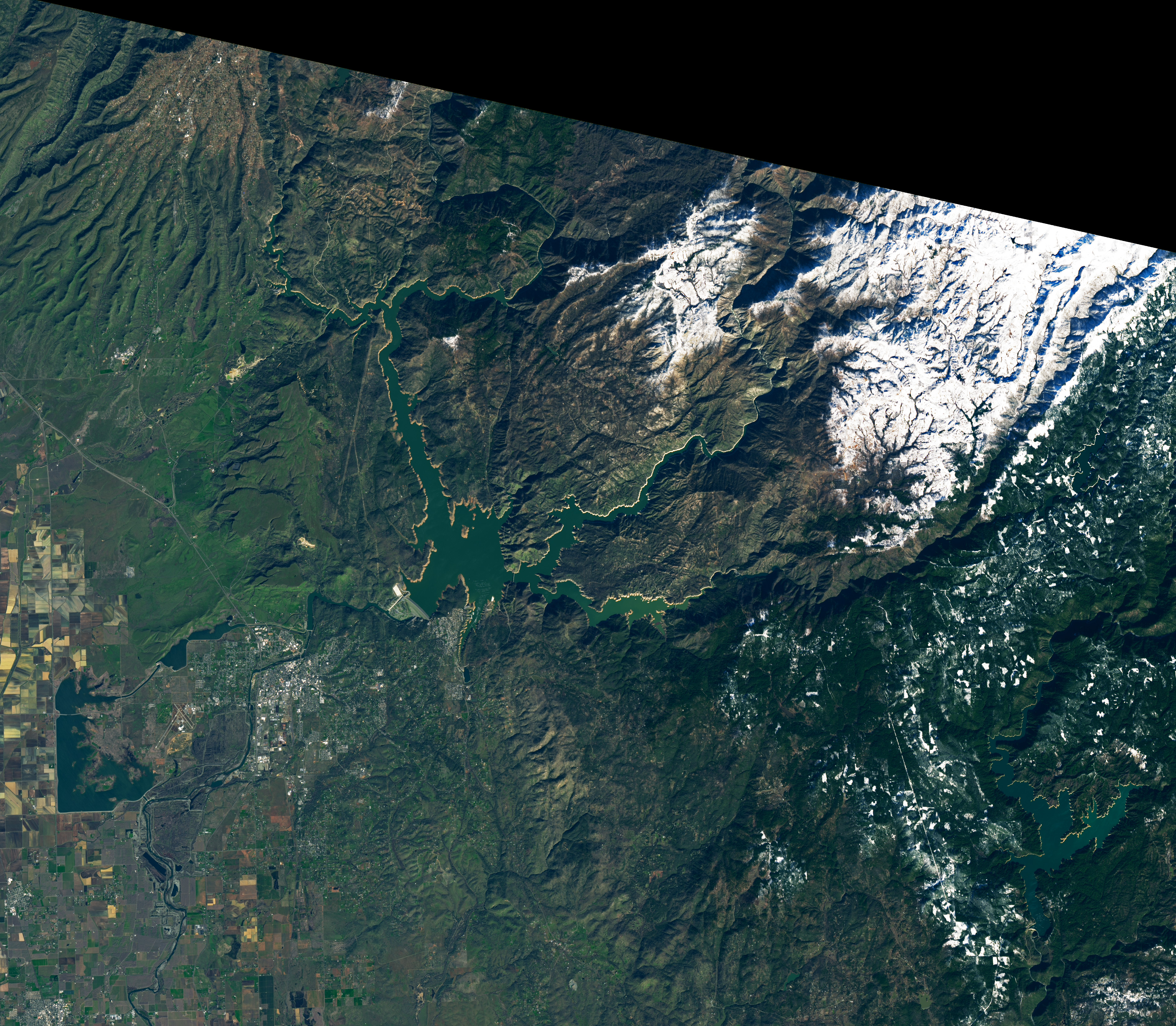
The images above and below show the two largest reservoirs in California—Shasta Lake and Lake Oroville—before and after the winter storms. They were acquired in November 2022 (left) and in late January 2023 (right) by the Operational Land Imager (OLI) on Landsat 8 and the OLI-2 on Landsat 9.
As of January 29 (top-right) Shasta stood at 56 percent of capacity, or about 87 percent of the historical average for the time of year, according to the California Department of Water Resources. That’s up from 31 percent of capacity on November 19 (top-left). As of January 30 (below-right), Lake Oroville stood at 64 percent of capacity, or about 111 percent of the historical average for the time of year. That’s up from 28 percent of capacity on November 19 (below-left).
Notice the tan fringes around the lakes in the November images. This is where calcium carbonate and other mineral compounds have attached to the sandstone during past instances of higher water levels. By late January, much of these “bathtub rings” were underwater again.
Water from recent winter storms is needed by farmers, wildlife, and residents in the region, where precipitation and lake levels in recent years have been among the lowest since the 1970s. However, scientists caution that similar large precipitation events in the past have not been enough to reverse the longer-term depletion of groundwater—a reserve of water that supplements surface sources used for irrigation and other purposes.
“The abundant water is expected to recharge the groundwater in the next few months, as we have seen during similar events in 2011 and 2017,” said Pang-Wei Liu, a scientist at NASA’s Goddard Space Flight Center. “However, if the climate pattern is the same as before—dry and hot in summer followed by low precipitation—and the water demands are still high, then we expect the groundwater drawdown will continue.”
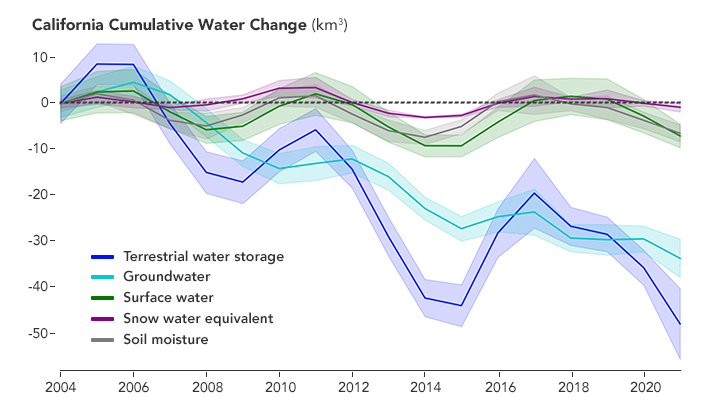
The chart above, produced with data provided by Liu, shows a downward trend in California’s terrestrial water storage (dark blue line) spanning nearly two decades. This includes surface and groundwater, and water held within the soil and in snow. The rest of the lines show why this is happening; amid some variability in all types of stored water, it is groundwater (light blue line) that is sharply decreasing.
Liu and colleagues used data from the Gravity Recovery and Climate Experiment (GRACE) and GRACE Follow-On satellite missions to show that the depletion of groundwater in California’s Central Valley has been accelerating since 2003. Their results were published December 2022 in Nature Communications.
“Even the wettest wet seasons are simply never enough to make up for the far greater amount of groundwater that California extracts each year,” said Jay Famiglietti, a global futures professor at Arizona State University and a co-author of the paper. “Hopefully California’s Sustainable Groundwater Management Act can slow what will otherwise be a speedy trip to the bottom.”
NASA Earth Observatory images by Lauren Dauphin, using Landsat data from the U.S. Geological Survey and chart data courtesy of Pang-Wei Liu and Jay Famiglietti. Story by Kathryn Hansen.


