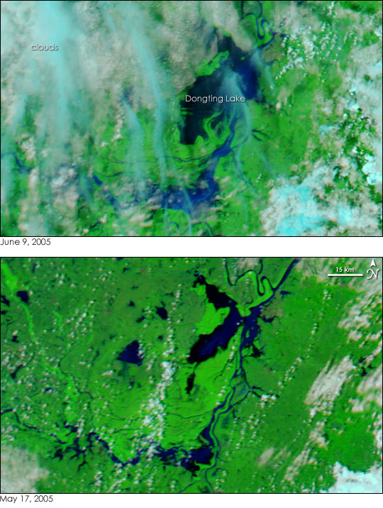
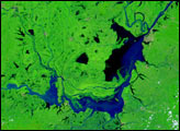
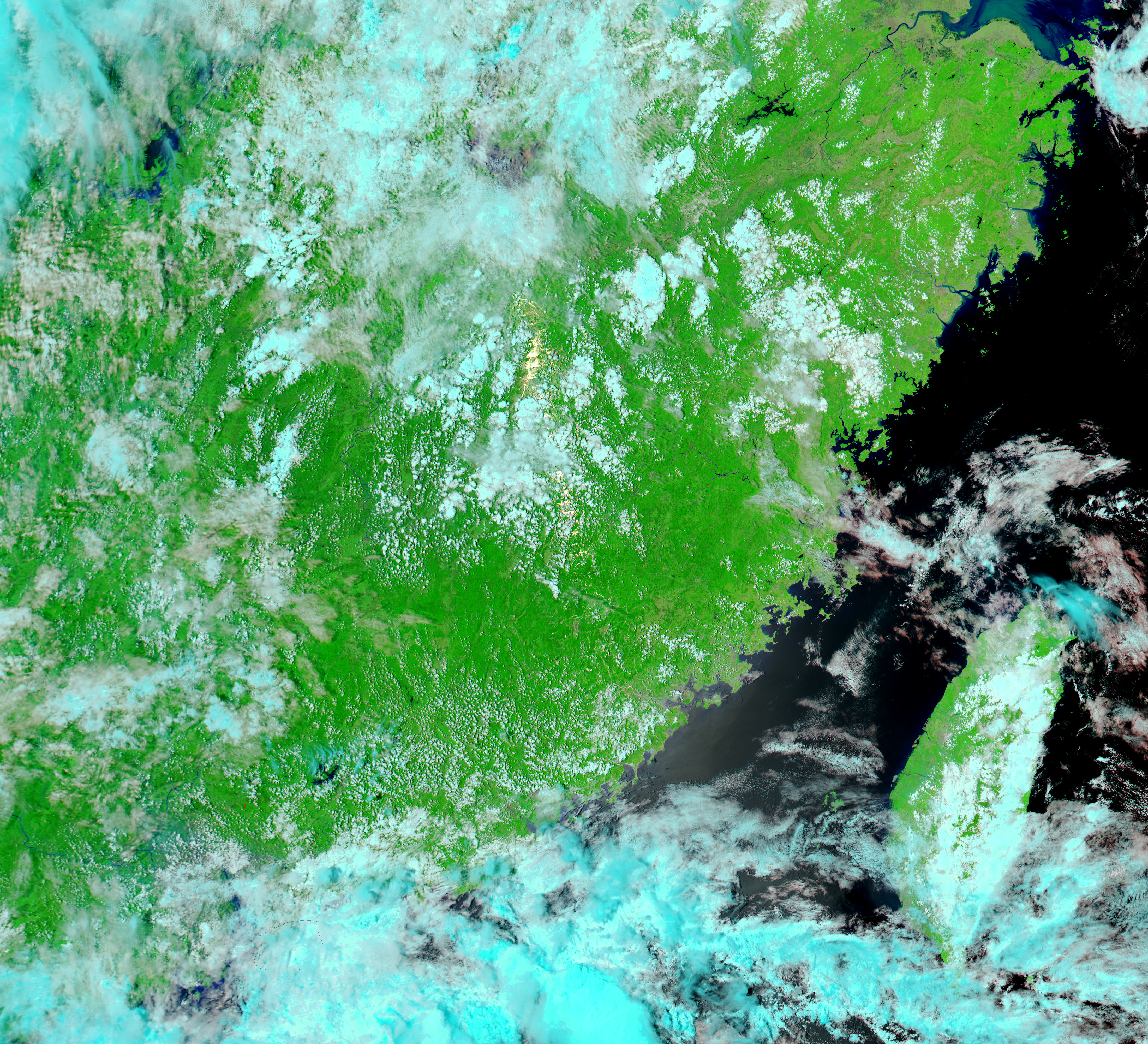
The summer monsoon pounds southern China with heavy rain year after year, often triggering deadly floods. The rainy season officially started on June 1, and by June 5, the media reported 204 flood-related deaths throughout China for the year. The floods started on May 31 when torrential rain caused flash floods and mudslides and have continued through June 9, 2005, when the top image was taken. These Moderate Resolution Imaging Spectroradiometer (MODIS) images show the region around Dongting Lake in China’s Hunan Province, the most severely affected province.
In the three weeks between May 17, when the lower image was acquired, and June 9, the lake and surrounding waterways swelled with flood water, extending kilometers beyond their dry-season banks. Light blue and white clouds linger over the flood region in the top image. Water is normally dark blue or black in this color combination, but in the top image, muddy runoff has tinted the water a lighter shade of blue.
The high-resolution images provided above are at MODIS’ maximum resolution of 250 meters per pixel. Both images were taken by NASA’s Aqua satellite and are available in additional resolutions from the MODIS Rapid Response Team.
NASA images courtesy the MODIS Rapid Response Team at NASA GSFC.


