Today’s caption expands upon images highlighted our new feature: A Celebration of Clouds.
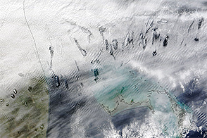
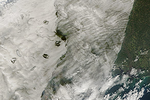
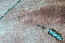
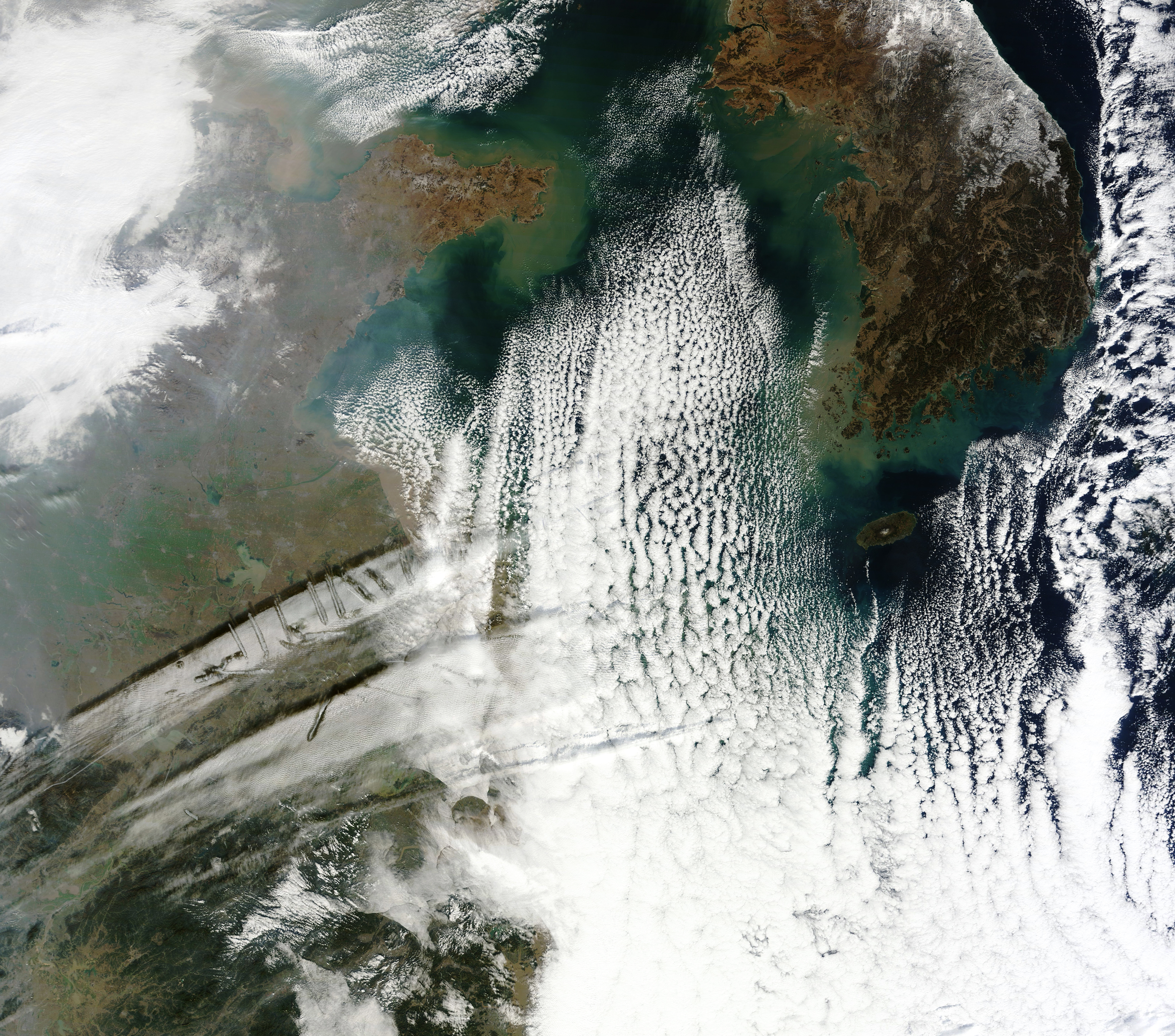
In January 2007, satellites captured an extraordinary example of hole-punch clouds visible over the southern United States. But occurrences of the cloud type, albeit usually less pronounced, show up every year over Earth’s mid- and high-latitudes. A more recent display developed over eastern China, visible in this image acquired on December 28, 2016, with the Moderate Resolution Imaging Spectroradiometer (MODIS) on NASA’s Terra satellite.
This strange phenomenon results from a combination of cold temperatures, air traffic, and atmospheric instability. If you were to look from below, it would appear as if part of the cloud was falling out of the sky. As it turns out, that’s actually what’s happening.
The mid-level clouds are initially composed of liquid drops at a super-cooled temperature below 0° Celsius. As an airplane passes through the cloud, it creates a disturbance that triggers freezing. Ice particles then quickly grow in the place of the water droplets. Eventually the ice crystals in these patches of clouds grow large enough that they literally fall out of the sky—earning hole-punch clouds their alternate name: “fallstreak holes.” Falling crystals are often visible in the center of the voids.
The formations in this image are less like holes and more linear, like long canals. The same basic processes are responsible for producing both configurations. Whether the void takes on a circular or linear shape depends on differences such as cloud thickness, wind shear, and air temperature. Hole-punch and canal clouds can appear together, as they did in this image from December 2015. They often occur in the vicinity of an airports.
NASA Earth Observatory image by Joshua Stevens, using MODIS data from LANCE/EOSDIS Rapid Response. Caption by Kathryn Hansen.
alert message