Citizens of Bangladesh are quite familiar with floods. Situated on a wide deltaic plain at the confluence of several large rivers, the low-lying country is one of the most flood-prone in the world. But even by local standards, the onslaught in the summer of 2014 has been unusual.
A combination of heavy monsoon rainfall in the country’s main river basins and the arrival of meltwater from the Himalayas has triggered severe flooding in Bangladesh’s Lalmonirhat, Kurigram, Nilphamari, Rangpur, Gaibandha, Bogra, Sirajganj, Jamalpur, and Sherpur districts.
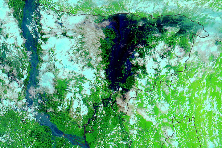
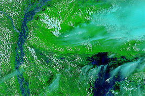
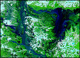
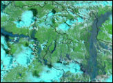
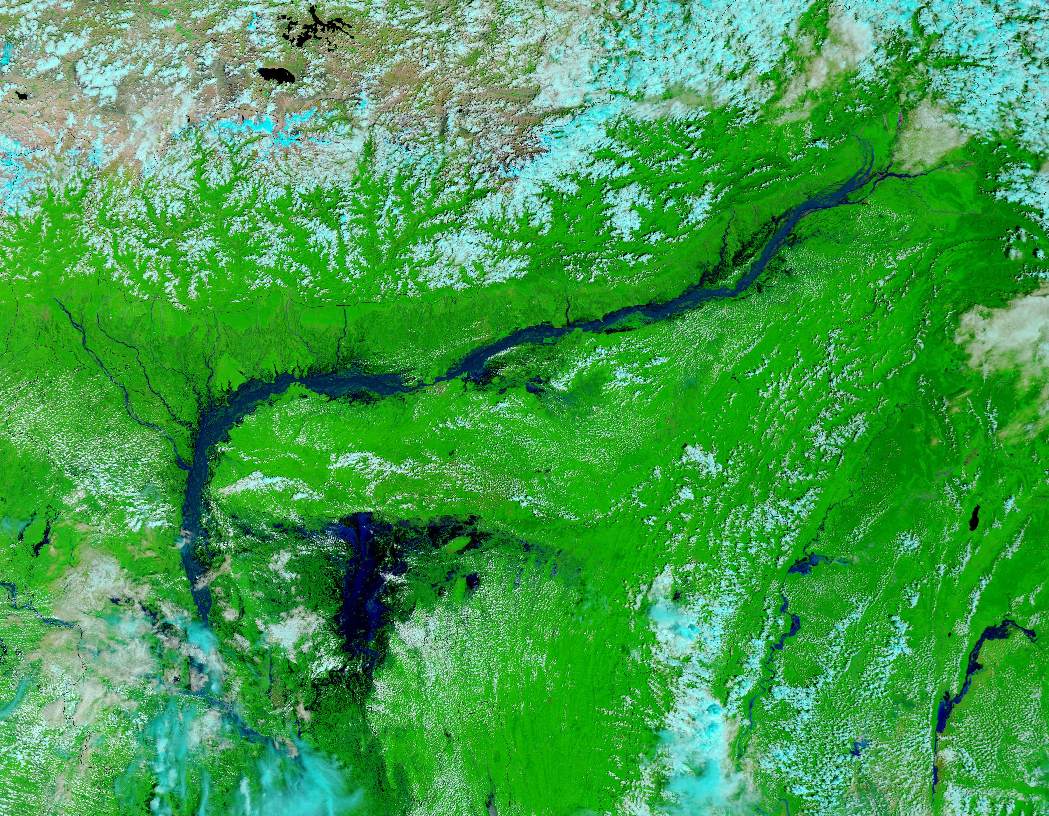
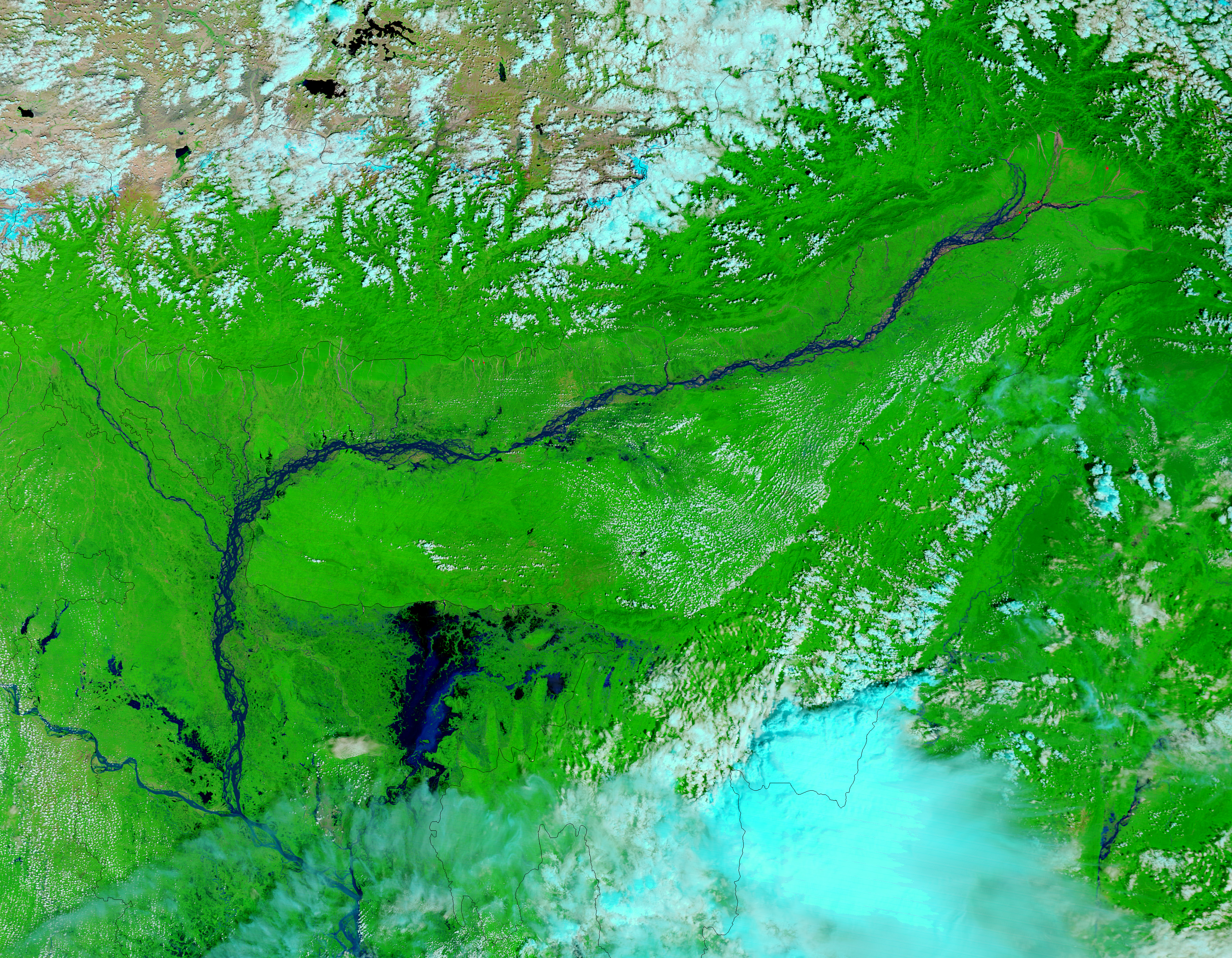
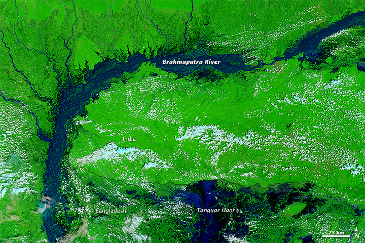
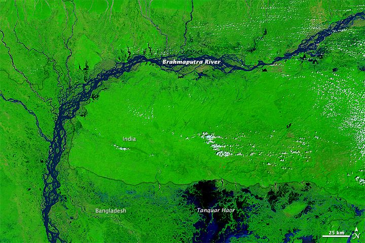
On August 29, 2014, the Moderate Resolution Imaging Spectroradiometer (MODIS) on NASA’s Terra satellite captured the top image, which shows flooding along the Brahmaputra River and Tanquar haor, a large wetland region. The lower image shows the same area on September 8, 2012, a more typical year. (Turn on the image comparison tool to see the difference.) Both are false-color images made from a combination of infrared and visible light (MODIS bands 7-2-1). Water varies in color from blue to black; vegetation is bright green; and bare ground is brown. This band combination makes it easier to spot changes in river dimensions.
According to some estimates, more than 275,000 people had been displaced and more than 31,000 homes had been destroyed and 188,000 damaged. As of September 4, 2014, most rivers in Bangladesh had crested, but flooding remained severe in many areas.
NASA images courtesy the MODIS Rapid Response Team at NASA GSFC. Caption by Adam Voiland.