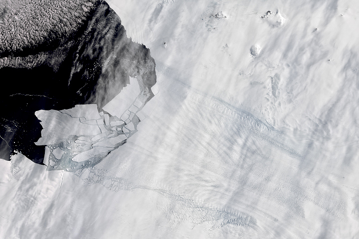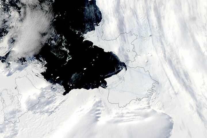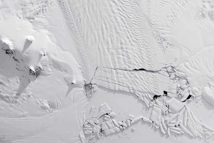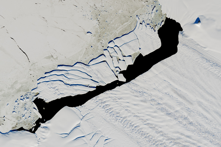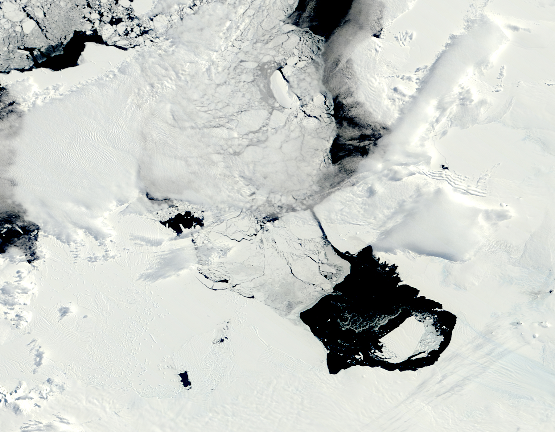
In early November 2013, a large iceberg separated from the front of Antarctica’s Pine Island Glacier. It thus began a journey across Pine Island Bay, a basin of the Amundsen Sea. The ice island, named B31, will likely be swept up soon in the swift currents of the Southern Ocean, though it will be hard to track visually for the next six months as Antarctica heads into winter darkness.
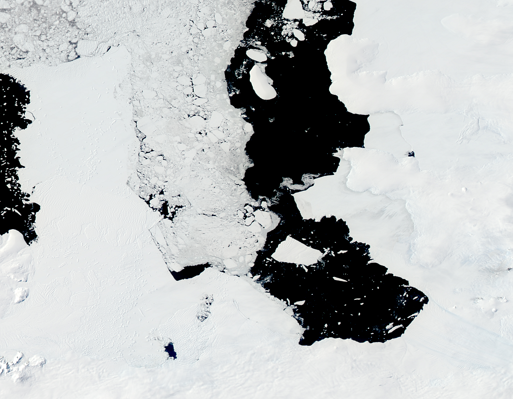
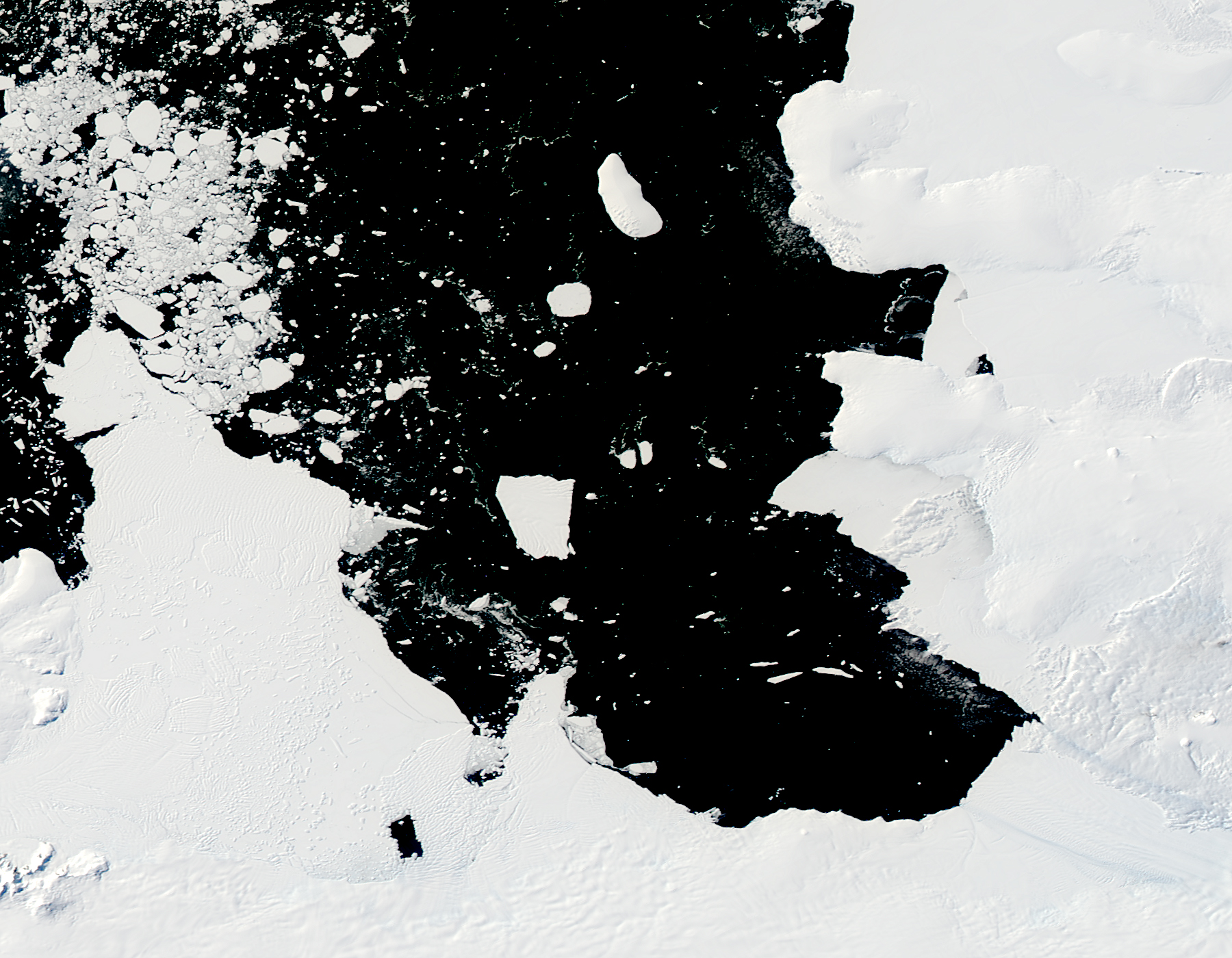
Over the course of five months in Antarctic spring and summer, the Moderate Resolution Imaging Spectroradiometer (MODIS)—an instrument on NASA’s Terra and Aqua satellites—captured a series of images of ice island B31. On this page, Terra captured the image from November 18 and December 10, 2013; while Aura acquired those from February 5 and March 11, 2014. The time-lapse video below shows the motion of the massive chunk of ice.
The significance of the event is still being sorted out. “Iceberg calving is a very normal process,” noted Kelly Brunt, a glaciologist at NASA’s Goddard Space Flight Center. “However, the detachment rift, or crack, that created this iceberg was well upstream of the 30-year average calving front of Pine Island Glacier (PIG), so this a region that warrants monitoring.”
PIG has been the subject of intense study in the past two decades because it has been thinning and draining rapidly and may be one of the largest contributors to sea level rise. But ice islands and icebergs are not only tracked for scientific purposes; maritime agencies follow them because of the danger they can pose to ships.
A research team led by Grant Bigg of the University of Sheffield has been tracking the ice island with synthetic aperture radar and visible satellite imagery, while also modeling the drift of the ice.
“It has been very interesting how little sea ice there has been in the area,” Bigg said. “In the video, you can certainly see clouds suggesting strong katabatic wind flow off the glacier in the first month or two, which would have kept the Bay ice-free and helped guide the iceberg out.”
“B31 has been well-tracked,” said David Jones of the British Antarctic Survey (BAS). In January 2013, a few months after a rift was detected in the ice shelf of Pine Island Glacier, Jones and colleagues flew over the region and dropped 37 javelin-shaped Aircraft Deployable Ice Observation Systems (ADIOS) onto the ice. ADIOS is basically a GPS tracker, and it is helping researchers monitor the glacier’s movements. Two of the ADIOS javelins were dropped on top of B31 before it broke off from the continent. “Thanks to the early detection of its calving by the IceBridge program, we have been able to study its dynamics from early on in its lifecycle.”
A BAS research ship (BAS) also visited Pine Island Bay in February 2014 to observe conditions.
“We are doing some research on local ocean currents to try to explain the motion properly. It has been surprising how there have been periods of almost no motion, interspersed with rapid flow,” Bigg added. “There were a couple of occasions early on when there might have been partial grounding or collisions with the seafloor, as B31 bounced from one side of the Bay to the other.”
As of April 11, 2014, the U.S. National Ice Center (NIC) reported that B31 was 33 kilometers long and 20 kilometers wide (18 by 11 nautical miles). “While some mass was lost very early on in the life of B-31, it has remained pretty much the same shape since early December and is still about six times the size of Manhattan,” Bigg said. “Going on measurements of Pine Island glacier before the calving—and hints of partial grounding in the history of the iceberg movement—we think it is possibly 500 meters thick.”
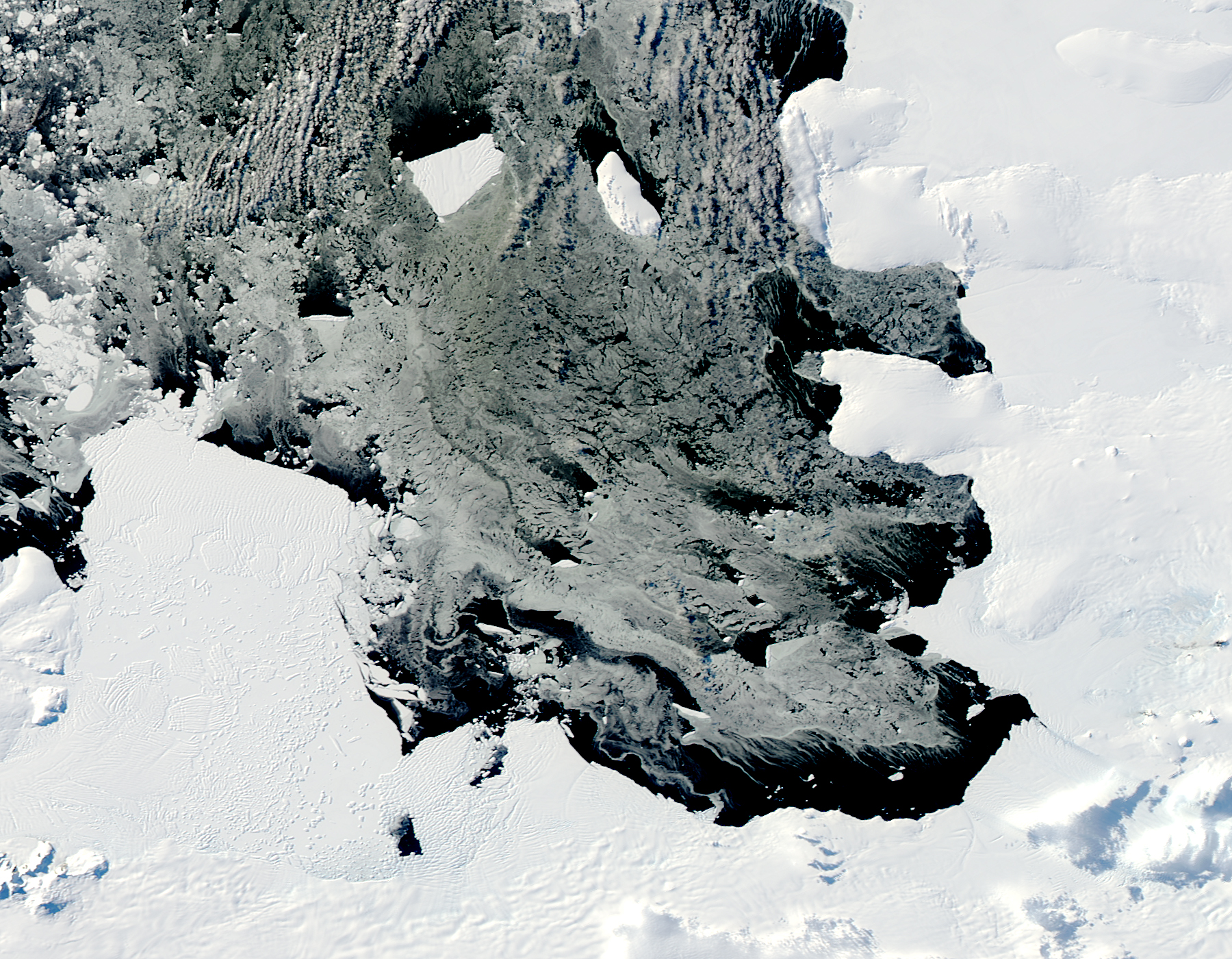
NIC last observed B31 at 72° 23' South latitude, 108° 03' West longitude. Bigg added that “the iceberg is now well out of Pine Island Bay and will soon join the more general flow in the Southern Ocean, which could be east or west in this region.”
NASA images by Jeff Schmaltz, LANCE/EOSDIS Rapid Response. Caption by Michael Carlowicz.