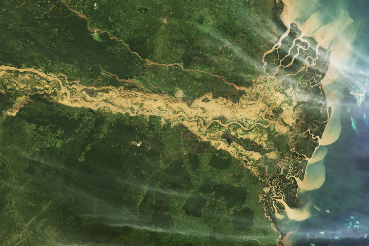
As human populations grow, habitat loss threatens many creatures. Mapping wildlife habitat using satellites is a rapidly expanding area of ecology, and NASA satellites play a crucial role in these efforts. Tigers are just one of the vulnerable big mammals whose habitats NASA is helping track from space.
“Satellites observe vast areas of Earth’s surface on daily to weekly schedules,” said Keith Gaddis, the ecological conservation program manager at NASA Headquarters in Washington. “That helps scientists monitor habitats that would be logistically challenging and time-consuming to survey from the ground—crucial for animals like tigers that roam large territories.”
In the past two centuries, tigers have lost at least 93 percent of their historical range, which once spanned Eurasia. Today, the big cats live in just 10 countries, mostly in Asia. Scientists estimate that there are only about 3,700 to 5,500 wild tigers left, though that is an increase from an estimated low of 3,200 individuals in 2010.
In a recent analysis, researchers reviewed over 500 studies from 2001 to 2020 that contained data on tigers and their habitat. The team found that the area where the big cats are known to live declined 11 percent over the past two decades, from about 1,025,000 square kilometers (396,000 square miles) in 2001 to about 912,000 square kilometers (352,000 square miles) in 2020.
Countries in Southeast Asia were among the hardest hit. During the last 20 years, the big cats disappeared from three nations: Cambodia, Vietnam, and Laos, the researchers reported. Those nations also saw declines in habitat, though the team said it is unclear if the loss of habitat alone is behind the decline in tiger numbers. The animals can also be illegally hunted and killed or decline as their food sources disappear.
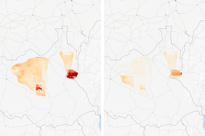
Other countries in the region, such as Thailand, also saw a loss of tiger habitat. But in in parts of the eastern Thailand and in a large conservation area called the Western Forest Complex, the country’s tigers are well-protected. These areas might be sources of tigers that can disperse to other areas, according to the study, published in December 2023 in Frontiers in Conservation Science.
Led by the Wildlife Conservation Society (WCS) and funded by NASA’s Ecological Conservation program, the team developed a tool that uses Google Earth Engine and NASA Earth observations to monitor changes in tiger habitat. The goal: aid conservation efforts in near-real time, using data from the VIIRS and MODIS sensors and from Landsat satellites.
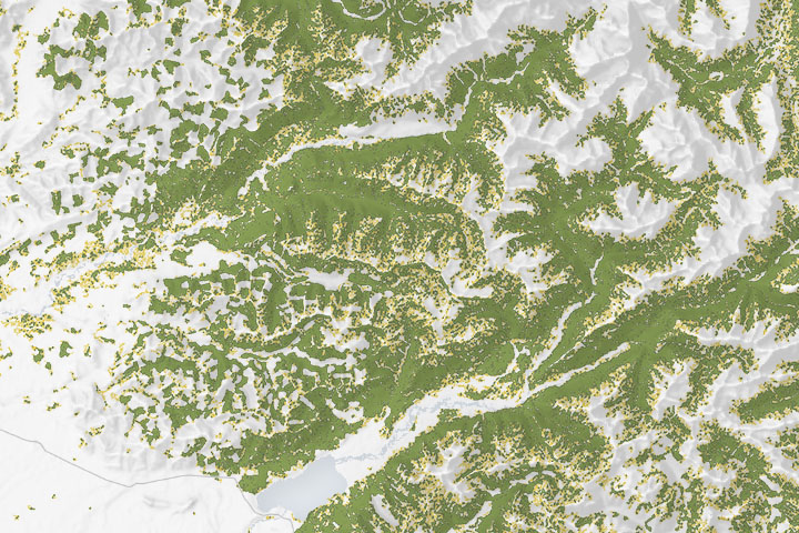
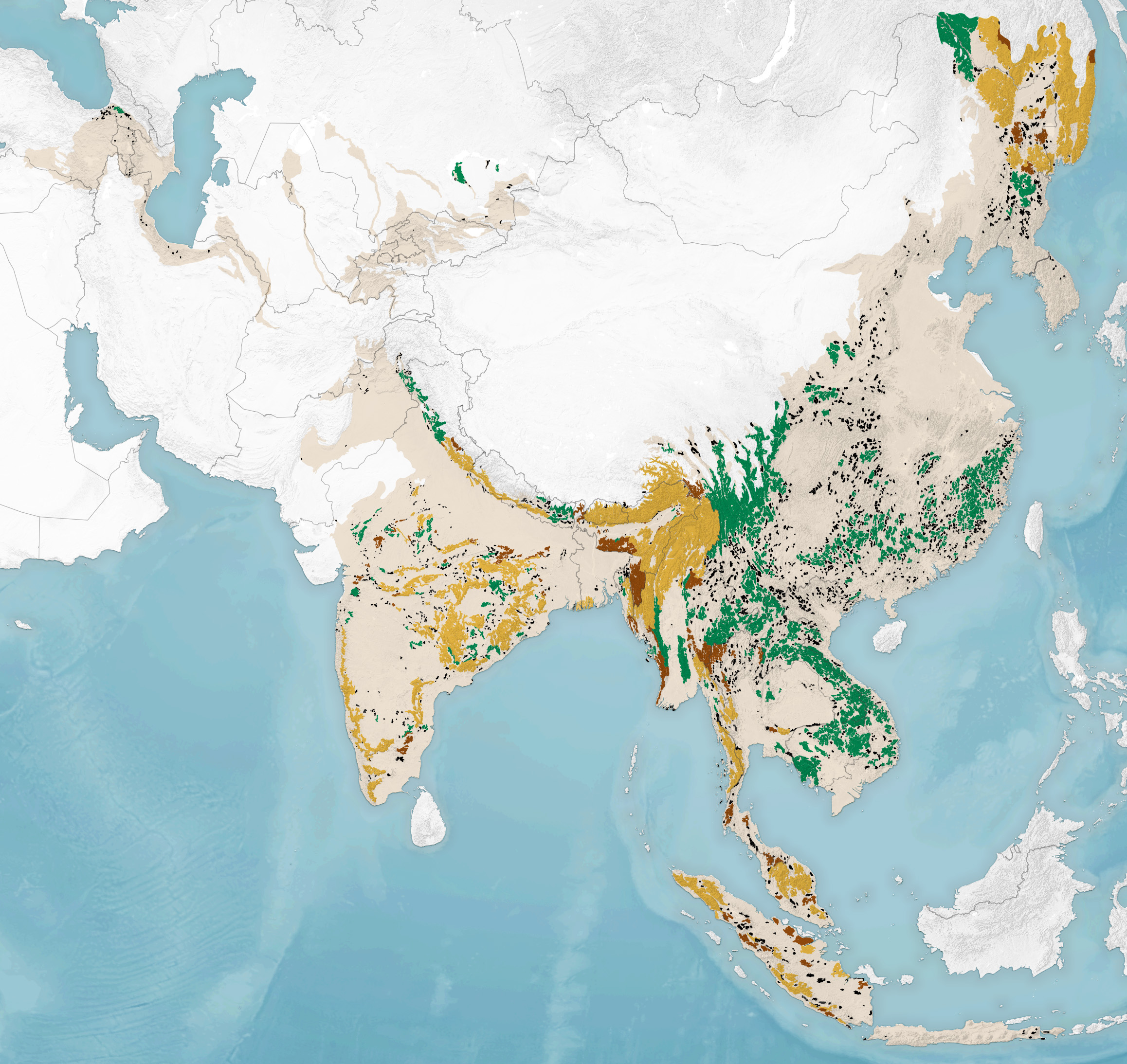
The map at the top of this page shows the status of tiger habitat as of January 2020 with respect to their indigenous range (tan). Orange areas show zones of suitable habitat where tigers are known to be found. Those are areas to be conserved and expanded, including prey populations, the team concluded. Green areas are “empty forests” where tigers aren’t known to live recently, but because these areas were suitable for tigers in the past and are still big enough to support a tiger population, they are potential landscapes for tiger restoration. The remaining colors show where habitat is potentially suitable but tiger residence is unknown (brown), and areas where habitat is too fragmented to support tigers (black).
Notice the large stretches of potential tiger restoration habitat (green). If tigers could reach those areas, either through natural dispersal or active reintroduction, and assuming they have enough food to survive there, it could “increase the land base for tigers by 50 percent,” the scientists reported.
“It wasn’t so long ago that people thought tigers were going to go extinct in the wild. But there’s still a lot more room for tigers in the world than even tiger experts thought,” said lead author Eric Sanderson, formerly a senior conservation ecologist at WCS and now vice president of urban conservation at the New York Botanical Garden. “We were only able to figure that out because we brought together all of this data from NASA and integrated it with information from the field.”
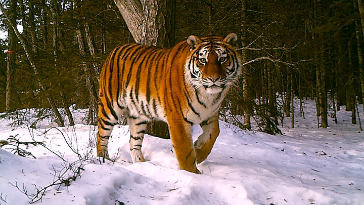
NASA Earth Observatory image by Wanmei Liang using data from Sanderson, E., et al. (2023). Photo courtesy of ANO WCS and Sikhote-Alin Biosphere Reserve. Story by Emily DeMarco/NASA’s Earth Science Division, Headquarters.