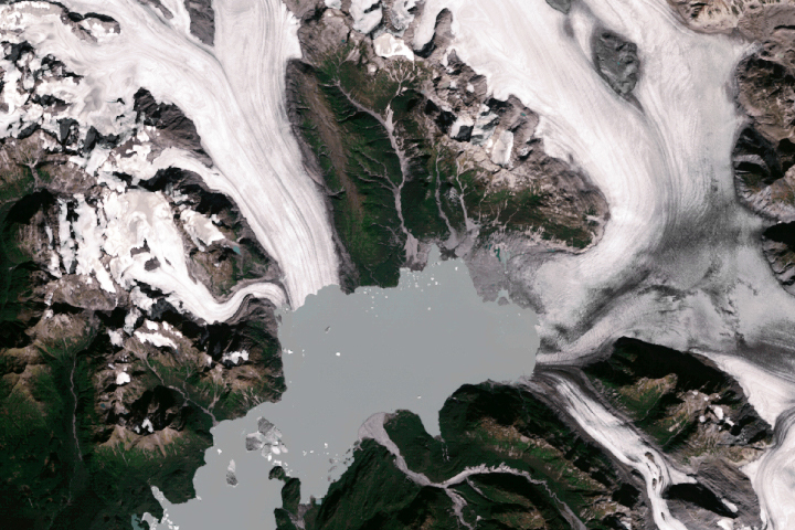
New Zealand’s Tasman Glacier is a massive block of ice, but it is no bulwark. The longest glacier in the country is neither immovable nor permanent. Instead, it continues to shrink by the day.
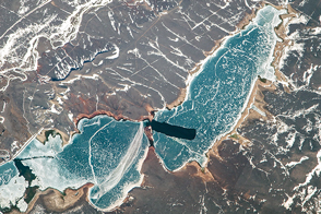
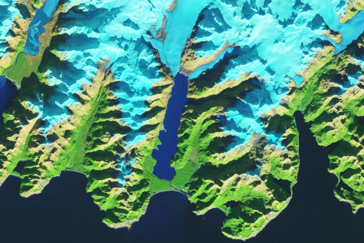
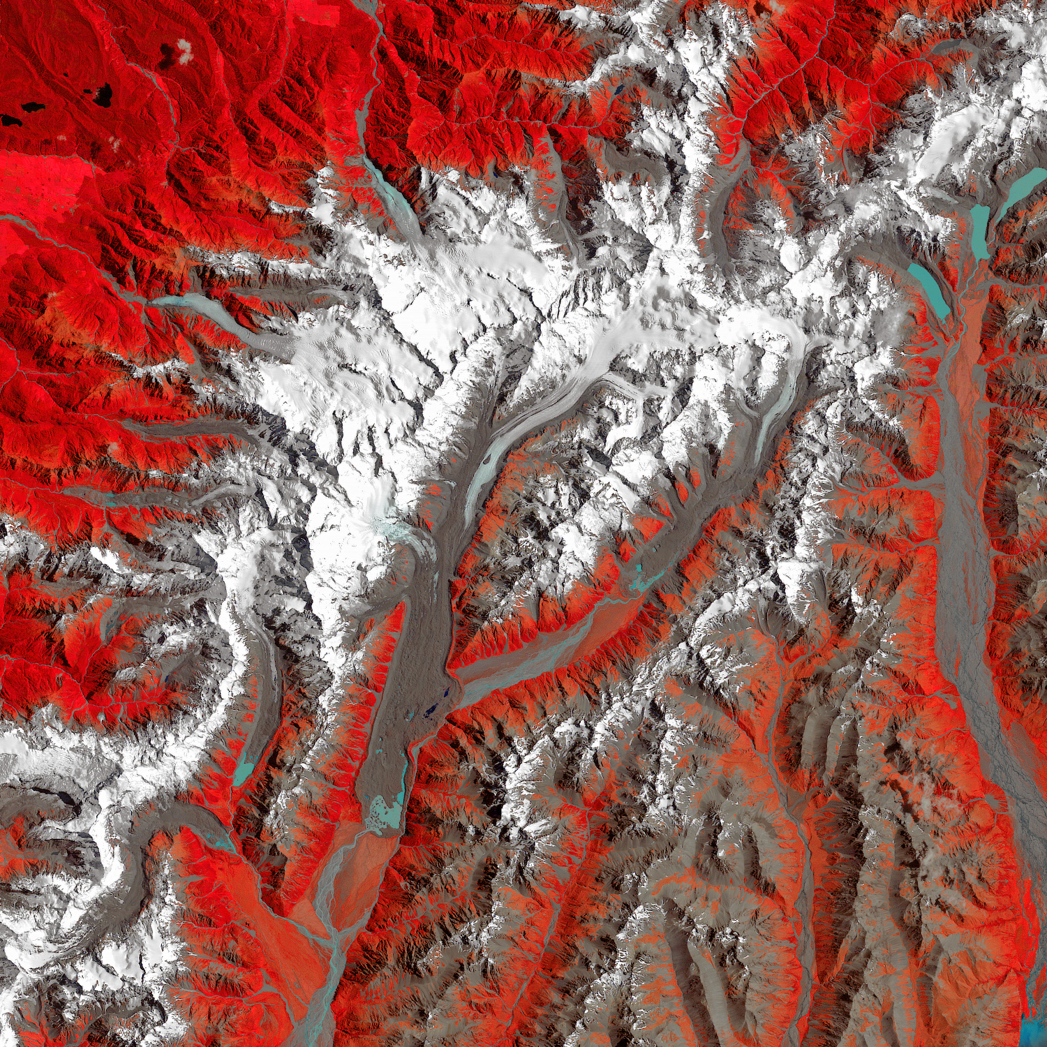
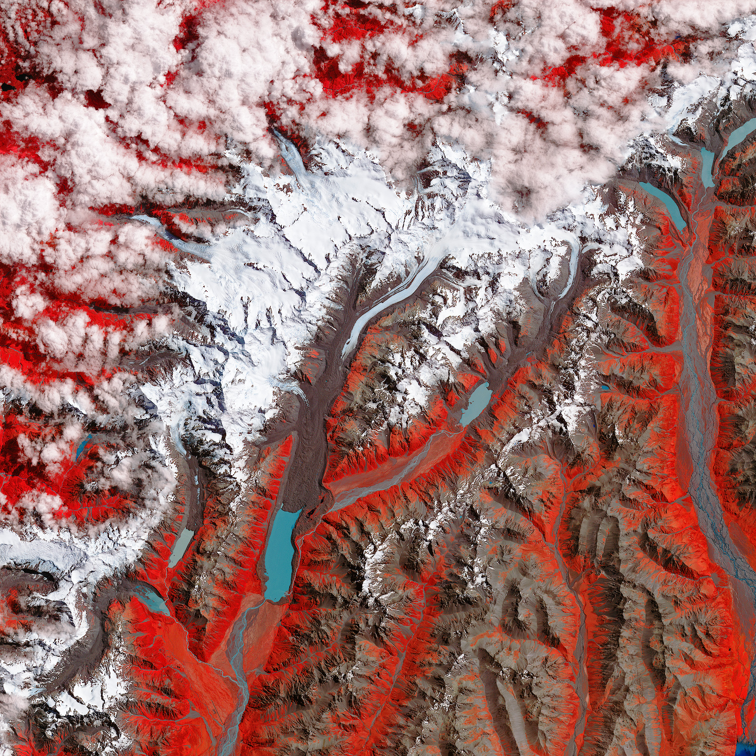
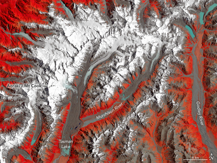
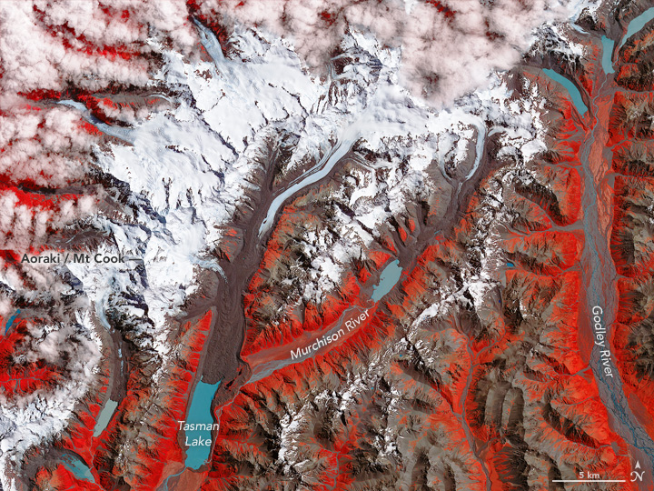
In the first image, captured on December 30, 1990, by the Thematic Mapper on the Landsat 4 satellite, the Tasman Glacier stretched like a serpentine tongue. The second image was acquired on January 29, 2017, by the Advanced Spaceborne Thermal Emission and Reflection Radiometer (ASTER) on NASA’s Terra satellite. Both false-color images use white to show frozen snow or ice, and blue for water. Brown represents bare ground, while red areas are covered in vegetation.
In the 27 years between images, the ice has retreated an average of 180 meters per year, according to New Zealand’s National Institute of Water and Atmospheric Research. Turn on the image comparison tool to see the retreat.
Before 1973, Tasman Lake did not exist. In the past decade, it has swollen to 7 kilometers (4 miles) long. The lake growth is a direct result of the glacier’s decline. Tasman Glacier retreated 4.5 kilometers (2.8 miles) from 1990 to 2015 mostly through calving, according to Mauri Pelto, a glaciologist at Nichols College. Researchers have predicted the lake will “increase dramatically in near future” as the glacier produces more meltwater. The footprint of nearby Murchison Lake (below Murchison Glacier) has also grown.
New Zealand is home to more than 3,000 glaciers, many of which are in decline. The Tasman Glacier is one of several that drains into Lake Pukaki, which is used to generate hydroelectric power. Further downstream, the same water feeds the Waitaki River, a habitat to trout and salmon.
NASA Earth Observatory image by Jesse Allen and Joshua Stevens, using data from NASA/GSFC/METI/ERSDAC/JAROS, and U.S./Japan ASTER Science Team. Caption by Pola Lem.