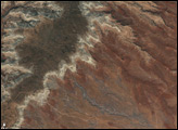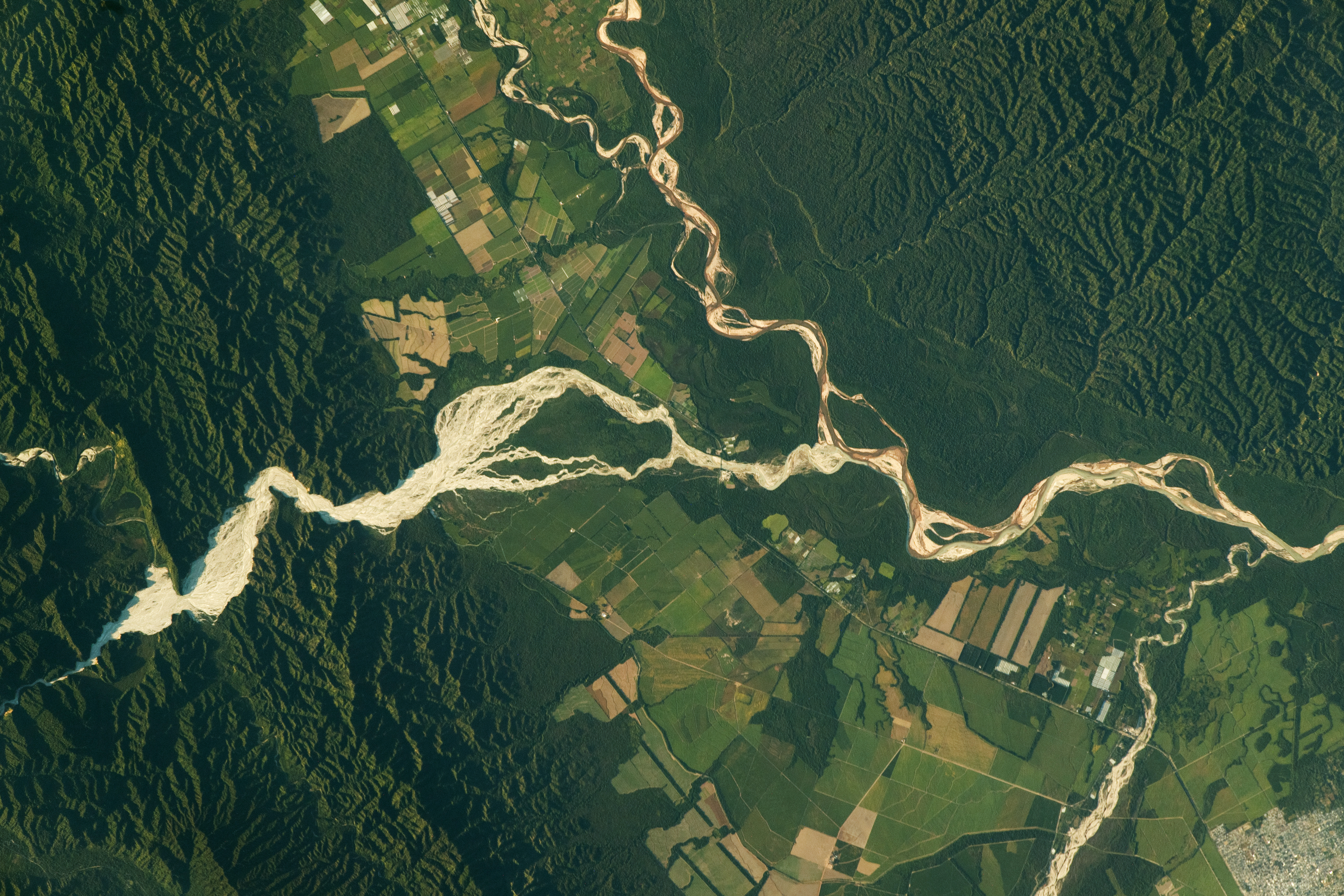
An astronaut aboard the International Space Station took this nadir photograph of the Salta Province in northern Argentina while in orbit over South America. The photo shows the city of Orán (lower-right) and a small section of Aniceto Arce (top), a Bolivian province that is surrounded by the Bermejo River and Río Grande de Tarija.
The meandering rivers in this image are sourced in the Andes Mountains and generally flow southeast through valleys in the foothills—the region between the high mountains and plains. The Iruya River deposits particles of silt and clay as it flows into the valley centered in this image.
Visible indications of the rivers’ shifting channels include river islands, point bars (on the inside curve of streams), and several meander scars. Such scars form when a river gets cut off from the main flow and fills in with sediment, soil, and vegetation.
Sediment from the adjacent highlands filled valleys that were formed by tectonic forces driving uplift of the Andes. These deposits are subsequently carried by rivers, such as the Iruya, along with new sediment to form the light-toned braided channels and the adjacent darker-toned floodplains. Nutrient-rich floodplain soils provide fertile ground for agricultural fields.
In mountainous areas (top-right and top-left), considerable erosion of the underlaying sedimentary rock has produced rugged topography with steep slopes that are accentuated in this image by shadows.
Astronaut photograph ISS069-E-23110 was acquired on June 19, 2023, with a Nikon D5 digital camera using a focal length of 400 millimeters. It is provided by the ISS Crew Earth Observations Facility and the Earth Science and Remote Sensing Unit, Johnson Space Center. The image was taken by a member of the Expedition 69 crew. The image has been cropped and enhanced to improve contrast, and lens artifacts have been removed. The International Space Station Program supports the laboratory as part of the ISS National Lab to help astronauts take pictures of Earth that will be of the greatest value to scientists and the public, and to make those images freely available on the Internet. Additional images taken by astronauts and cosmonauts can be viewed at the NASA/JSC Gateway to Astronaut Photography of Earth. Caption by Wilfredo García López/Jacobs-JETS II Contract at NASA-JSC.