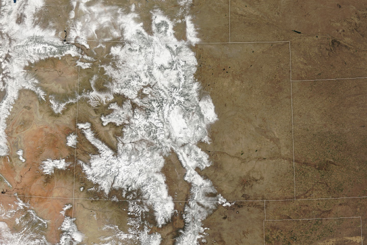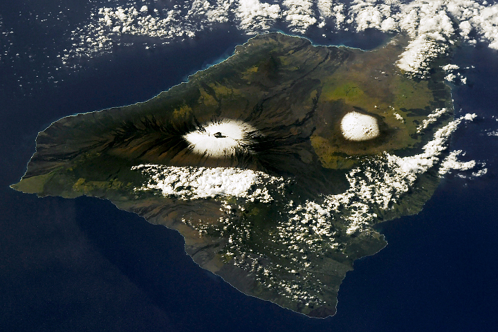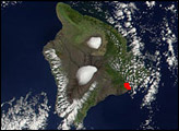
Traces of snow clung to Hawaii’s tallest peaks after a winter storm brought over a foot of precipitation to the chain of islands in late November 2023.
An area of low pressure over the Pacific Ocean (known as a Kona low) brought copious moisture to Hawaii from November 29 to December 1, 2023, resulting in intense rainfall. Gauges on the ground measured the most rainfall on the Big Island and on the eastern side of Maui, where 11 to 20 inches (28 to 51 centimeters) fell during those days, according to the National Weather Service.
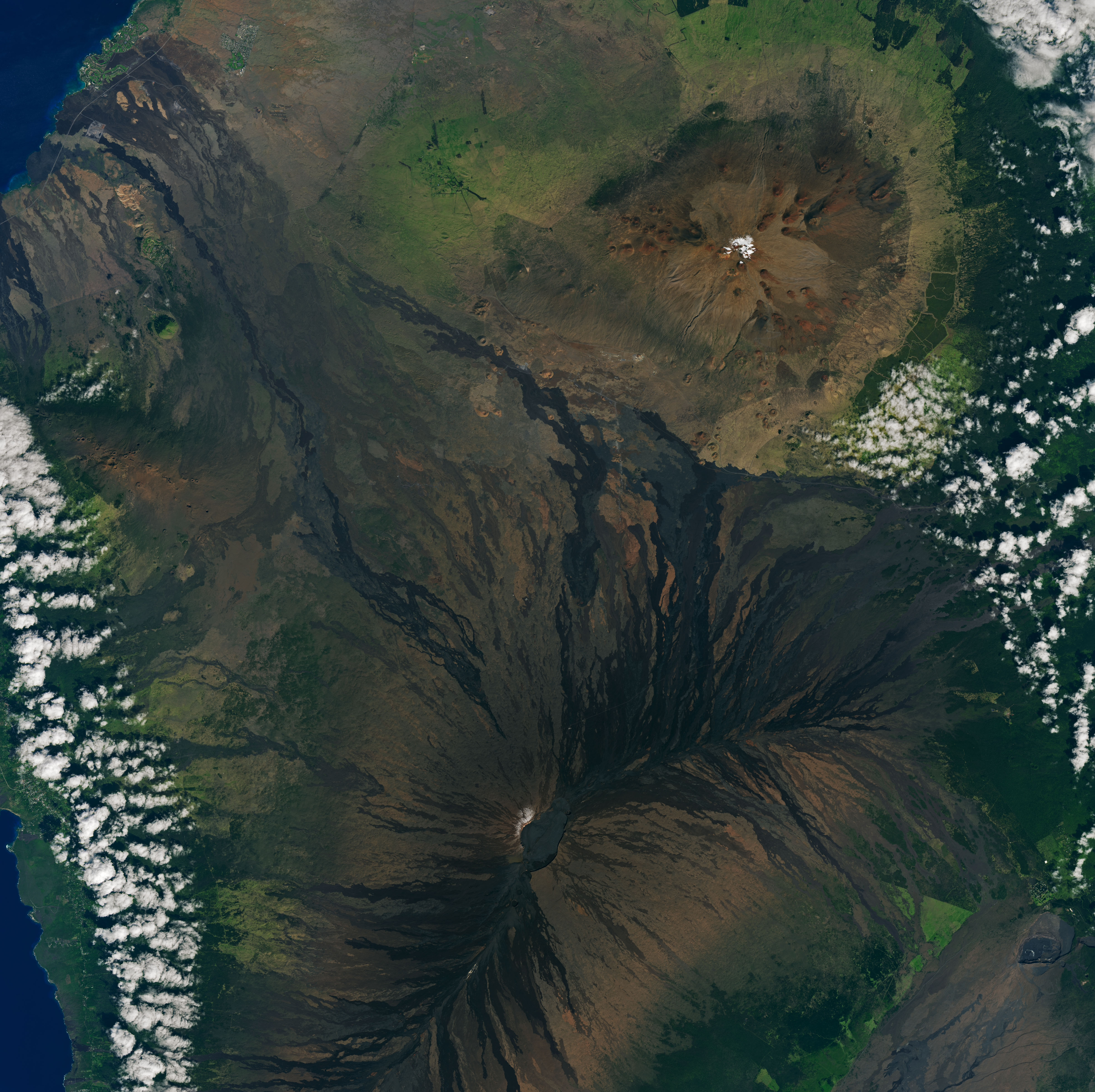
On the summits of Hawaii’s two tallest peaks, the storm dropped snow instead of rain. Up to five inches (13 centimeters) of snow fell on the Big Island’s Mauna Kea and Mauna Loa, where high elevations—up to about 13,800 and 13,700 feet above sea level, respectively—are associated with cold air temperatures. Although some of the snow visible in previous days had since melted, traces of snow were still visible in this image, acquired on December 5, 2023, by the OLI-2 (Operational Land Imager-2) on Landsat 9.
Snow is not unusual on these peaks. Nearly every year, Mauna Kea and Mauna Loa volcanoes are temporarily dusted with white. For example, satellite images from 2014, 2015, 2016, and 2021 show similarly snowy landscapes.
Snow on the Hawaiian Islands is often associated with a Kona low, which occurs when winds that typically blow out of the northeast shift and begin to blow from the southwest, over the leeward or “Kona” side of the islands. As the air, laden with moisture from the tropical Pacific, is forced up by the mountainous topography, the moisture precipitates as heavy rain and snow. Kona storms are common between October and April.
NASA Earth Observatory image by Lauren Dauphin, using Landsat data from the U.S. Geological Survey. Story by Emily Cassidy.