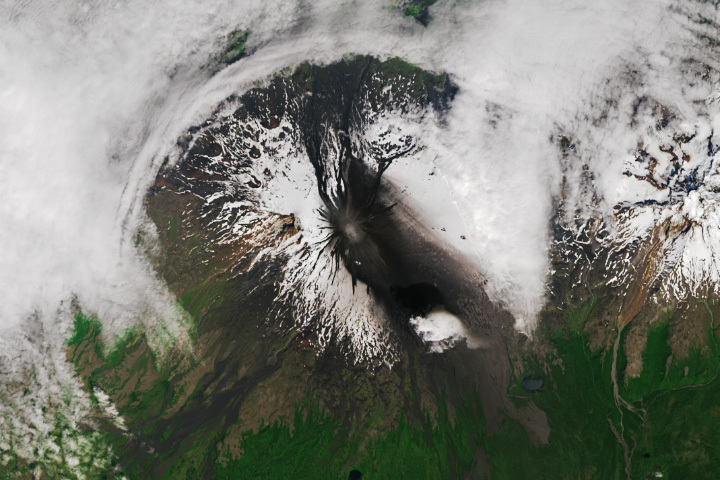
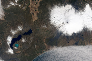
After three years of quiet, the Shishaldin volcano in Alaska’s Aleutian Islands erupted in mid-July 2023. Explosions from the volcano lofted ash several miles into the air, prompting aviation alerts.
Mount Shishaldin is a cone-shaped stratovolcano located on Unimak Island and is one of the most active volcanoes in the Aleutian arc. On July 11, the Alaska Volcano Observatory observed elevated surface temperatures and seismic activity. Then, in the early hours of July 14, a significant explosion sent an ash cloud 6 to 7.5 miles (9 to 12 kilometers) into the air which drifted south over the Pacific Ocean. Two smaller explosions occurred on July 14 and 15, launching ash plumes about 3 miles (5 kilometers) above sea level.
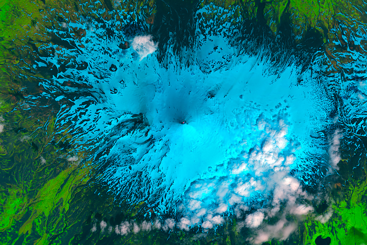
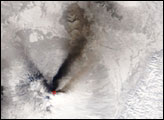
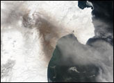
Ash fallout from the eruptions can be seen on the southern flanks of Shishaldin in this image, acquired by the Operational Land Imager (OLI) on Landsat 8 on July 17. A series of lahars (dark streaks of volcanic mud) are also visible on the volcano’s northern and southern flanks.
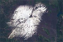
Two other periods of elevated volcanic activity resulted in significant ash plumes between July 17 and July 23. An eruption on July 18 generated another large ash cloud that led the National Weather Service to issue a warning to pilots to avoid the area. Plumes of volcanic ash can contain sharp objects that can damage jet engines.
According to the Alaska Volcano Observatory, Shishaldin has had 24 confirmed eruptions since 1775. Most eruptions have been relatively small, although a 1999 event generated an ash column that reached 8.5 miles (14 kilometers) above sea level. The most recent events to produce lava flows outside the crater area, as this eruption has, were in 2019-2020 and 1976.
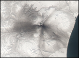
Seismic and eruptive activity was still ongoing as of July 23, according to the observatory, which noted that it is not clear how long the eruptive activity will last. Previous eruptions have lasted weeks to months, with repeated cycles of activity similar to what has been seen so far in July.
NASA Earth Observatory image by Wanmei Liang, using Landsat data from the U.S. Geological Survey. Story by Emily Cassidy.