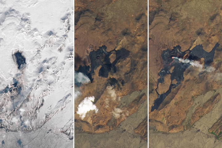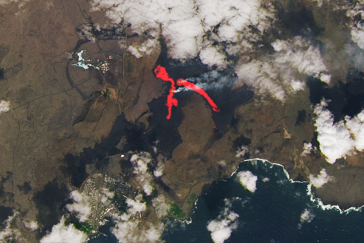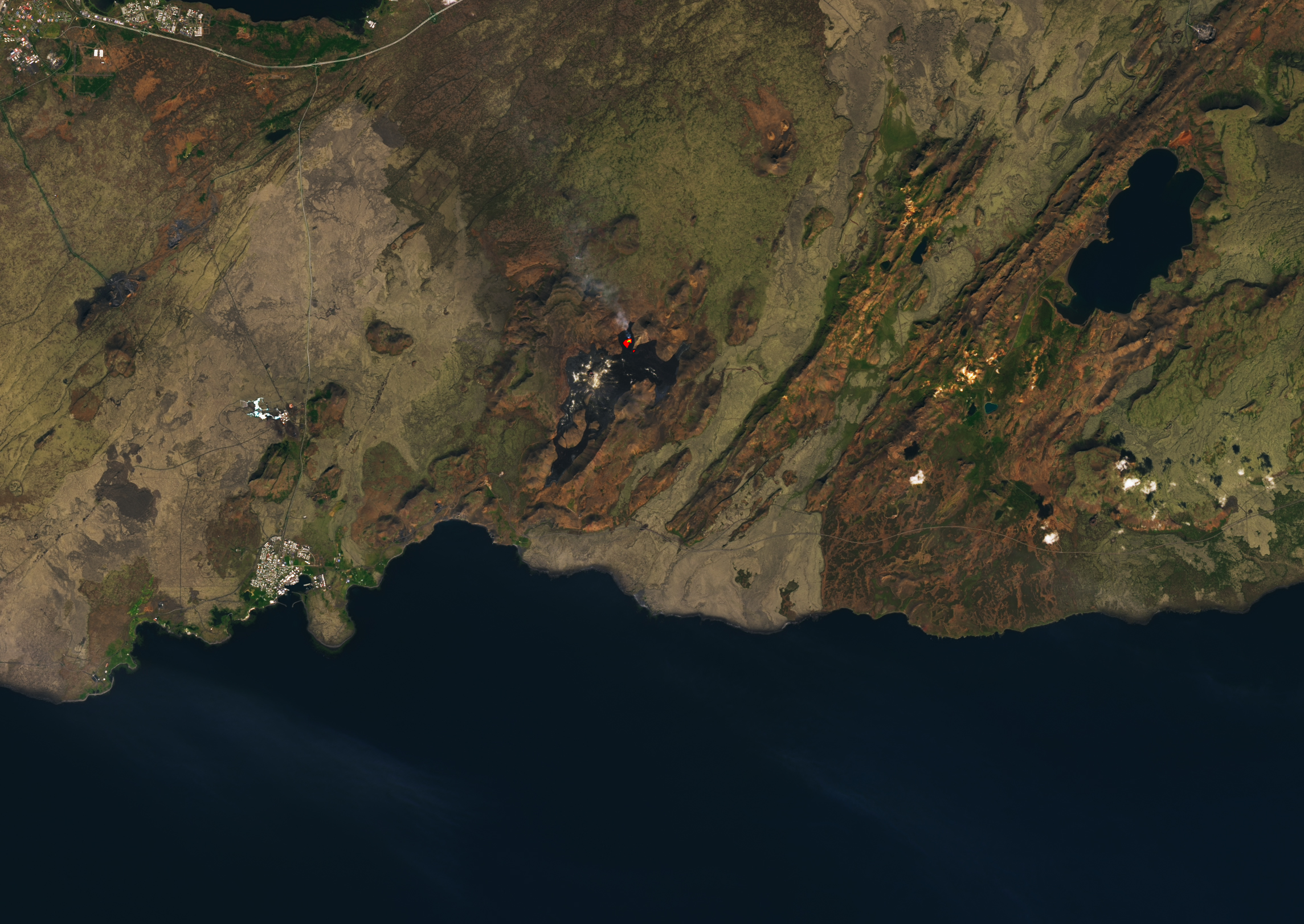
On August 3, 2022, a new volcanic eruption began in the Fagradalsfjall fissure zone on Iceland’s Reykjanes Peninsula. The eruption site in the Meradalir Valley is about a kilometer northeast of last year’s eruption in the Geldingadalir Valley. The recent eruptions come after an 870-year quiet period in the Krýsuvík–Trölladyngja volcanic system.
This volcanic system is composed of two groups of fissures or swarms, named Fagradalsfjall and Krýsuvík. The fissures trend northeast-southwest for 50 kilometers (30 miles) in the rift zone where the North American and Eurasian plates are moving apart, according to the Catalogue of Icelandic Volcanoes.
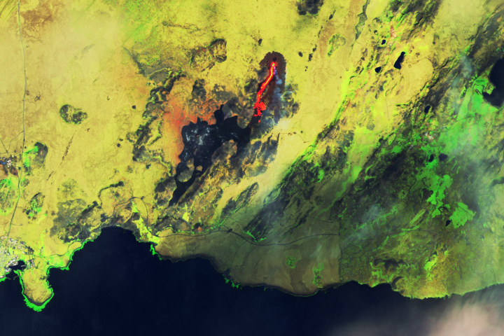
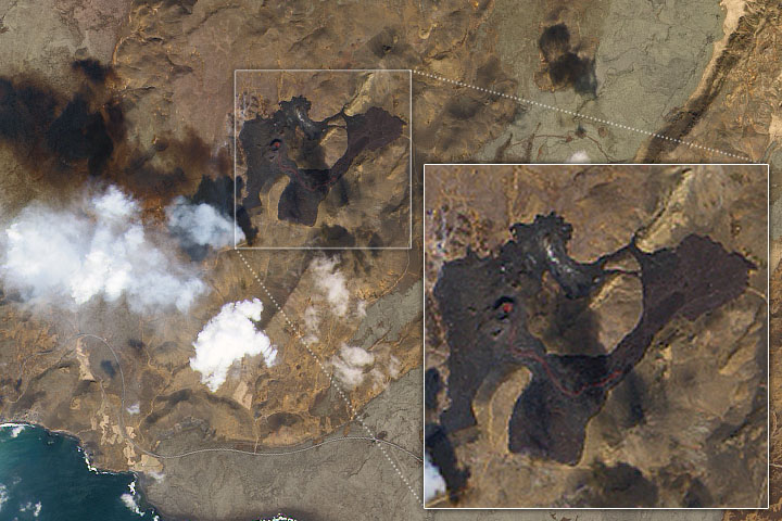
Starting in early August, the Meradalir eruption emitted fountains of lava along a 300-meter (1,000-foot) segment of the fissure. The brilliant display attracted crowds of tourists, who hiked in to see the slow-moving basaltic lava as it flowed east-northeast.
Iceland’s Institute of Earth Science estimated that 10.6 million cubic meters (14 million cubic yards) of lava had covered an area of 1.25 square kilometers (0.5 square miles) by August 15.
Early on, the eruption was emitting lava at a rate of up to 32 cubic meters (40 cubic yards) per second, which soon slowed to an average of 11 cubic meters per second. By August 16, the Meradalir eruption rate had dropped to 2 cubic meters (3 cubic yards) per second. The March 2021 eruption in Geldingadalir issued 5 to 10 cubic meters (7 to 13 cubic yards) of lava per second during its first three weeks.
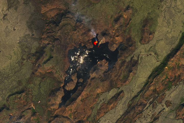
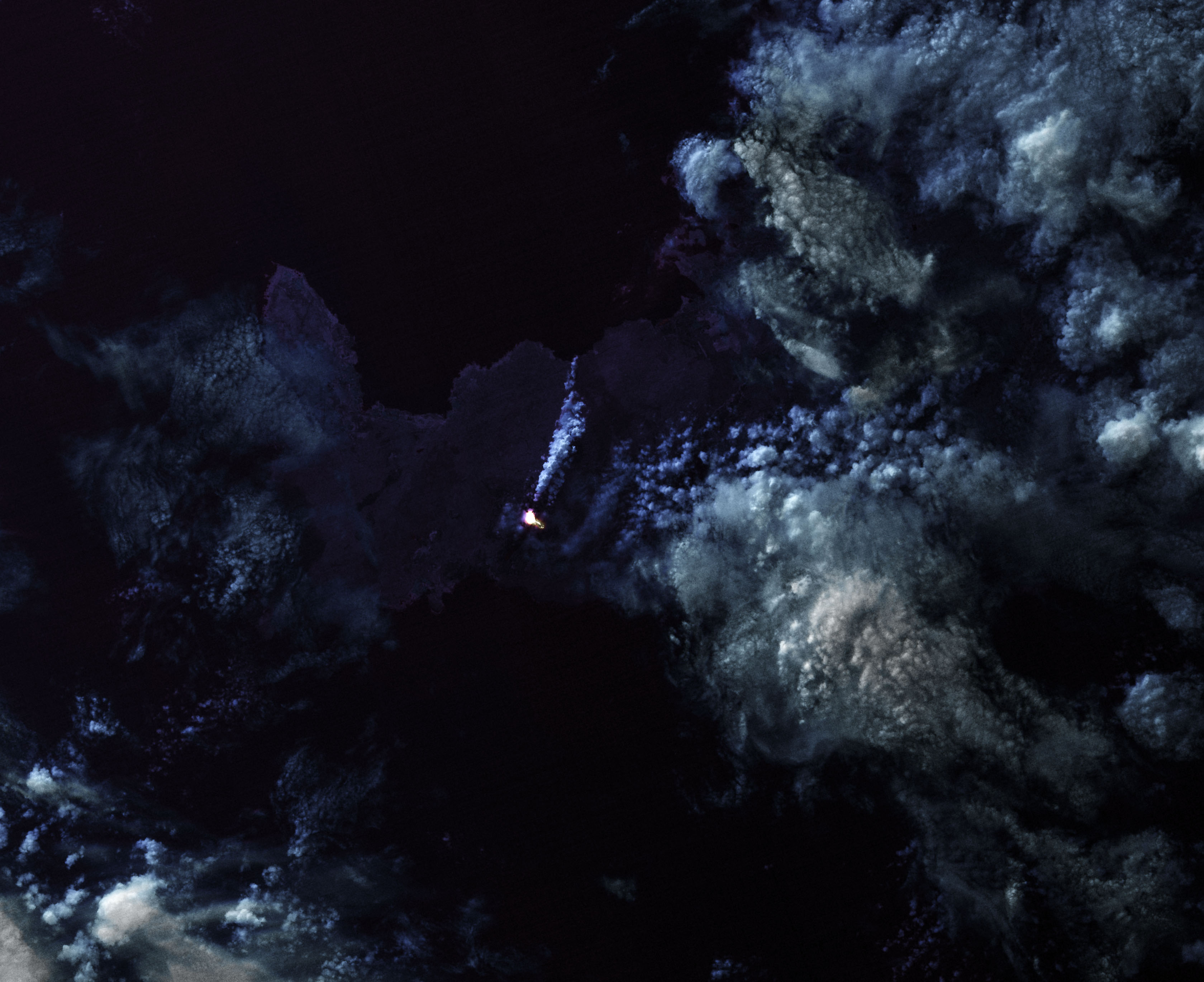
The first image above was acquired on August 16, 2022, by the Operational Land Imager (OLI) on Landsat 8. The image includes a combination of visible and infrared light (bands 6-5-3), which helps distinguish the heat signature of the lava. The second image also shows the thermal infrared signature of the lava flow, but at night. It was acquired on August 7, 2022, with OLI and the Thermal Infrared Sensor (TIRS) on Landsat 8.
According to the Catalogue of Icelandic Volcanoes, the Krýsuvík-Trölladyngja system has been "moderately active" during the Holocene Epoch. At least 10 eruptions, lasting from a few years to decades, have occurred over the past 8,000 years. This suggests an eruption interval of 400 to 1,000 years, with an average of more than 750 years.
The last significant eruption before 2021 happened in the 12th century, when four lava flows ejected 220 million cubic meters (287 million cubic yards) of lava. The molten rock covered more than 36 square kilometers (14 square miles) and reached the north and south coasts of the Reykjanes Peninsula.
NASA Earth Observatory images by Lauren Dauphin and Joshua Stevens, using Landsat data from the U.S. Geological Survey. Story by Sara E. Pratt.