

The chain of hundreds of low-lying islands, also called cays or keys, that extend from southern Florida are relics of a time when global sea levels were higher than today. About 125,000 years ago, during a warm interglacial period, water covered the area.
However, the sea was shallow enough that big communities of coral flourished just below the surface and built up reefs. As time passed and an ice age took hold, sea levels dropped and the tops of some reefs—as well as some sand bars—began to poke above the water surface. Over time, material from these exposed reefs and sand bars hardened and fossilized, forming the sedimentary rocks that make up the modern Florida Keys.
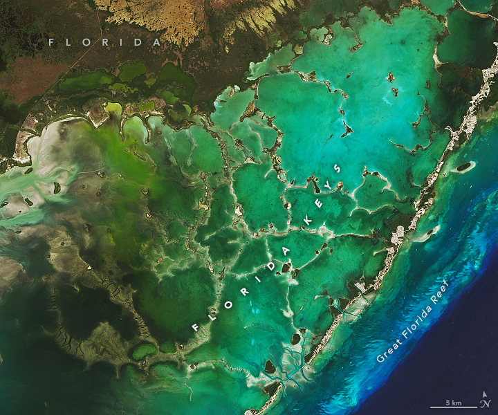
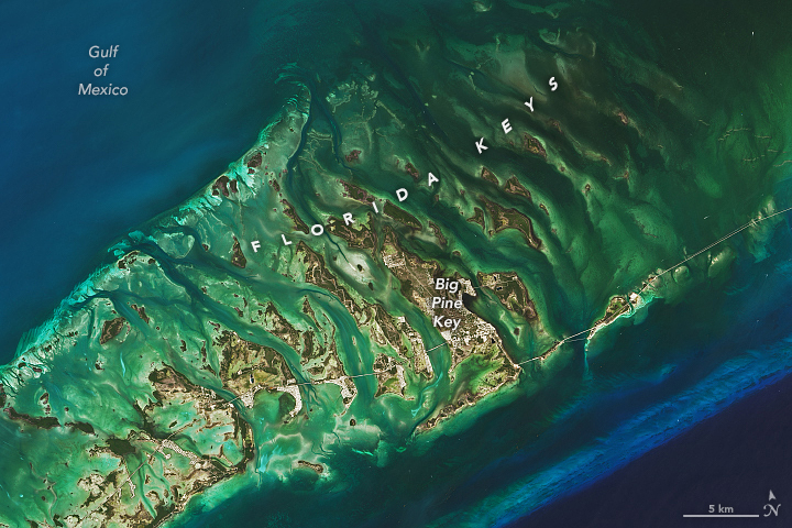
On March 30, 2022, the Operational Land Imager (OLI) on Landsat 8 captured these natural-color views of the islands. North and west of the island chain, light passing through shallow waters and reflecting off the sea grass beds and sandy bottoms of Florida Bay gives this part of the scene a green-yellow hue. The light blue line south and east of the islands is a living coral reef system—among the largest in the world. Deeper water beyond the edge of the Florida platform appears dark blue.

Many of the Florida Keys fall within the boundaries of national parks. Biscayne National Park includes several of the northernmost keys. Most of those within Florida Bay are part of Everglades National Park. The westernmost keys fall within Dry Tortugas National Park. The Florida Keys National Marine Sanctuary protects many of the keys as well.
More than 80,000 people live on 30 populated islands, and several million people visit the Florida Keys each year. Still, some parts of Big Pine Key and several other islands retain patches of pine rockland, an unusual ecosystem found exclusively in southern Florida. In these areas, scattered slash pine soars over an understory of palms, palmettos, berries, grasses, and several types of herbaceous plants.
While falling sea levels brought the Florida Keys into existence, rising seas now pose a threat to their long-term existence. Sea level rise projections from the Interagency Sea Level Rise Scenario Tool (published by NASA’s Sea Level Change Team) indicate that Key West could experience between 0.45 and 2.16 meters (1 and 7 feet) of sea level rise by 2100.
NASA Earth Observatory images by Lauren Dauphin, using Landsat data from the U.S. Geological Survey. Caption by Adam Voiland.
Growing corals and falling sea levels brought these small islands above the water line.
Image of the Day for May 31, 2022