Taken July 8, 2011, this astronaut photograph shows the border region of Turkey, Armenia, and Iran, including the Aras River.
Published Jul 25, 2011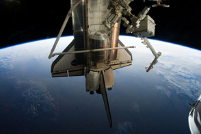
Astronauts supplied the International Space Station with a new logistics module; tested tools, technologies, and techniques to refuel satellites in space; and collected old equipment.
Published Jul 21, 2011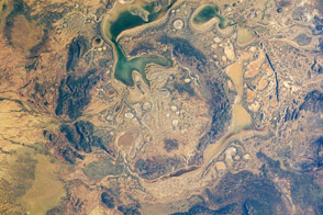
The Shoemaker impact site in Australia may have been formed as long as 1.63 billion years ago.
Published Jul 18, 2011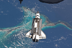
Space Shuttle Atlantis approaches the International Space Station for docking for the last time on July 10, 2011.
Published Jul 15, 2011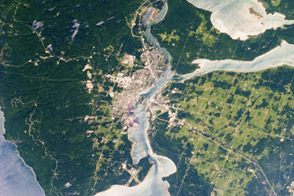
The twin cities of Sault Ste Marie straddle the border of Canada and the U.S. and lie amidst the lakes and islands that separate Lake Huron and Lake Superior.
Published Jul 11, 2011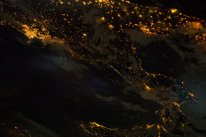
City lights trace the outline of Italy's “boot” and the island of Sicily.
Published Jul 4, 2011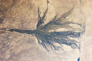
Sometimes called the Jewel of the Kalahari, the area is an enormous, pristine wetland that almost miraculously appears out of a desert.
Published Jun 27, 2011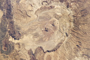
Astronauts on the International Space Station snapped this photograph of the volcano in Eritrea just months before it erupted for the first time in recorded history.
Published Jun 20, 2011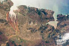
This astronaut photograph highlights two biologically productive estuaries on the coast of Madagascar.
Published Jun 13, 2011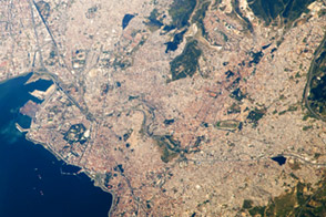
Ä°zmir is Turkey’s third most populous city and its second largest port, and its history dates back at least 3,500 years.
Published Jun 6, 2011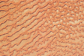
The Ar Rub’ al Khali, or Empty Quarter, covers much of the south-central portion of the Arabian Peninsula and is the largest continuous sand desert on Earth.
Published May 30, 2011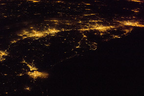
One of the largest conurbations in the world is located along East Coast of the United States, and stretches from Boston to Washington.
Published May 23, 2011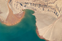
This astronaut photograph highlights two river deltas along the southwestern shoreline of Lake Ayakum, near the northern boundary of the Tibetan Plateau.
Published May 9, 2011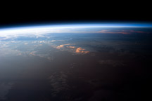
The changeover between day and night is marked by the terminator, a line on Earth's surface separating the sunlit side from the darkness.
Published Apr 25, 2011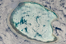
A photograph of an uninhabited atoll in the Indian Ocean has an almost surreal quality due to varying degrees of sunglint.
Published Apr 18, 2011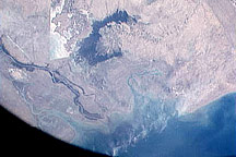
Astronauts on flight STS-1 captured this view of the Tigris and Euphrates through a viewport on the space shuttle during its first flight in April 1981.
Published Apr 13, 2011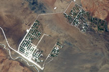
The Shebelle River has its headwaters in the Ethiopian Highlands, and transports water and sediment 1,000 kilometers to the southeast across Ethiopia and into Somalia.
Published Apr 11, 2011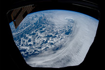
In these astronaut photographs from the ISS cupola, two distinct cyclonic vortices whirl within an area of low pressure that spanned the Pacific coast from southern California to Vancouver Island.
Published Apr 4, 2011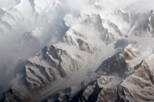
This astronaut photograph provides a view of the central Tien Shan mountains east of where the borders of China, Kyrgyzstan, and Kazakhstan meet.
Published Mar 28, 2011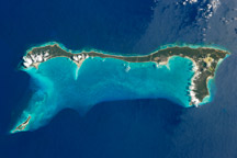
Once named San Salvador, the island may be where Christopher Columbus made his first landfall in the Americas.
Published Mar 21, 2011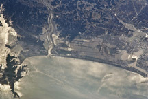
Taken March 13, 2011, this astronaut photograph shows the Japanese coast north of the city of Sendai, in the wake of a devastating earthquake and tsunami.
Published Mar 15, 2011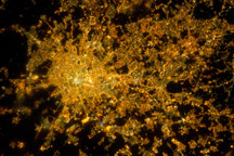
Milan, the largest city in Italy, is one of Europe’s major transportation, industrial, and commercial hubs, and a global center of fashion and culture.
Published Mar 14, 2011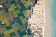
Narrow cordons of coastal dunes stretch for hundreds of kilometers along Argentina’s coast, including the Médano Blanco dunes near the arid and windy border of Patagonia.
Published Mar 7, 2011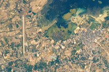
NASA recently improved the view from the space station, as displayed in this January 2011 photograph of That Choeng Shum, Thailand.
Published Mar 5, 2011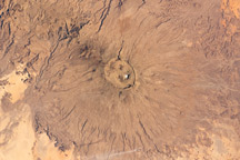
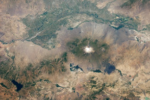
At 3,415 meters above sea level, the summit is the highest of Africa’s Sahara region.
Published Feb 14, 2011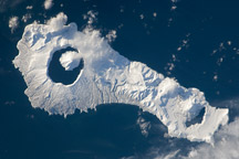
Snow cover highlights the calderas and volcanic cones that form the northern and southern ends of Onekotan Island, part of the Kuril Island arc.
Published Jan 24, 2011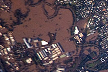
Acquired January 13, 2011 by astronauts aboard the ISS, this photograph shows extensive flooding in the Brisbane suburb of Rocklea.
Published Jan 18, 2011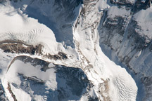
This astronaut photograph highlights the northern approach to the world’s tallest mountain.
Published Jan 17, 2011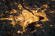
Montreal, the largest city in the mostly French-speaking Province of Quebec, is considered by some to be the cultural capital of Canada.
Published Jan 10, 2011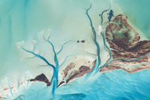
The islands are situated on large depositional platforms composed mainly of carbonate sediments and ringed by reefs.
Published Jan 3, 2011