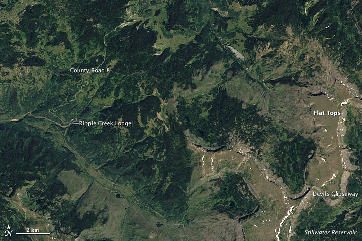
Congratulations to Alan for being our first reader to work out that the December puzzler showed an area near the Flat Tops in northwestern Colorado. Alan recognized that the treeless regions in the lower right were plateaus and pinpointed the location on December 19, even pointing out Devils Causeway. Meanwhile, other puzzler players — notably Angie Connelly and Bill Butler — weighed in with interesting details about the type of rock (basalt) that makes up the plateau and the impact that a recent fire had on vegetation in the area.
It’s worth noting that the image does not show the Great Wall of China, which was the most common answer we received. It’s a popular myth that the Great Wall is one of only human-made structures visible from space. As this NASA story explained in 2005 and this Scientific American story detailed in 2008, the Great Wall is quite difficult for astronauts (either in orbit or on the moon) to see because there isn’t enough contrast between the color of the wall and the surrounding vegetation.
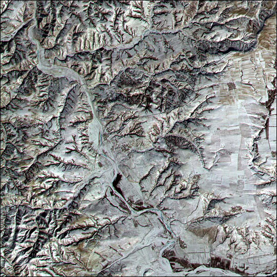
Sensors on Earth-observing satellites can detect the Great Wall more readily than the human eye, but it isn’t easy to distinguish the structure even in images from the higher-resolution sensors in NASA’s fleet. The Advanced Spaceborne Thermal Emission and Reflection Radiometer (ASTER) instrument on NASA’s Terra statellite, which has a 15-meter spatial resolution, acquired the image below of the wall in the winter of 2001. At the time, a low sun angle and light snow cover helped highlight a section of the wall in Shanxi Province.

Ronald Beck, a program information specialist for the Landsat program told Scientific American that the wall is visible to Landsat as well, but only under certain weather conditions. “We have satellite images where snow covers the fields near the wall and snow has been cleared on the wall, and that allows us to see the wall,” he said. “The key is contrast.”
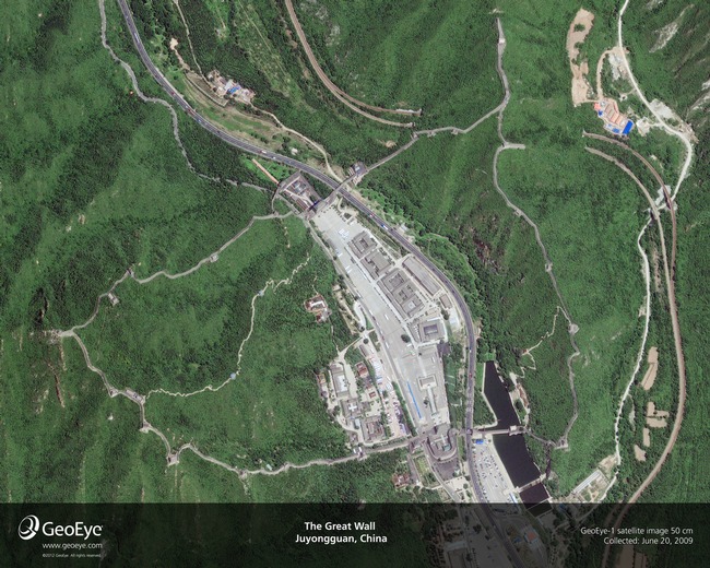
Commercial satellites, operated by companies such as GeoEye, offer the clearest view of the Great Wall from space. A sensor with half-meter resolution on the GeoEye-1 satellite acquired the image below on June 20, 2009. If you’re interested in seeing how sensors on various Earth-observing satellites compare, here’s a useful list categorized by their spatial resolution.
On December 22, we published a caption that provides more details about the Flat Top mountain scene. In addition to being a location with noteworthy geology, the image shows the part of White River National Forest where park rangers harvested the 2012 U.S. Capitol Christmas tree. The videos below explain more about how the tree was selected, transported, and decorated.


