
Fire Alerts Go Global | |||
MODIS fires alerts have found wide application outside of South Africa. When Diane Davies moved from Etosha National Park in Namibia to join the Geography Department at the University of Maryland, she knew how difficult it was to access web-based satellite images from remote field locations. Having used satellite data to monitor fires in the sprawling park, she also knew just how valuable the fire data were. So she began to email fire locations from the university’s MODIS-based Web Fire Mapper to individuals in remote areas where she knew that Internet access was poor. “People found it really useful,” she says. “It’s so much easier for people to get an email in their inbox, which they check regularly, than having to actively go to the Website and look and see if there is a fire in their area.” |
|||
 | |||
Since that time, Davies has expanded the system into a global fire alert system that automatically emails subscribers whenever there is a fire near their area of interest. By January 2007, the global system, called the Fire Information for Resource Management System, or FIRMS, had been operating for just a few months and already had 580 subscriptions. “We now have users in 60 countries,” says Davies. |
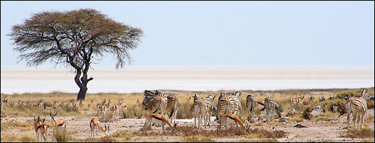
Etosha National Park in northern Namibia is both remote and prone to fire. Satellite-based fire monitoring, linked to email alerts, is important in the game reserve because of the difficulty of detecting fires across the entire park from the ground. (Photograph © 2005 Ironmanix.) | ||
 | |||
Among those users is Richard Hansen, an archeologist and Mayan expert that heads up the Mirador Basin Project in northern Guatemala (the cradle of Mayan civilization) and the Foundation for Anthropological Research and Environmental Studies. “We’ve been monitoring fires in Guatemala with MODIS since 2002,” says Hansen. “MODIS has been extremely useful. It let us understand the extent of fire and deforestation in protected areas in Guatemala.” Seeing fire encroaching on the Mirador Basin, where he was uncovering some of the earliest remnants of Mayan civilization, Hansen began a campaign to preserve the forest in the basin. |
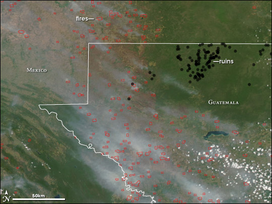
Red squares outline fires burning in Guatemala and Mexico on April 10, 2005. The fires surround, but don’t penetrate, the Mirador Basin, where some of the earliest Mayan sites are being excavated. The undisturbed forest in the basin is deep green, but the surrounding land, stripped of trees, is tan. (NASA image by Jeff Schmaltz and Robert Simmon, based on data from MODIS Rapid Response and the Global Heritage Fund.) | ||

One of Hansen’s supporters is the Global Heritage Fund, who is working to make Mirador a natural and cultural World Heritage Site through UNESCO. “Seeing the MODIS fire locations surrounding the Maya’s major transportation and waterway networks prompted them [UNESCO] to get this nomination through because of the time urgency,” says Josie Thompson, network manager at the Global Heritage Fund. Now, Thompson subscribes to Davies’ fire alerts, waiting for fire to enter the Mirador Basin. “Fortunately, fires have not occurred in the area that we’re concerned with,” says Thompson, but fires in surrounding areas keep her vigilant. “The monitoring system is fabulous because it’s based off of a location. Whenever something comes up in that location, it’s flagged, and we can find out about it as soon as possible.” Thompson imports the fire locations into her own map that also contains national park boundaries and the locations of Mayan ruins. “We use these maps for directly communicating with the Guatemala government, other wildlife nature conservancies, and the Department of Monuments in Guatemala. It gives us a good picture of what is happening.” |
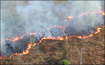
People use fire as a tool to clear underbrush on newly deforested land across the world. This controlled fire burned in Guatemala, where scientists keep watch for fires that might invade significant Mayan archeological sites. (Photograph copyright Global Heritage Fund.) | ||