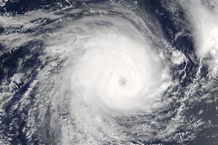
Tropical Cyclone Enawo is lined up to make a direct hit on Madagascar as a powerful category 3 or category 4 storm. The Moderate Resolution Imaging Spectroradiometer (MODIS) on NASA’s Aqua satellite captured this image of the storm at 1:10 p.m. local time (10:10 Universal Time) on March 6, 2017. Forecasters expect that the unusually moist storm could drop as much as 16 inches (41 centimeters) of rain in some areas.
NASA image by Jeff Schmaltz, LANCE/EOSDIS Rapid Response. Caption by Adam Voiland.