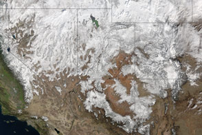
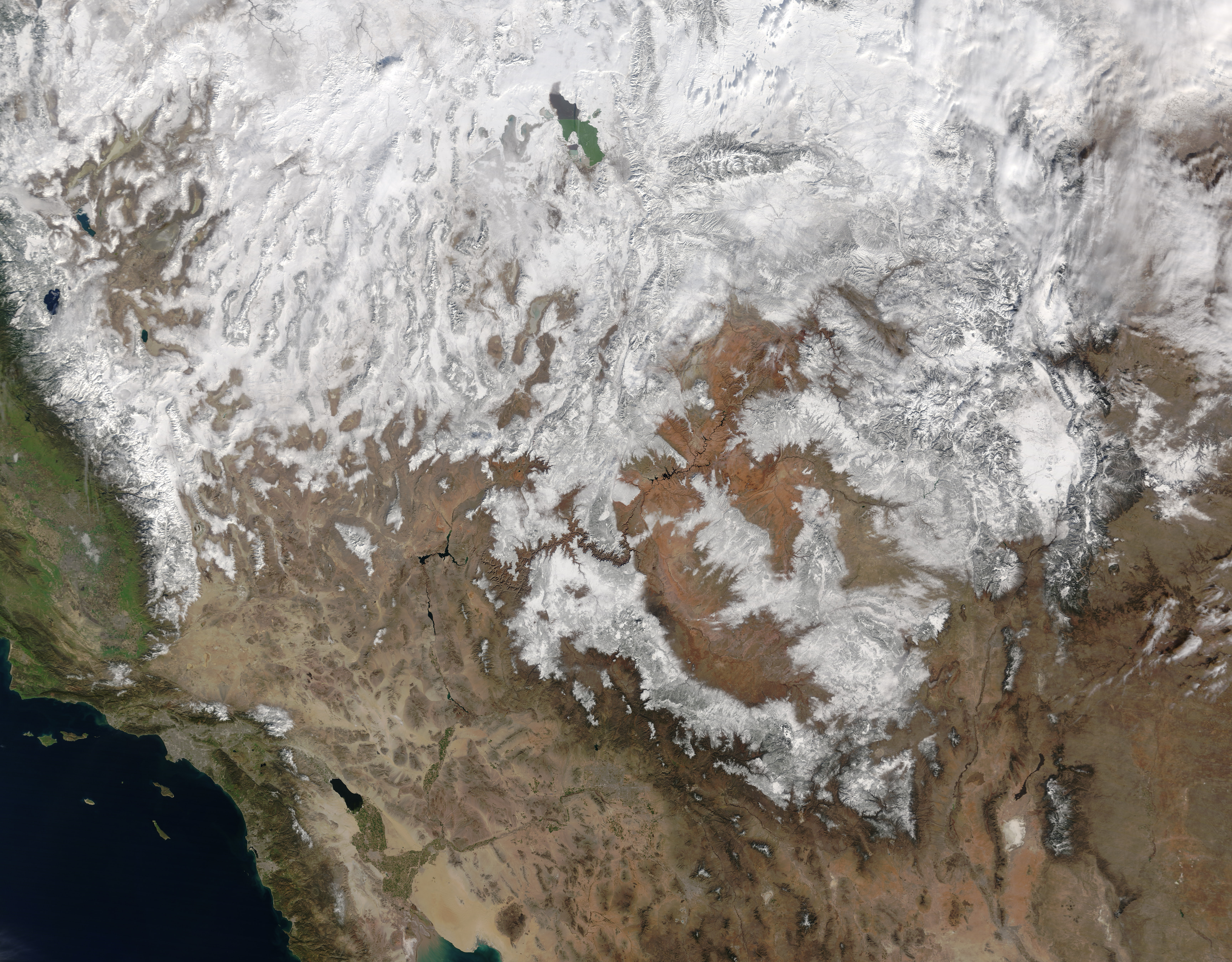
On January 28, 2017, the Moderate Resolution Imaging Spectroradiometer (MODIS) on NASA’s Terra satellite captured this image of snow cover across the American Southwest, including California, Nevada, Utah, Colorado, Arizona, and New Mexico.
NASA image by Jeff Schmaltz, LANCE/EOSDIS Rapid Response. Caption by Pola Lem.
Snow covered the Sierra Nevada and much of Utah and Colorado.
Land Severe Storms Snow and Ice
Winter snow covered parts of the U.S. in January 2017.
After four months without precipitation, a winter storm slammed Arizona on March 11, 2006, covering the parched land with widespread snow and record rain.
Acquired December 10, 2012, these images show the partial retreat of recently deposited snow cover in New Mexico and neighboring states.
alert message