

On April 25, 2014, the Moderate Resolution Imaging Spectroradiometer (MODIS) on NASA’s Aqua satellite observed dozens of fires burning in North Korea. Since MODIS was designed to monitor broad swaths of Earth’s surface every day, its top resolution of 250 meters (820 feet) per pixel does not offer much detail.
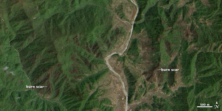
On May 3, NASA’s Advanced Land Imager (ALI) on Earth Observing-1 (EO-1) passed over North Korea and captured closer view of charred areas left by fires in Kangwon Province. The detail shows an area centered at 38.719 degrees North and 127.136 degrees East. The burn scars appear light brown.
Many fires appeared in farming areas along rivers. While North Korea’s best agricultural land is located on the coastal plain in the western part of the country, many people farm marginal land along rivers in the mountainous areas. They use fire to clear debris from last year’s crops and to help fertilize the soil for the coming season.
However, some of the fires burned in forested areas as well, suggesting there were also wildfires. Drooping wires on aging power lines are a common cause of wildfires in North Korea, according to a report published in the Asia-Pacific Journal.
NASA Earth Observatory image by Jesse Allen and Robert Simmon using EO-1 ALI data provided by the NASA EO-1 team. Caption by Adam Voiland.