The Earth Observatory has published its last Image of the Day on this website. Please join us on our new home at science.nasa.gov/earth/earth-observatory.
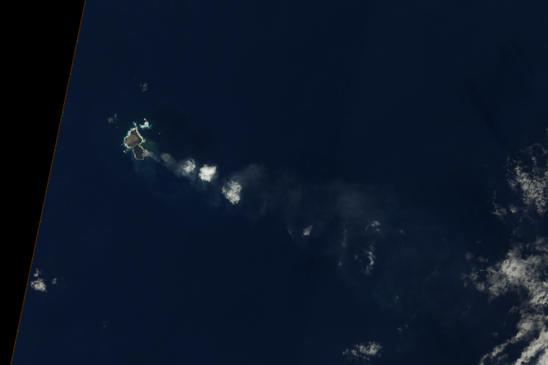
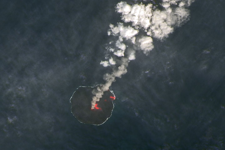
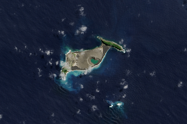
Volcanic activity along the western edge of the Pacific “Ring of Fire” gave rise to a small island in November 2013. Located in the Ogasawara Islands, the new islet sits about 1,000 kilometers (600 miles) south of Tokyo in waters considered to be part of Japanese territory.
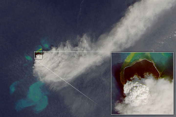
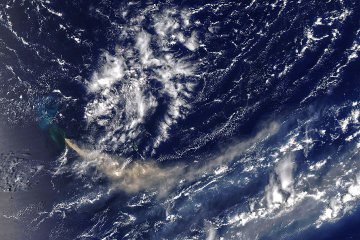
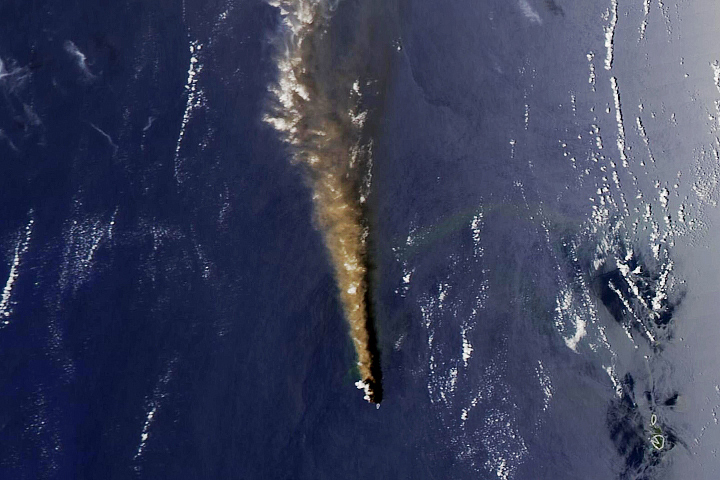
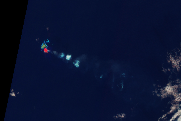
The new island rose out of the sea during a volcanic eruption first reported on November 20, 2013. It is adjacent to Nishino-shima, the summit of a massive submarine volcano that last erupted and expanded in 1973–74. Ongoing eruptions have caused the new island to grow, and the two islands may soon fuse into one.
The Advanced Land Imager (ALI) on NASA’s Earth Observing-1 (EO-1) satellite captured this natural-color image of the islands on December 24, 2013. Only a narrow channel of water appeared to separate the two. The water around the islands was discolored by volcanic minerals and gases, as well as by seafloor sediment stirred up by the ongoing eruption. A faint plume, likely steam and other volcanic gases associated with the eruption, extended away from the new island to the southeast.
Infrared imagery from the same satellite showed intense heat from the fresh lava, which was continuing to come to the surface and build the island as of December 24, 2013.
NASA Earth Observatory image by Jesse Allen, using EO-1 ALI data provided courtesy of the NASA EO-1 team. Caption by Robert Simmon and Jesse Allen.


