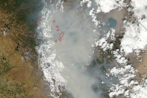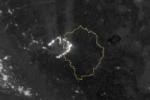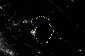

The Rim Fire is now the largest in the United States in 2013 and the fourth largest fire in California since records began in 1932. By the morning of September 3, the fire had burned 235,841 acres (954 square kilometers or 369 square miles) of brush, oaks, and pine in the Sierra Nevada Range near and in Yosemite National Park. The fire started on August 17 and has destroyed 111 buildings; it is threatening 4,500 more. The cause is under investigation.
The top image shows the spread of the fire between August 19 and September 2, 2013, as reported by fire managers on InciWeb. Each day in the period is represented by a different color, and the difference from one day to the next shows how much the fire burned that day. The fire was extremely active on some days and less active on others, depending largely on weather conditions. For example, much of the burning in Yosemite National Park occurred on August 26, when crews reported extreme fire behavior. Less burned on September 2, when cooler, more humid weather slowed the fire’s growth. By September 3, the fire was 75 percent contained, though it still had a high potential for growth.
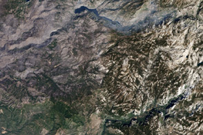
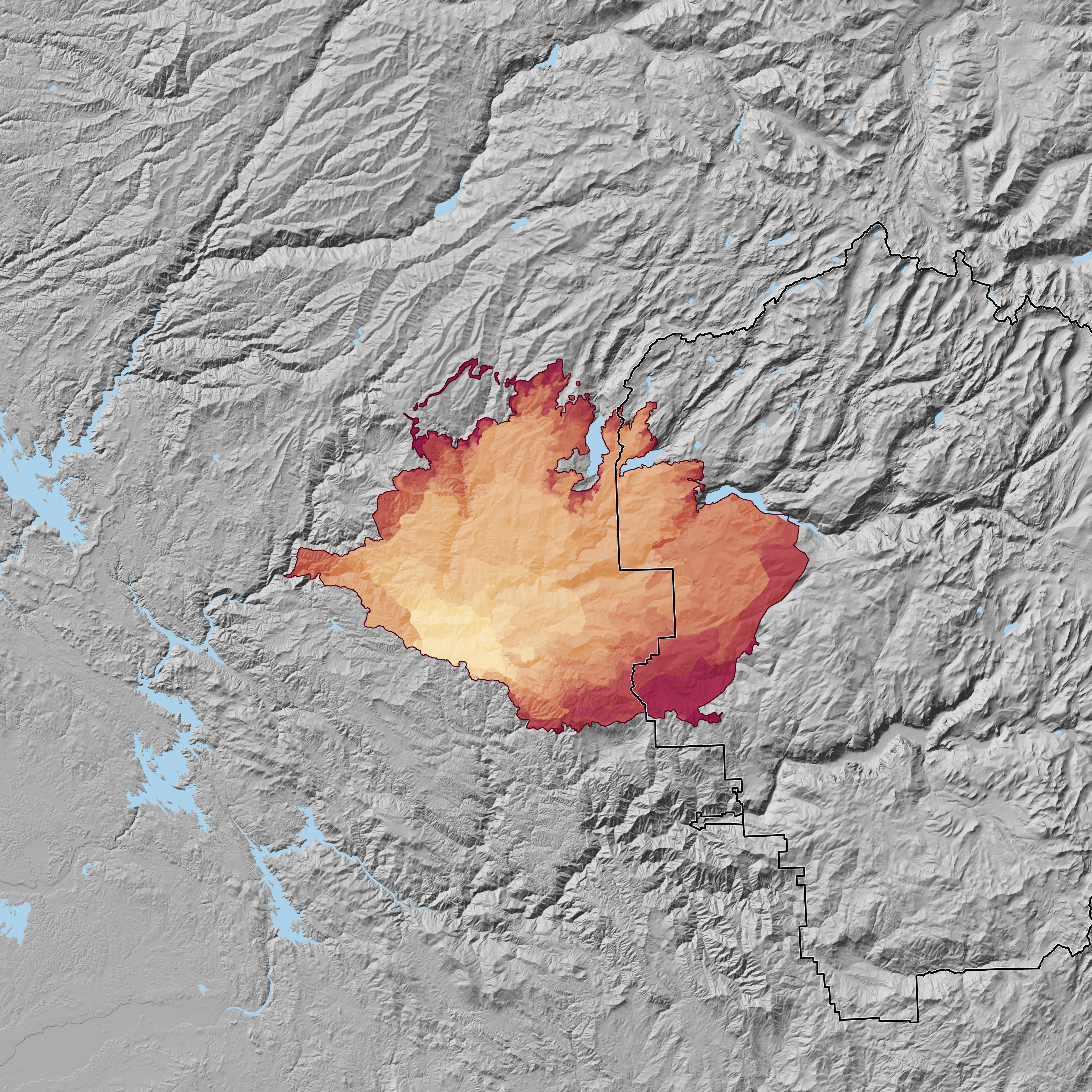
The fire extent is overlaid on a topographic map to illustrate just how challenging the terrain has been for firefighters. The Rim Fire is burning in a mountainous, difficult-to-access area, making aerial support essential for managing the fire. By September 1, airplanes and helicopters had dropped 1.7 million gallons of fire retardant and 1.4 million gallons of water.
The topographic map also how the fire has burned to the edge of the Hetch Hetchy Reservoir, the water supply for the San Francisco Bay area. Some of the watershed falls within the burned area. Rain and snow falling on water-resistant, burned ground could run into the streams that feed the reservoir, carrying sediment and clouding the water.
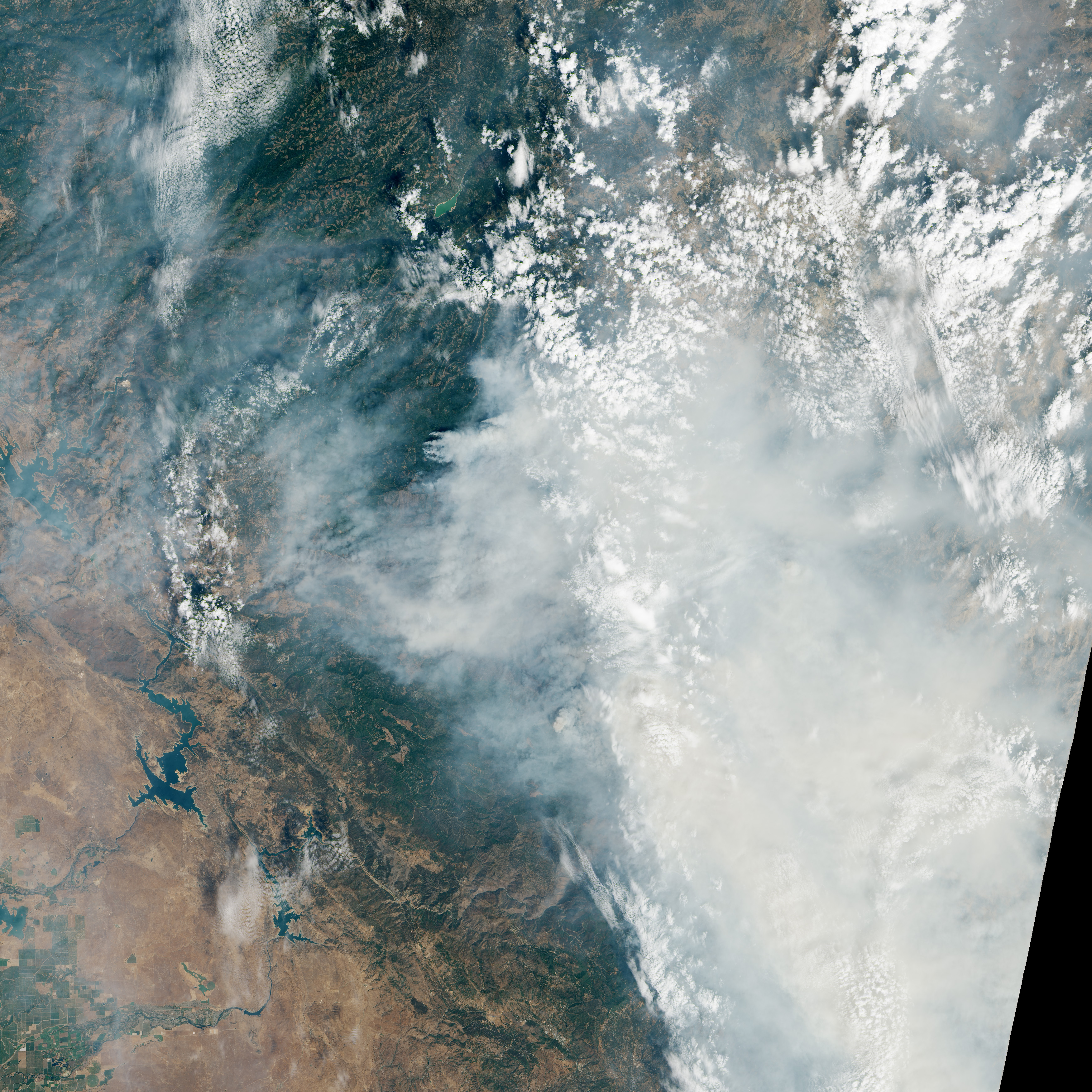
The lower image is a natural-color view of the Rim Fire on August 31 as observed by the Operational Land Imager on the Landsat 8 satellite. Plumes of smoke rise from the active front and obscure the view of the fire area. The smoke caused poor air quality from Yosemite National Park to the San Joaquin Valley on August 31.
NASA Earth Observatory images by Robert Simmon, using Landsat 8 data from the USGS Earth Explorer and fire extent data from InciWeb Thanks to Betsy Mason of the Wired Map Lab for links to data sources.