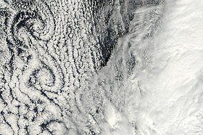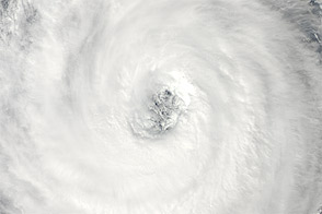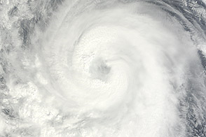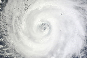
Prapiroon was winding down on October 18, 2012. The U.S. Navy’s Joint Typhoon Warning Center reported that the storm had sustained winds of just 35 knots (65 kilometers per hour). By the time the Moderate Resolution Imaging Spectroradiometer (MODIS) on NASA’s Terra satellite captured this natural-color image, Prapiroon lacked the distinct eye and spiral arms it had sported days earlier. Prapiroon was forecast to continue weakening as it moved toward the east-northeast over the Pacific Ocean.
While observing the dissipating storm, MODIS captured something else: von Karman vortices.
Though we think of ocean water and air as completely different things, they are both fluids, and when fluids encounter obstacles, they can form spiral eddies. The air-flow obstacle responsible for these vortices was likely Cheju (Jeju) Island. A volcanic peak on Cheju, Halla Mountain, rises to 1,950 meters (6,398 feet) above sea level. The spiral eddies extended about 720 kilometers (450 miles) south of the island.
NASA image courtesy Jeff Schmaltz, LANCE MODIS Rapid Response Team at NASA GSFC. Caption by Michon Scott.