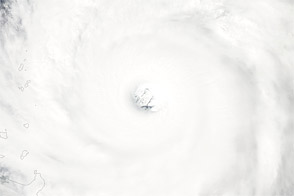
On September 25, 2012, Jelawat continued its northwestward trip over the western Pacific Ocean. The U.S. Navy’s Joint Typhoon Warning Center (JTWC) reported that Jelawat was located about 385 nautical miles (715 kilometers) east-northeast of Manila in the Philippines. The storm had maximum sustained winds of 140 knots (260 kilometers per hour) and gusts up to 170 knots (315 kilometers per hour).
The Moderate Resolution Imaging Spectroradiometer (MODIS) on NASA’s Terra satellite captured this natural-color image on September 25. Compared to the previous day, the storm had moved toward the north-northwest. Storm clouds stretched over part of the Philippines.
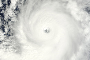
According to the Taipei Times, the Taiwan weather bureau had warned that Jelawat would pass near Taiwan around September 27–28. The JTWC projected storm track showed the storm moving toward the north-northwest, to the same latitude as Taiwan, then veering to the northeast.
NASA image courtesy Jeff Schmaltz, LANCE MODIS Rapid Response Team at NASA GSFC. Caption by Michon Scott.