The Earth Observatory has published its last Image of the Day on this website. Please join us on our new home at science.nasa.gov/earth/earth-observatory.

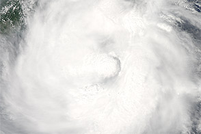
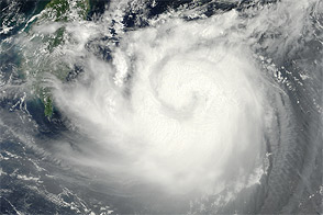
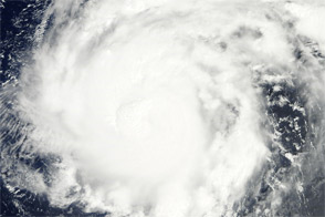
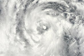
After four other Typhoons—Saola, Damrey, Haikui, and Kai-tak—made landfall in eastern China in just three weeks, Typhoon Tembin appeared ready to do the same. Tembin formed as a tropical depression over the western Pacific Ocean on August 19, 2012, and strengthened to a typhoon the next day.
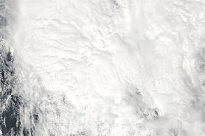
The Moderate Resolution Imaging Spectroradiometer (MODIS) on NASA’s Terra satellite captured this natural-color image on August 20. Sporting a well-defined eye, Tembin hovered over the ocean just east of the Philippine island of Luzon. Although next to the Philippines, Tembin was not actually forecast to make landfall there. The U.S. Navy’s Joint Typhoon Warning Center (JTWC) forecast that Tembin would head northward before turning west and coming ashore in Taiwan and China. Focus Taiwan News Channel reported that Tembin might make landfall on Taiwan’s east coast on August 23.
The same day that MODIS took this picture, the JTWC reported that Tembin was a powerful storm. Located about 320 nautical miles (595 kilometers) northeast of Manila, Tembin had maximum sustained winds of 95 knots (175 kilometers per hour) and gusts up to 115 knots (215 kilometers per hour). Over the next 36 hours, Tembin was expected to strengthen, developing maximum sustained winds of 120 knots (220 kilometers per hour) and gusts up to 145 knots (270 kilometers per hour).
NASA image courtesy Jeff Schmaltz, LANCE MODIS Rapid Response Team at NASA GSFC. Caption by Michon Scott.