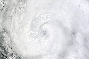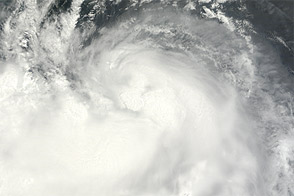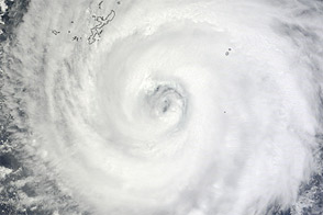
After strengthening into a typhoon, Kai-tak continued its approach to the China coast on August 16, 2012. The Moderate Resolution Imaging Spectroradiometer (MODIS) on NASA’s Terra satellite captured this natural-color image the same day. Kai-tak lacked a clear eye, but had the apostrophe shape typical of strong storms.
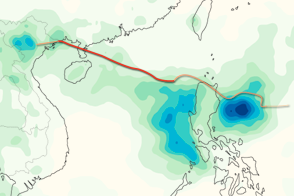
The U.S. Navy’s Joint Typhoon Warning Center (JTWC) forecast that Kai-tak would continue its movement toward the west-northwest, passing over China’s Leizhou Bandao peninsula and northern Vietnam on August 17 and 18. As of August 16, the JTWC reported that Kai-tak was roughly 195 nautical miles (360 kilometers) south-southeast of Hong Kong, with maximum sustained winds of 65 knots (120 kilometers per hour) and gusts up to 80 knots (150 kilometers per hour). The JTWC forecast that Kai-tak would strengthen somewhat over the next 12 hours before weakening slightly.
State news agency Xinhua reported that China’s national disaster relief authority had issued an alert for Kai-tak on August 15. The typhoon was expected to impact Guangdong and Fujian Provinces, and bring as much as 400 millimeters (16 inches) of rain to the Pearl River Delta west of Hong Kong.
Typhoon Kai-tak was the fourth storm to make landfall in eastern China in just over two weeks, following Typhoons Saola, Damrey, and Haikui.
NASA image courtesy Jeff Schmaltz, LANCE MODIS Rapid Response Team at NASA GSFC. Caption by Michon Scott.