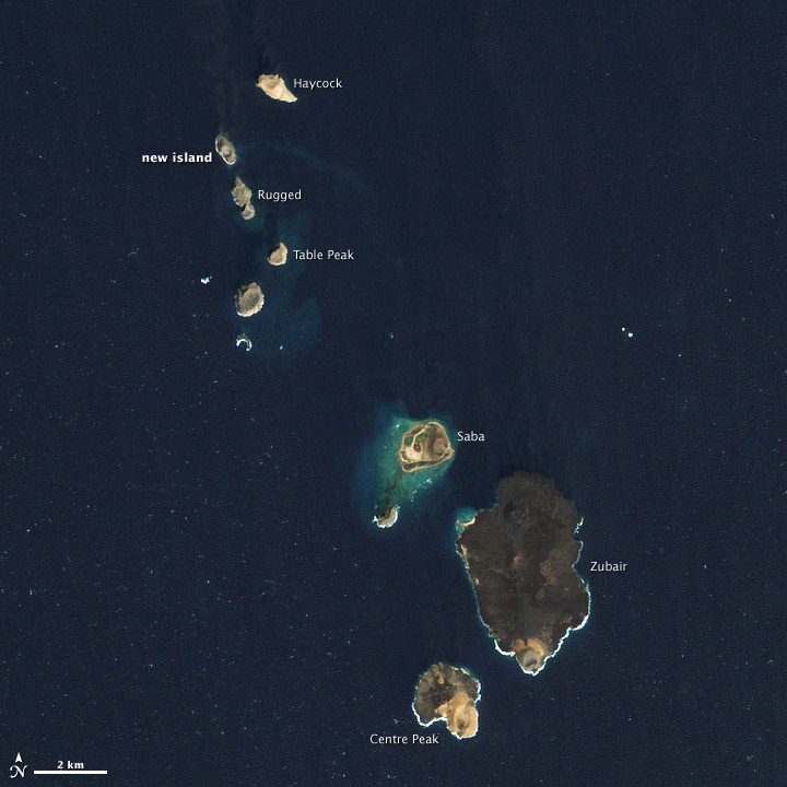


Volcanic activity in the Zubair Island Group appears to have ceased. On December 19, 2011, satellites detected sulfur dioxide and a small volcanic plume in the area, and by December 23 a new island had formed in the Red Sea. The island continued to grow in early January, but stopped by January 15th.
This natural-color image from the Enhanced Thematic Mapper Plus (ETM+) on Landsat-7 shows the entire island group on February 15, 2012. The islands are about 60 kilometers (40 miles) off the coast of Yemen.
NASA image by Jesse Allen and Robert Simmon, using Landsat data from the USGS Earth Explorer. Caption by Robert Simmon.