The Earth Observatory has published its last Image of the Day on this website. Please join us on our new home at science.nasa.gov/earth/earth-observatory.
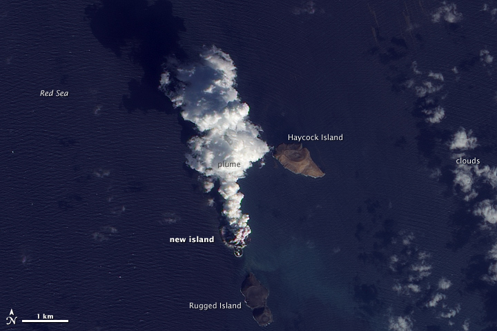
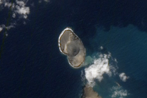
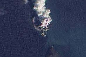
An eruption occurred in the Red Sea in December 2011. According to news reports, fishermen witnessed lava fountains reaching up to 30 meters (90 feet) tall on December 19. The Moderate Resolution Imaging Spectroradiometer (MODIS) on NASA’s Terra and Aqua satellites observed plumes on December 20 and December 22. Meanwhile, the Ozone Monitoring Instrument (OMI) on NASA’s Aura satellite detected elevated levels of sulfur dioxide, further indicating an eruption.
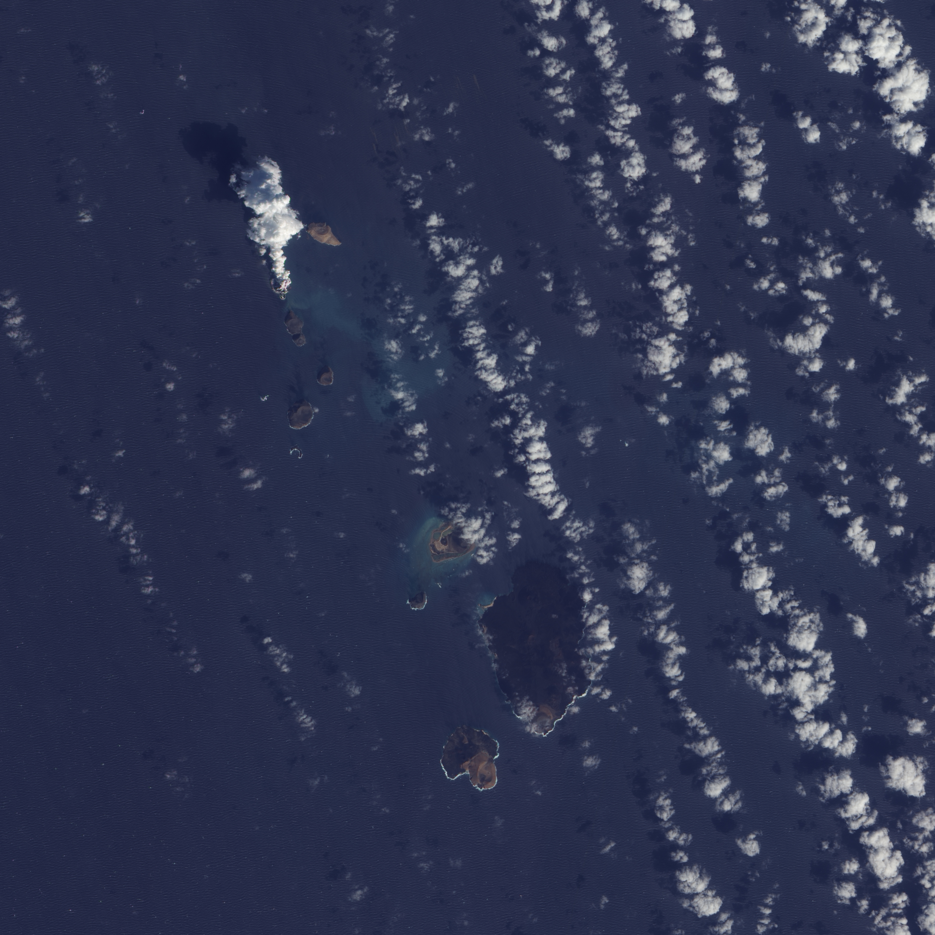
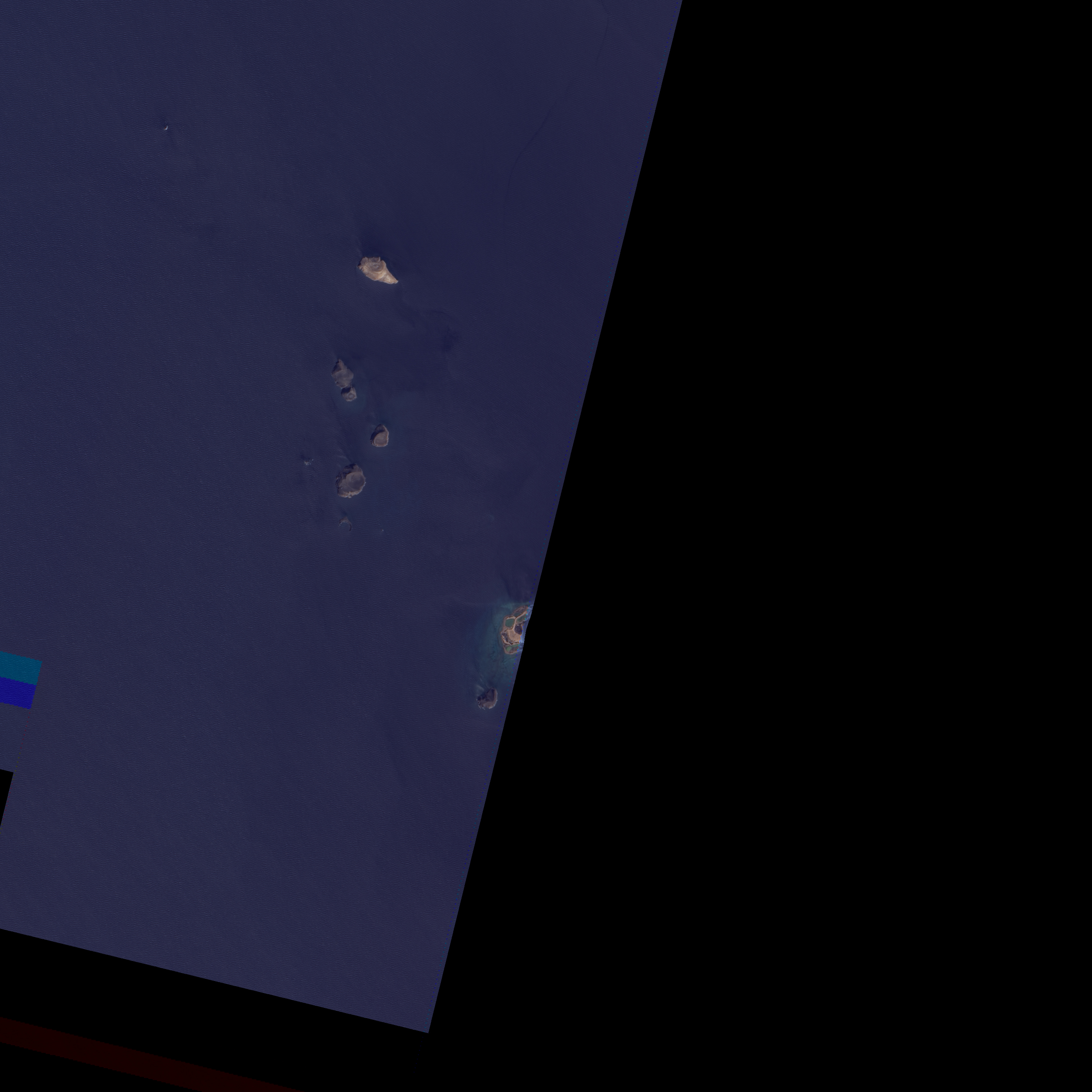
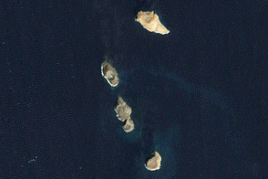
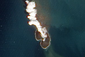
The activity in the Red Sea included more than an eruption. By December 23, 2011, what looked like a new island appeared in the region. The Advanced Land Imager (ALI) on NASA’s Earth Observing-1 (EO-1) satellite captured these high-resolution, natural-color images on December 23, 2011 (top), and October 24, 2007 (bottom). The image from December 2011 shows an apparent island where there had previously been an unbroken water surface. A thick plume rises from the island, dark near the bottom and light near the top, perhaps a mixture of volcanic ash and water vapor.
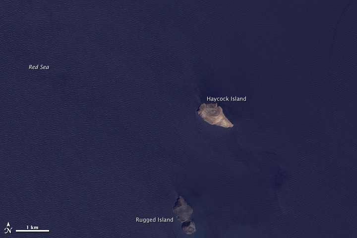
The volcanic activity occurred along the Zubair Group, a collection of small islands off the west coast of Yemen. Running in a roughly northwest-southeast line, the islands poke above the sea surface, rising from a shield volcano. This region is part of the Red Sea Rift where the African and Arabian tectonic plates pull apart and new ocean crust regularly forms.
NASA Earth Observatory image created by Jesse Allen, using EO-1 ALI data provided courtesy of the NASA EO-1 team. Caption by Michon Scott.


