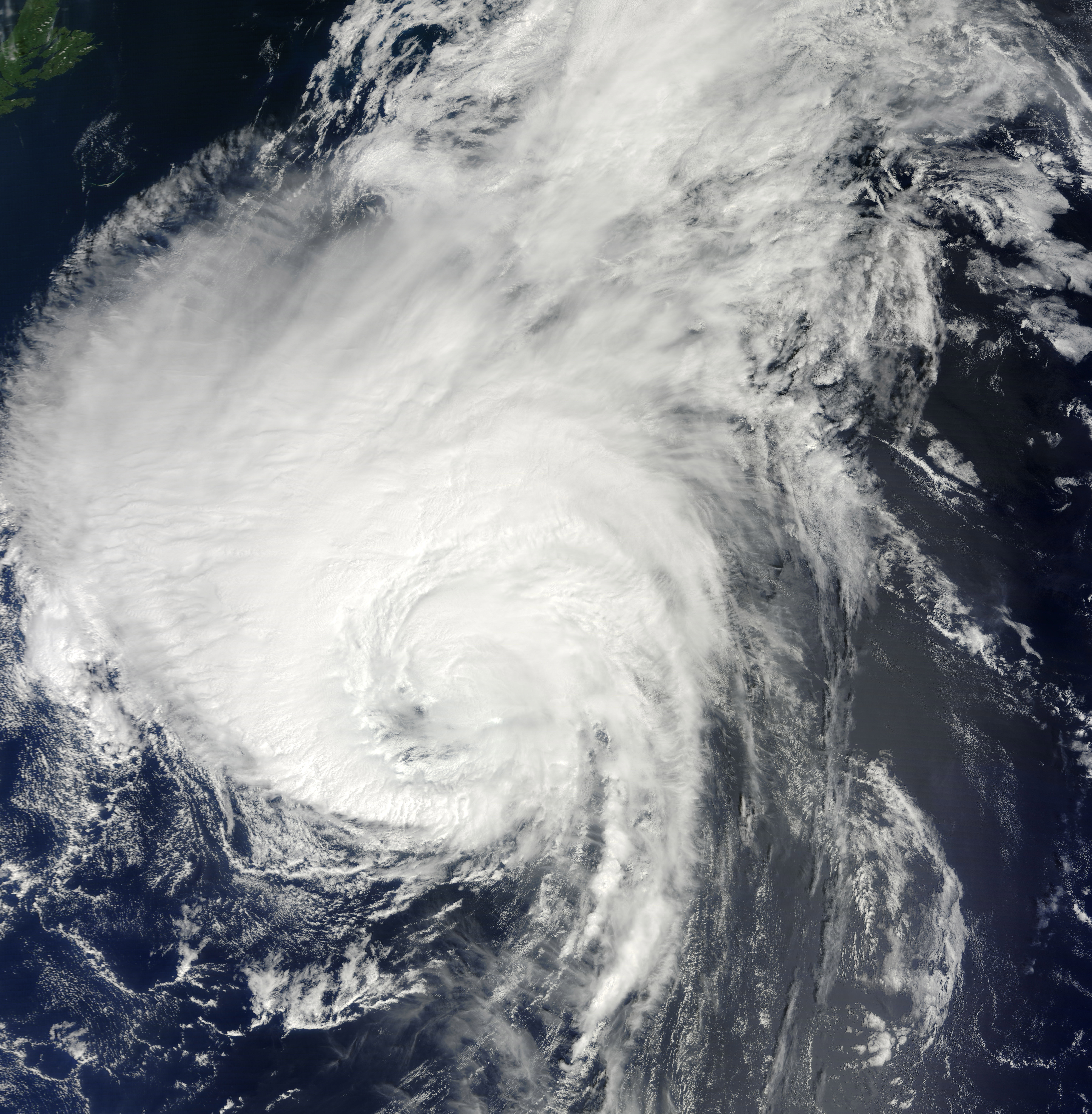
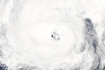
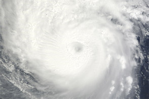
The Moderate Resolution Imaging Spectroradiometer (MODIS) on NASA’s Terra satellite captured this natural-color image of Hurricane Danielle over the North Atlantic Ocean at 14:20 Universal Time (UTC), on August 29, 2010. By 15:00 UTC, the U.S. National Hurricane Center (NHC) reported Hurricane Danielle was centered near latitude 35 degrees North, longitude 55.5 degrees West and far from any land masses (about 605 miles/975 kilometers south from Cape Race, Newfoundland). Sustained winds reached 85 miles (140 km) per hour, with air pressures at 976 millibars.
Though the storm never passed close to land, it brought heavy surf and strong rip currents in Bermuda and along much of the Atlantic coast of the United States. The Associated Press reported that two people died and more than 320 were pulled from the waters of Maryland and Florida due to the hurricane's effects.
The first major hurricane (category 3 or higher) of the 2010 North Atlantic season has been steadily losing energy since it peaked as a category 4 storm on August 28. By 1500 UTC on August 30, Danielle had been downgraded to a category one hurricane as it reached cooler waters.
Both Danielle and Hurricane Earl appeared in a single overpass of the Terra satellite on August 29, 2010.
NASA image by Jeff Schmaltz, MODIS Rapid Response Team at NASA GSFC. Caption by Mike Carlowicz.


