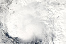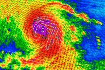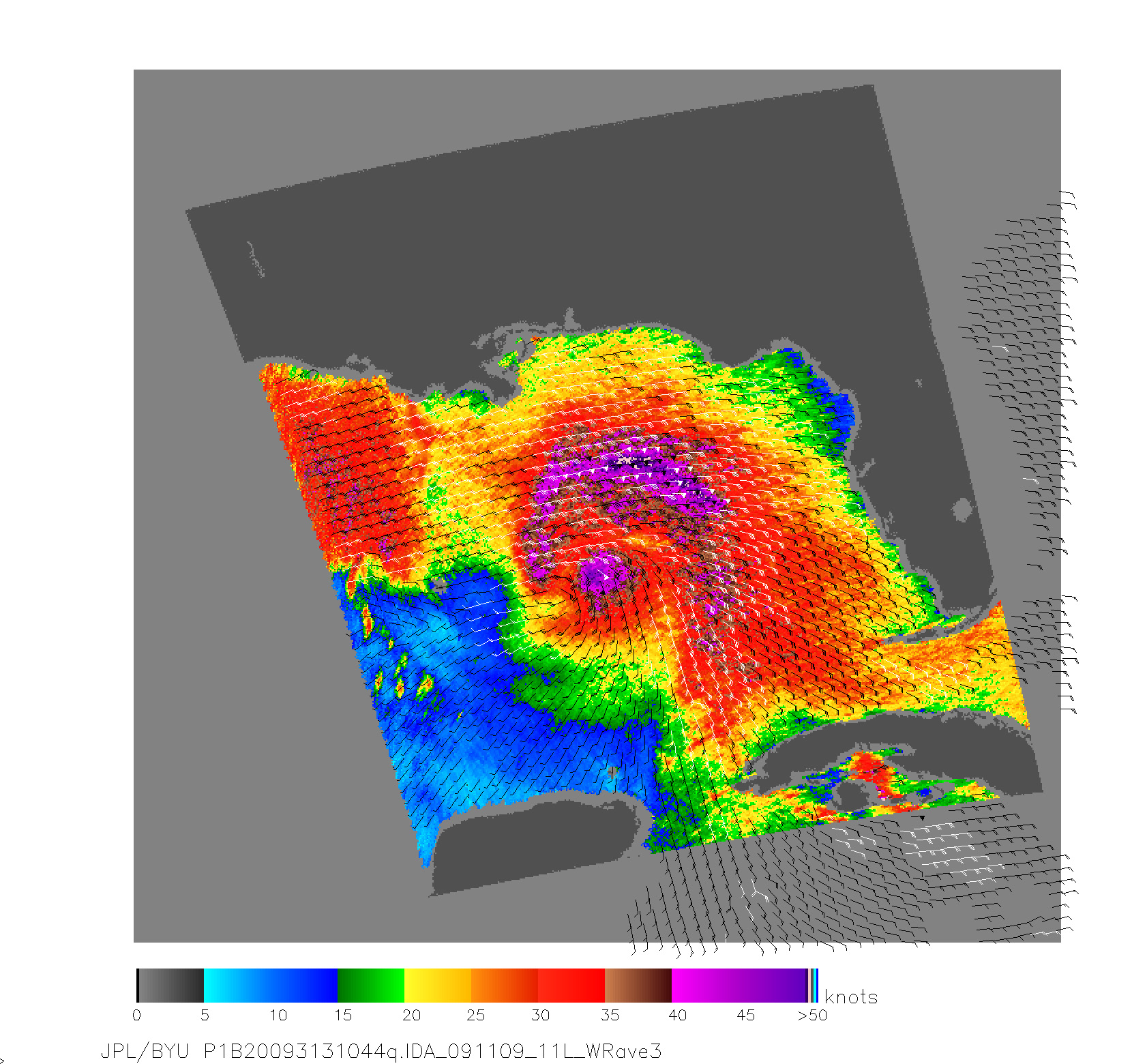
Ida was a Category 1 hurricane on the morning of November 9, 2009, when the QuikSCAT satellite acquired the data used to make this image. The image shows wind fields in color and wind direction with small arrows. QuikSCAT observed the storm at 5:23 a.m. U.S. Central time. At 6:00 a.m., the National Hurricane Center (NHC) warned that Ida had winds near 80 miles per hour (130 kilometers per hour), making it a Category 1 hurricane on the Saffir-Simpson Hurricane Wind Scale.
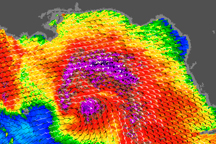
In this image, Hurricane Ida has a concentrated center of strong winds, shown in purple, with an additional field of strong winds north of the center. Weaker winds radiate out from the center. The storm lacks distinctive bands apparent in the wind and rain fields of more organized storms. By the time of the next NHC warning, Ida had become a tropical storm, and it was predicted to come ashore near the border of Mississippi and Alabama on the morning of November 10.
QuikSCAT monitors wind speed with a radar that sends out pulses of microwave energy and listens for the echo after the pulse bounces off the wind-roughened ocean surface. Scientists translate radar signals into estimates of wind speed by matching the radar echoes to physical measurements collected from buoys at the same time and place.
Cyclone-strength wind speeds are rare, however, and scientists generally don’t have enough matching buoy observations to convert wind speeds above roughly 50 knots. Intense rain rippling the ocean’s surface can also interfere with the radar signal. Because of these limitations, QuikSCAT images don’t show absolute, maximum wind speeds. Instead, they give forecasters a valuable picture of the wind structure within the storm, for example, revealing whether a storm has a strong or a weak eye and how large an area is experiencing tropical-storm-strength winds.
NASA image courtesy David Long, Brigham Young University, on the QuikSCAT Science Team, and the Jet Propulsion Laboratory. Caption by Holli Riebeek, NASA Earth Observatory.