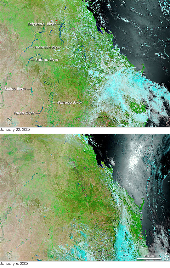
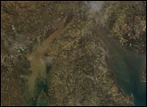
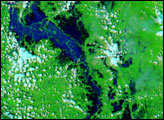
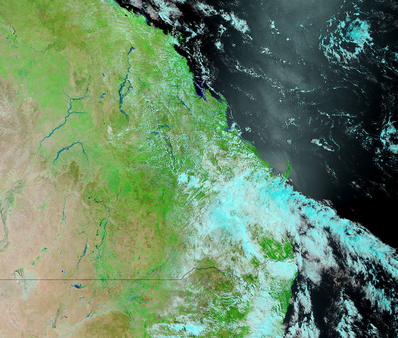
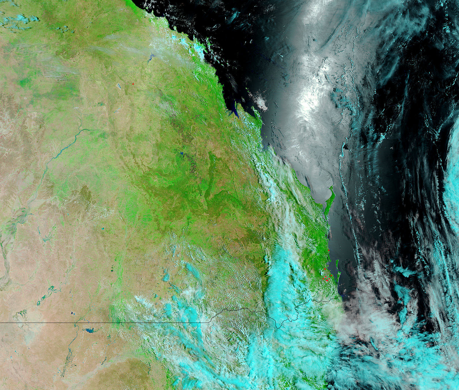
Rivers across Queensland, Australia, ran high in the wake of heavy summer rain in early 2008. The top image, captured by the Moderate Resolution Imaging Spectroradiometer (MODIS) on NASA’s Terra satellite, illustrates just how wide-spread the flooding was. The image covers approximately 960 kilometers (about 600 miles) north to south, and rivers along this entire length are notably flooded. Rivers in inland Queensland tend to be seasonal in nature, swelling during the summer monsoon, and shrinking or disappearing at other times of the year. The lower image, taken on January 6, 2008, shows southern Queensland just as the rivers were beginning to expand.
The images are false color, meaning that the scene does not appear as the human eye would see it. Instead, the images were made with a combination of infrared and visible light to make water stand out distinctly from the surrounding landscape. Water is black in this type of image. Mud-laden water (as in the flooded rivers) or very muddy earth is dusty blue, while dry earth covered by few or no plants is tan. Plant-covered land is bright green, and clouds are turquoise and white. The silver-white streak on the surface of the ocean is reflected sunlight. In the true-color, photo-like version of the scene, the muddy rivers blend in with the brown earth. Daily images of Queensland in both true and false color are available from the MODIS Rapid Response System.
Because the images cover such a large area, the large images provided above are not at maximum resolution. They have a resolution of one kilometer per pixel. The MODIS Rapid Response System provides the images in two separate tiles at MODIS’ full resolution of 250 meters per pixel.
NASA images courtesy the MODIS Rapid Response Team at NASA GSFC. Caption by Holli Riebeek.


