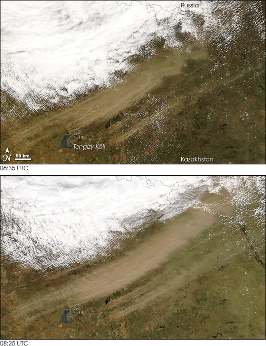


On May 2, 2007, a dust storm formed in Kazakhstan, just south of the Russian border. The Moderate Resolution Imaging Spectroradiometer (MODIS) on NASA’s Terra satellite captured an image of the storm at 06:35 UTC. At 08:25 UTC, the MODIS sensor on NASA’s Aqua satellite took another picture, showing a discernible increase in the storm’s size and intensity.
In both of these images, the dust plumes appear as diagonal tan swipes. Dust storms often originate from distinct locations that can be seen in satellite imagery, and the high-resolution images reveal source points for the storm in the southwest, indicating that the wind direction is toward the northeast. Many of the source points appear in the vicinity of Tengizy (Tengiz) Köli.
Immediately north of the dust is a bank of clouds, perhaps associated with the same weather system that kicked up the dust. Sprinkled throughout northern Kazakhstan are hotspots where the sensor picked up anomalously warm surface temperatures. Likely indications of fires, these hotspots appear as red dots.
NASA image by Jeff Schmaltz, MODIS Rapid Response Team, Goddard Space Flight Center.