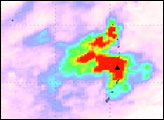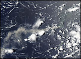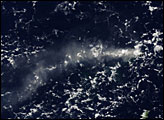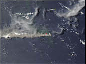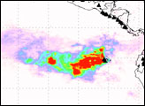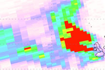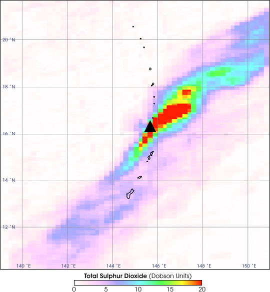
A long plume of sulfur dioxide extends northeast and southwest of the Anatahan volcano in the Northern Mariana Islands in the western Pacific Ocean. The volcano has been erupting almost continuously since January 5, 2005, when it started its third eruption in recorded history. This image, collected by the Ozone Monitoring Instrument on NASA’s Aura satellite, shows sulfur dioxide concentrations in the atmosphere between January 31 and February 4, 2005.
In the above image, the edge of the sulfur dioxide plume covers Guam (the southernmost island) and the other Mariana Islands immediately north and south of the volcano. Highest concentrations are shown in red, with the lowest concentrations in pale pink. The Ozone Monitoring Instrument measured sulfur dioxide concentrations in Dobson Units—the number of molecules per square centimeter of atmosphere. One Dobson Unit equals 0.0285 grams of sulfur dioxide per square meter.
Sulfur dioxide is one of the gases that can be emitted in volcanic eruptions. Once in the atmosphere, sulfur dioxide combines with water to create a sulfuric acid haze. Called “vog,” this haze can cause illness and make breathing difficult. Volcanic haze grew so thick during the first week of February that the National Weather Service issued a volcanic haze advisory on Guam,where several illnesses were reported.
Added to the Aura satellite as part of a collaboration between the Netherlands’ Agency for Aerospace Programs and the Finnish Meteorological Institute, the Ozone Monitoring Instrument was tracks global ozone change and monitors aerosols like sulfates in the atmosphere.
NASA image courtesy Simon Carn, Joint Center for Earth Systems Technology (JCET), University of Maryland Baltimore County (UMBC)
alert message