This page contains archived content and is no longer being updated. At the time of publication, it represented the best available science.
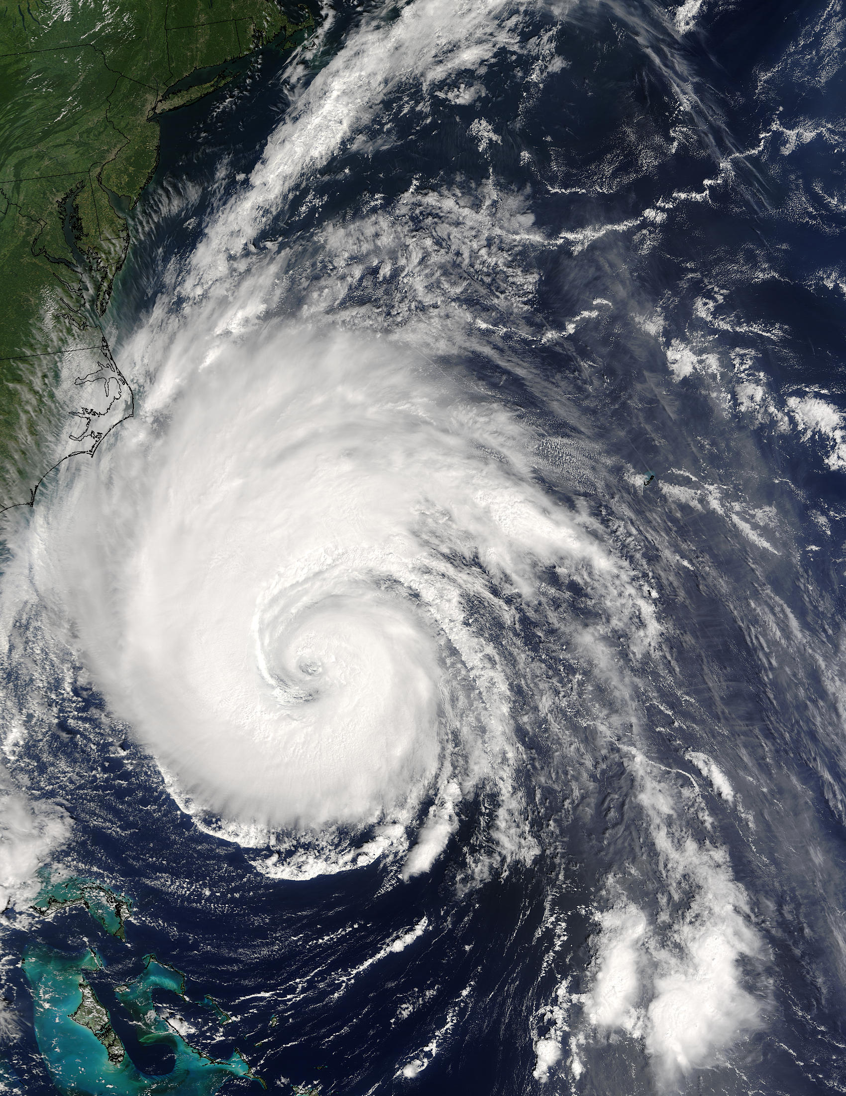
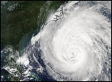
Hurricane Isabel creeps closer to the US east coast in this true-color
MODIS image taken
by the Terra satellite on September 17, 2003 at 11:09 am, US Eastern time.
Though downgraded to a powerful Category 2 hurricane, Isabel was packing
sustained winds of 110 miles per hour. The storm is about 400 miles
south-southeast of Cape Hatteras, North Carolina, in this image.