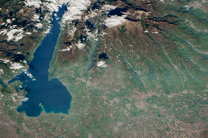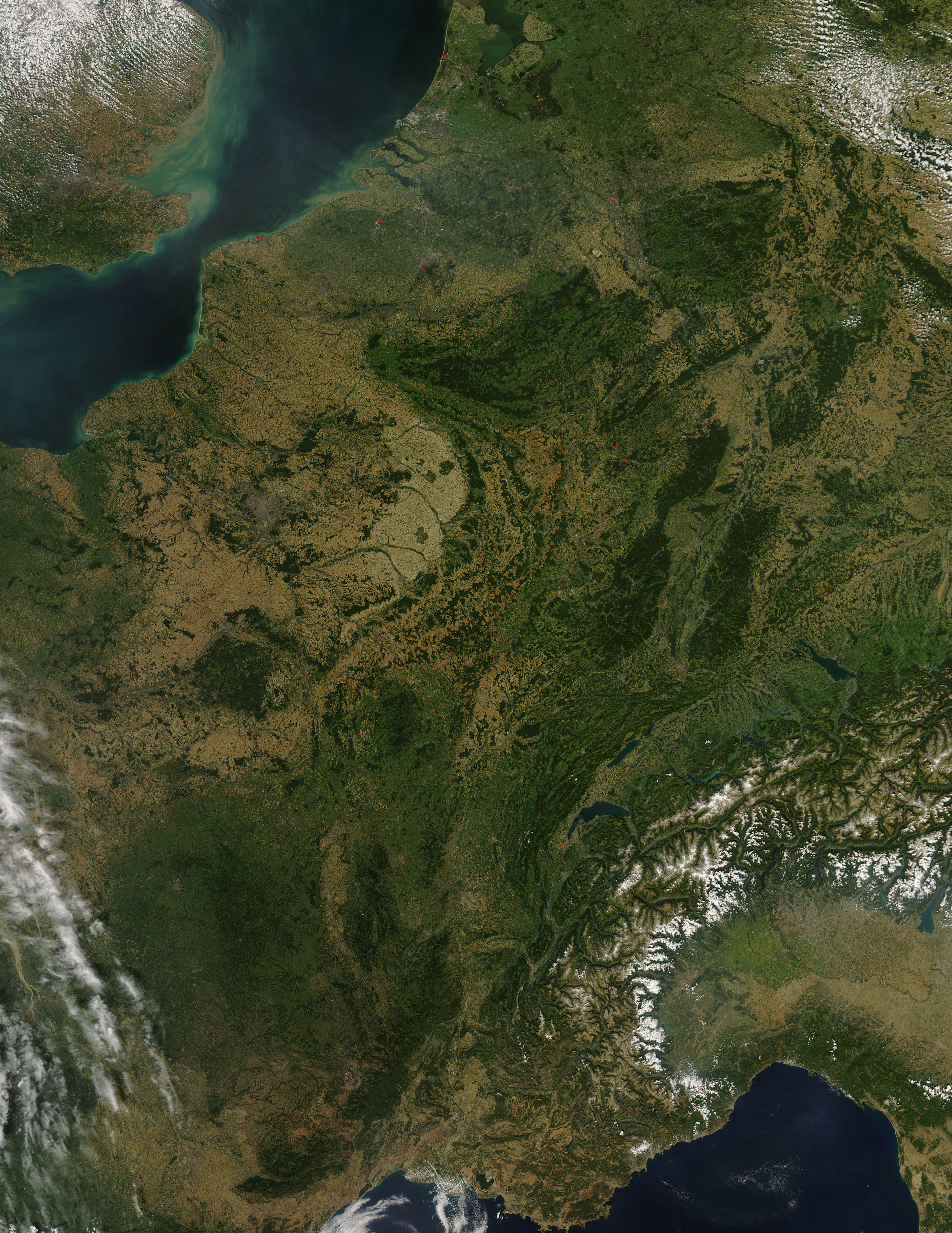
Rarely do weather patterns and satellite overpass schedules coordinate to permit such a cloud-free view of such a wide area of western Europe. This image of the region was captured by the Moderate Resolution Imaging Spectroradiometer (MODIS) on NASA’s Aqua satellite on August 30, 2008. Skies were clear from the Netherlands in the north to Italy in the south, revealing several of Europe’s famous natural and manmade features. A few small fires (marked with red dots) were detected, as well.
A pair of geologically matching mountain ranges appear at the border of France and Germany, covered in dark green forests. France’s Vosges and Germany’s Black Forest rise on either side of the Rhine River Valley. The valley in that area is known to geologists as the Rhine Graben; a graben is an elongated block of Earth’s crust that has sunk relative to surrounding blocks. To the south, the snow-covered Alps create an arcing boundary between Switzerland and Italy.
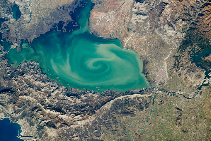
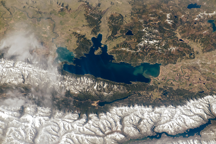
Near the bottom right of the image, one of the largest lakes in Europe, Lake Geneva (formally known as Lac Léman), fills a glacier-carved valley in western Switzerland. This natural lake occurs on the Rhône River, upstream of where it makes a sharp southward bend as it leaves the Alps. At the northern edge of the image is a larger, artificial lake: the Netherland’s IJsselmeer. Despite its closeness to the North Sea, IJsselmeer is a freshwater lake. It was originally a saltwater inlet at the mouth of the IJssel River, but in the early 1930s, the Dutch built a dike across the inlet. The freshwater flow of the IJssel River flushed out the seawater, forming the new lake.
NASA image by Jeff Schmaltz, MODIS Rapid Response Team. Caption by Rebecca Lindsey.