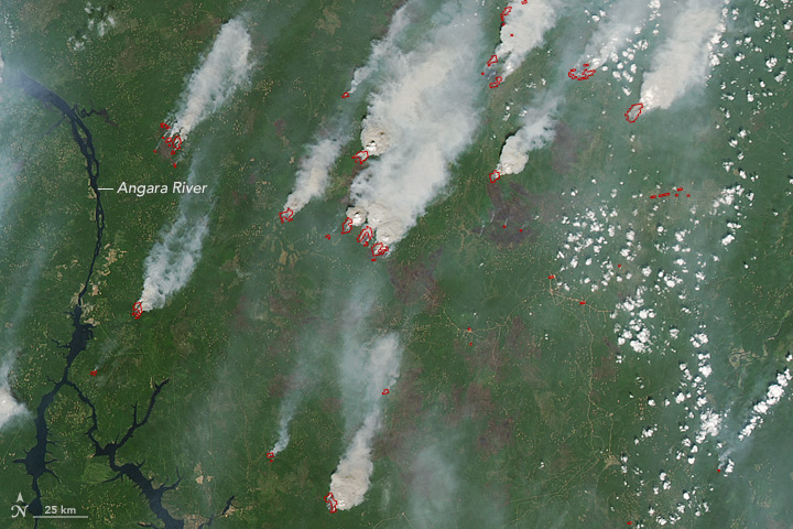


Wildfires spread across southern Siberia in late June 2017. According to Russian state media, at least 27,000 hectares (100 square miles) were burning in the Irkutsk Oblast region. Another 27,000 hectares burned in neighboring states and regions. More than 200 firefighters were sent to control the blazes. Dry lightning and human carelessness were cited as the causes of some of the fires.
On June 22, 2017, the Moderate Resolution Imaging Spectroradiometer (MODIS) on NASA’s Aqua satellite acquired the first two natural-color images of fires near Lake Baikal and the Angara River. The next day, Aqua MODIS acquired the third image (below), which shows dense smoke plumes spreading northeast toward Yakutsk. Red outlines on each image are hot spots detected by MODIS where surface temperatures indicate the presence of fire.
According to the science team of NASA’s Ozone Mapping and Profiler Suite (an instrument on the Suomi NPP satellite), the aerosol index reached 19 over the Lake Baikal/Irkutsk region, indicating very dense smoke at high altitudes. Researchers are investigating at least three possible pyrocumulus cloud formations in the area; such fire clouds can loft ash and particles high into the atmosphere.
NASA images by Jeff Schmaltz, LANCE/EOSDIS Rapid Response. Story by Mike Carlowicz.