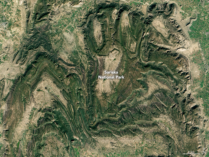


From space, the curving ridges of the Aravalli Range between Jaipur and Alwar look a bit like tiger tracks or scratch marks on an otherwise flat landscape. The mountain range, one of the oldest in India, began to rise when ancient tectonic plates collided in the Proterozoic Eon.
More than a billion years later, these weathered hills remain. Like the Appalachian Mountains in the United States, the hills of the Aravalli are the nubs of what was once a much more imposing range. In this area, the hills rise to roughly 600 meters (2,000 feet) of elevation.
The Operational Land Imager (OLI) on Landsat 8 captured this image of the range on December 22, 2016. The city of Jaipur appears gray in the lower left of the image; Alwar, with a population roughly ten times smaller, is on the upper right. Alwar was established in 1000 A.D; the Hindu ruler Jai Singh II founded Jaipur in 1726.
Astrology and astronomy were among Jai Singh II’s interests. With the aim of improving the Indian calendar and understanding of the position of the Sun and other celestial bodies, he had five astronomical observatories built in northern India between 1724 and 1730. The largest, located in Jaipur, included 20 large-scale stone instruments. Among them was the Samrat Yantra—the largest sundial ever built. The 22-meter (73-foot) structure can measure local time to an accuracy of two seconds.
Northeast of Jaipur is Sariska National Park, a wildlife sanctuary and tiger reserve. According to news reports, the number of tigers in the park dwindled to zero in 2005 due to poaching. Since then, a government program to reintroduce tigers to the area has boosted the population to 14, including one young cub.
NASA Earth Observatory image by Jesse Allen, using Landsat data from the U.S. Geological Survey. Caption by Adam Voiland.