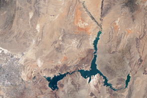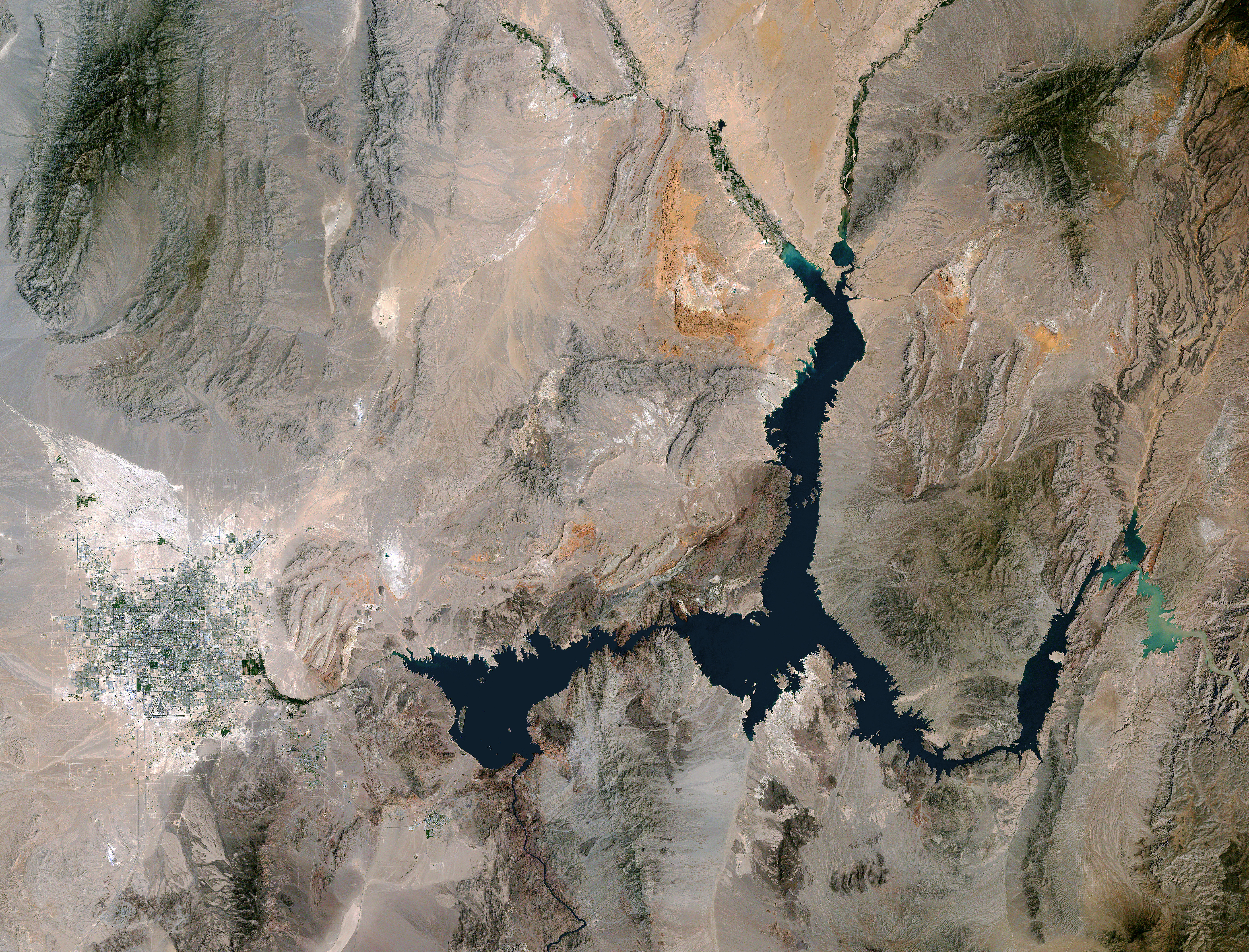
The last time Lake Mead was this low—in 1937—water managers were still filling the reservoir and putting finishing touches on the Hoover Dam. According to data from the U.S. Bureau of Reclamation, the water level has now reached a record low for the second year in a row.
On May 25, 2016, the surface level of Lake Mead at the Hoover Dam stood at 1,074.03 feet (327.36 meters) above sea level. The previous low of 1,075.08 feet (327.68 meters) was set in late June 2015. The lowest water levels each year are usually reached in late June or July, after water managers have released the yearly allotment of water for farmers and cities farther down the Colorado River watershed. That means water levels are likely to continue to fall in 2016 to roughly 1,070 feet (326 meters), according to the Bureau of Reclamation.
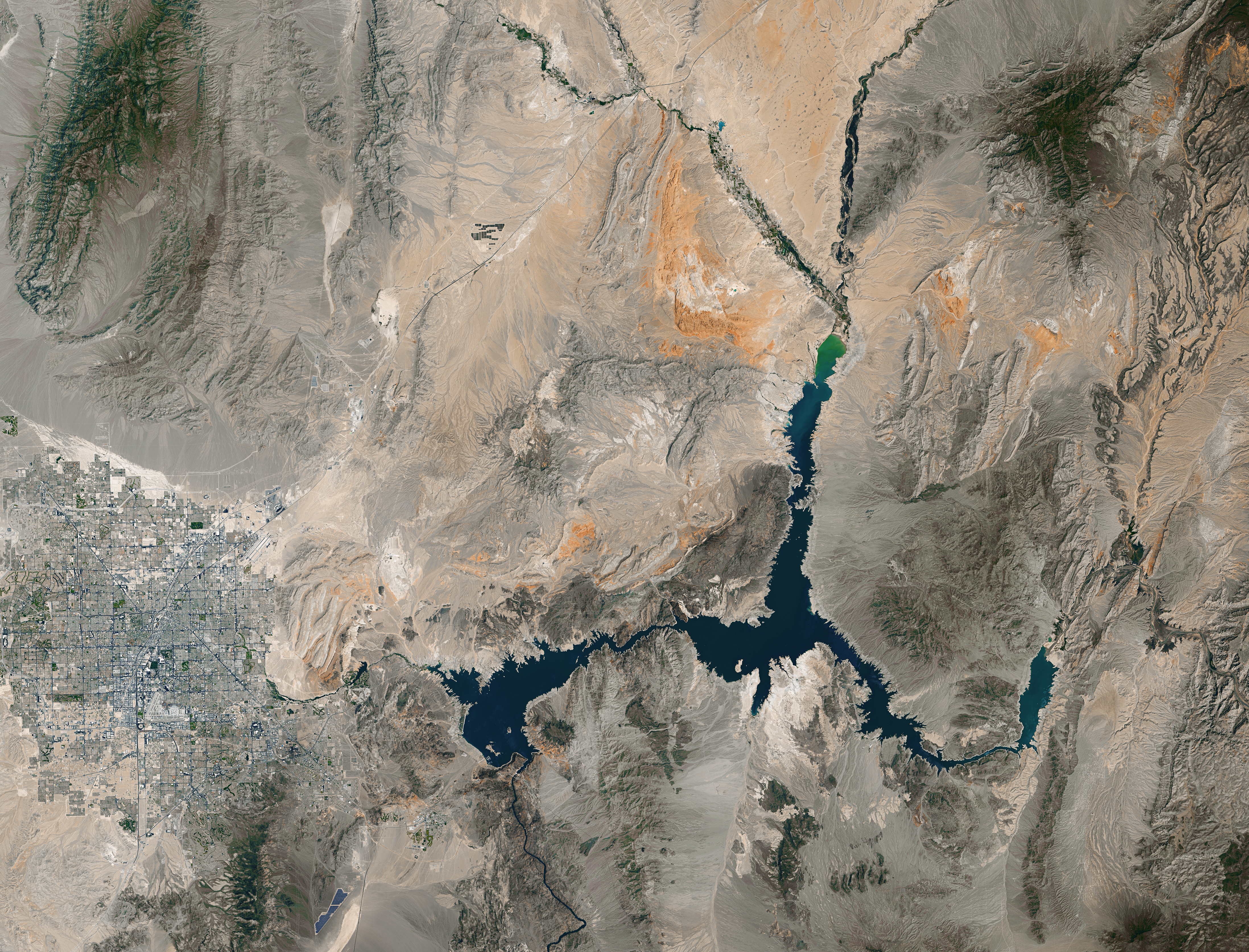
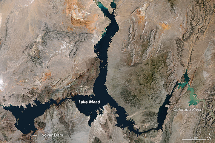
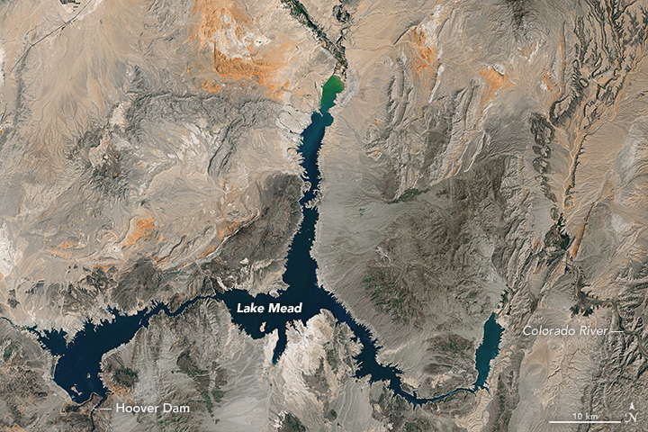
The pair of Landsat images above show the lake near its highest and lowest points over the past 32 years. The top image was acquired on May 15, 1984, by the Thematic Mapper on the Landsat 5 satellite. The lake last approached full capacity in the summer of 1983. The second image was acquired on May 23, 2016, by the Operational Land Imager (OLI) on Landsat 8. Turn on the image comparison tool to see the changes in the shoreline after lake water levels dropped 135 feet (41 meters). Notice the white-tan “bathtub ring” around the edges of the water; this is exposed sand and minerals that would normally be under water.
Lake Mead is now roughly 37 percent full. At maximum capacity, the reservoir would hold 9.3 trillion gallons (36 trillion liters) of water, reaching an elevation 1,220 feet (372 meters) near the dam. Most of the water in this great reservoir comes from snowmelt in the Rocky Mountain range and travels through Lake Powell, the Grand Canyon, and into Lake Mead. Farmers and some cities in Arizona, Nevada, California, and northern Mexico all rely on water from Lake Mead.
According to the Bureau of Reclamation, the lake will be refilled enough by the end of 2016 to avoid cuts in water deliveries in 2017. Lake Mead National Recreation Area continues to operate water sports, sightseeing, and hiking facilities in the area, despite ongoing drought.
The Colorado Basin has endured roughly sixteen years of drought and declining water levels in Lake Mead and Lake Powell. At the same time, populations continue to grow in the sun-drenched region.
NASA Earth Observatory images by Joshua Stevens, using Landsat data from the U.S. Geological Survey. Caption by Mike Carlowicz.