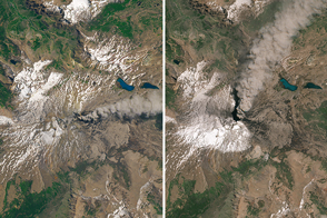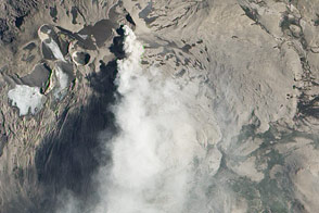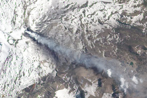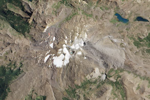

In early 2016, volcanic activity at Copahue—a stratovolcano in the Andes Mountains, straddling Chile and Argentina—continued. Volcanic plumes have periodically streamed from the volcano and several explosive events have occurred since it became restless again in 2012.
On January 13, 2016, the Advanced Land Imager (ALI) on the Earth Observing-1 (EO-1) satellite acquired this view of the elusive volcano, which is often obscured by clouds. At the time, winds blew a plume of steam, gas, and ash primarily toward the south and southeast, missing the town of Caviahue in Argentina.
Chile’s National Geology and Mining Service (SERNAGEOMIN) reported that monitoring stations near the volcano had recorded a series of earthquakes on January 14, 2016, associated with the fracturing of rock underground. The emissions and seismicity prompted SERNAGEOMIN to put the volcano at alert level yellow. The group recommends that people stay at least 1.5 kilometers (1 mile) away from the crater.
According to a January 19 news report, thermal baths were still open in Copahue village. The village and spa sit at the northeast base of the volcano amid numerous thermal pools, mud-pots, and steam vents.
Volcanic emissions from Copahue have been relatively common in recent years. See this image gallery to view more plumes emitted by the volcano since 2013.
NASA Earth Observatory image by Jesse Allen, using EO-1 ALI data provided courtesy of the NASA EO-1 team. Caption by Kathryn Hansen.
Image of the Day Land Volcanoes Snow and Ice Remote Sensing
Activity continued at Volcán Copahue—a stratovolcano in the Andes that straddles the border of Chile and Argentina.
Image of the Day for January 20, 2016
Explosive eruptions have occurred sporadically at Copahue since the 18th century.


