Humans have been setting fires in the savannas and forests of western Africa for thousands of years. For just as long, the smoke from these fires may have reduced rainfall during the dry season, according to new research from scientists at NASA’s Jet Propulsion Laboratory.
Michael Tosca and colleagues used data from three satellites and ground-based weather stations, along with an atmospheric model, to study how the small particles—called aerosols—in smoke affect the development of low-level cumulus clouds over land. In tropical regions, these clouds form in mid-morning, peak in late afternoon, and dissipate by evening, often producing rain in the process.
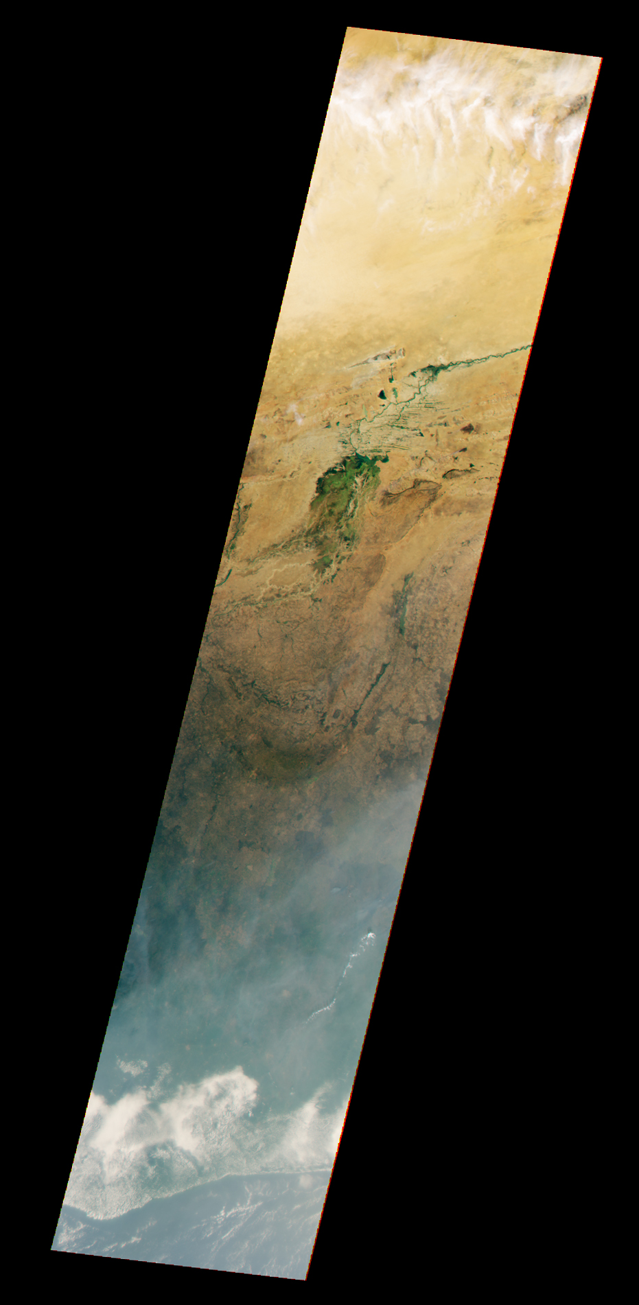
The first step for Tosca and his colleagues was to find smoke-filled scenes of West Africa as observed by the Multi-angle Imaging Spectroradiometer (MISR) sensor on the Terra satellite between 2006 and 2010. Most of the smoky scenes they selected were acquired in December, a month when fire activity in West Africa is high due to seasonal agricultural fires lit by farmers to clear land for crops and grazing animals. Next, they matched the smoke-filled MISR images with smoke-free scenes of days with statistically identical weather conditions. Then, using data collected during morning satellite overpasses by the Moderate Resolution Imaging Spectroradiometer (MODIS) on Terra and afternoon MODIS passes by Aqua, they compared how cloud cover evolved during the day in both smoky and non-smoky cases. They validated the MODIS observations with data from the Tropical Rainfall Measuring Mission (TRMM) and the European Center for Medium-Range Weather Forecasts.
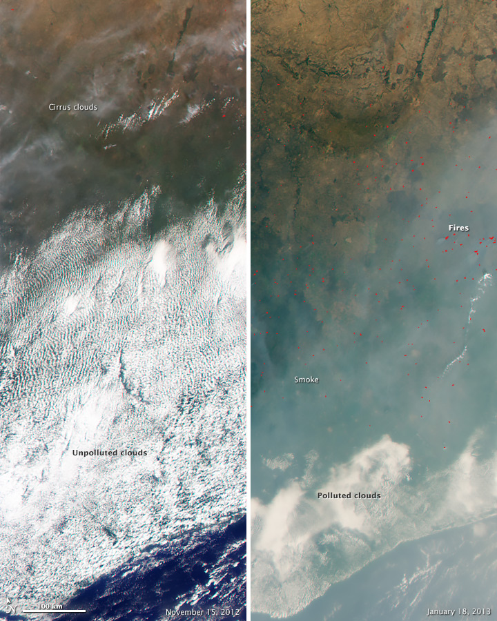
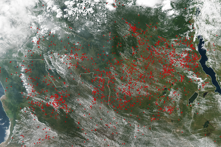
The results were striking. As the pair of MISR images above illustrates, the researchers found that the presence of smoke coincided with sharp decreases in the amount of cloud cover. The image on the left was collected on November 15, 2012, when few fires were burning; the image on the right was collected on January 18, 2013, in the midst of the burning season. Smoke appears gray. Fires are shown as small red dots. Note the extensive sheet of low-level cumulus clouds in the November image. In contrast, there are many fires and very few clouds in the smoke-filled January image.
“Fire-emitted particles crippled the atmosphere’s ability to build clouds and thunderstorms, and that ultimately caused a decrease in rainfall during what's already a seasonal drought,” Tosca said. “While this ‘smoky’ image just shows one day, remember that these conditions persist essentially unabated from December through February. Taken together, it represents a huge climate perturbation.”
Tosca attributes the reduction in cloud cover and rainfall to a phenomenon known as the semi-direct aerosol effect. The dark soot particles in smoke absorb incoming sunlight and warm the atmosphere. This warming reduces the upward movement of moisture, which is crucial to the development of cumulus clouds.
Though the semi-direct effect was quite pronounced on the low-level cumulus clouds in Tosca’s study, that does not mean that the same effect occurs with all aerosols types and for all cloud types. Rather, the relationship between clouds and aerosols is quite complicated. While dark aerosols inhibit cloud formation, more reflective aerosols can brighten clouds, making them last longer and, in some cases, increasing rainfall. Even the effect of dark can differ markedly depending on whether a smoke plume is at the same height as a cloud layer or drifting above it.
“The aerosol effects can be completely different if you are looking at smoke above clouds over the ocean,” Tosca said. “In fact, we will be in Namibia next summer researching this very case as part of the ORACLES campaign.”
NASA Earth Observatory images by Jesse Allen, using data from the NASA/GSFC/JPL MISR Team and MODIS data from the Level 1 and Atmospheres Active Distribution System (LAADS). Caption by Adam Voiland, with information from Carol Rasmussen.


