The Earth Observatory has published its last Image of the Day on this website. Please join us on our new home at science.nasa.gov/earth/earth-observatory.
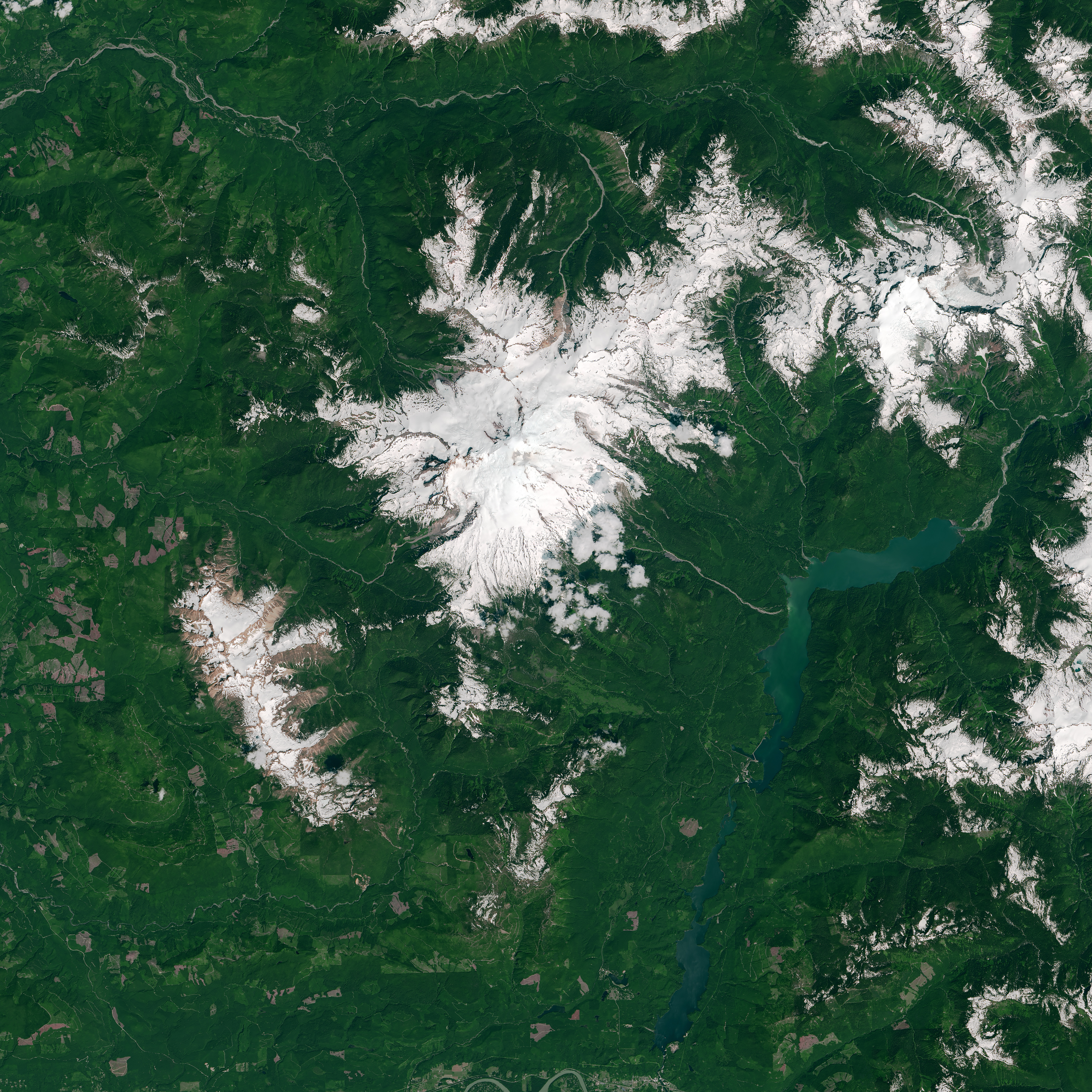
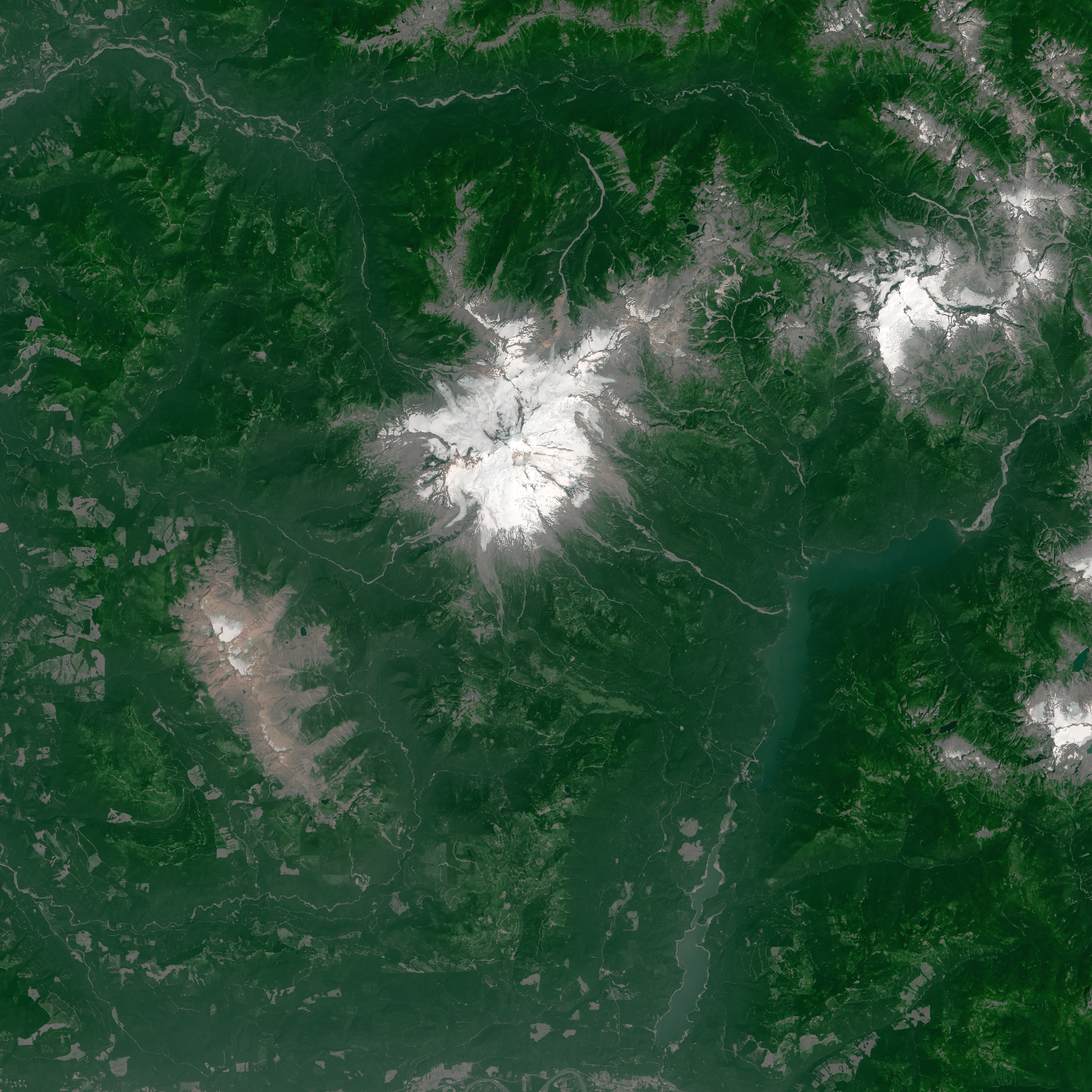
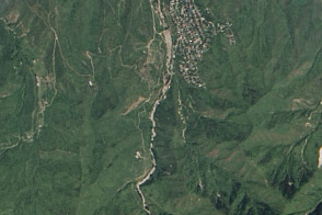
Winter and spring 2015 brought average or just-below average precipitation to the Pacific Northwest of North America. However, much of that precipitation fell as rain, not snow, and diminished snowpack was soon evident on peaks throughout the Cascade and Olympic mountain ranges. One of those peaks, Mount Baker, stands as a visible reminder of climate change in the area.
Mount Baker is located in Washington state, about 25 kilometers (15 miles) south of the Canadian border and 135 kilometers (85 miles) northeast of Seattle. The stratovolcano is the highest peak in the North Cascades, rising 3,286 meters (10,780 feet) above sea level. Every year the mountain retains a patch of “permanent” snow and ice that persists through the summer. The size of that patch, however, is shrinking and seeming less permanent.
The change is apparent in these natural-color images acquired with the Operational Land Imager (OLI) on Landsat 8. They show the extent of snow and ice cover on Mount Baker in early July 2013 and 2015.
Cryospheric scientist Dorothy Hall and programmer Nicolo DiGirolamo, at NASA’s Goddard Space Flight Center, used the Landsat images to calculate the snow cover extent. On July 3, 2013, about 123 square kilometers (47 square miles) blanketed the mountain; by July 9, 2015, the area had shrunk to 45 square kilometers (17 square miles). There were no cloud-free scenes in early July 2014.
However, it was not just the snow that was sparse in 2015. The glaciers on Mount Baker have also retreated—a change that has taken place over a period of decades.
“Landsat provides us with an unparalleled record from which we can measure interannual changes in snow and ice,” Hall said. “We can document details of the snow drought in the Pacific Northwest and even compute decade-scale trends, such as the extent of the glaciers on Mount Baker.”
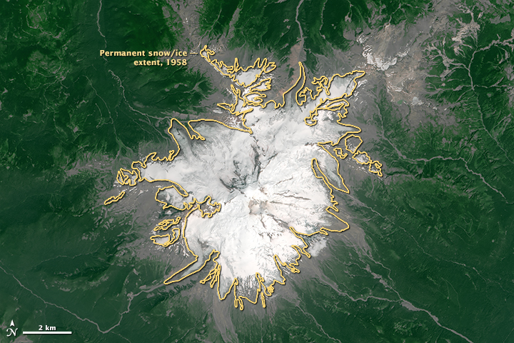
Mount Baker’s flanks support the largest contiguous network of glaciers in the North Cascades, and they have been extensively studied. In the close-up image below, the glacier extent in 1958—which at the time covered 51 square kilometers (20 square miles)—is outlined in yellow on top of the 2015 image. According to research published in 2012, glacier coverage has dropped to about 39 square kilometers.
The 2015 snow drought on Mt. Baker and other mountains in the Pacific Northwest has implications for wildlife, for fire risk, and for agriculture. Some reservoirs in the region were reported to be stable thanks to ample rainfall, but others that rely on snowmelt-fed streams are less abundant during the dry months.
NASA Earth Observatory images by Joshua Stevens, using Landsat data from the U.S. Geological Survey and glacier extent data courtesy of Andrew Fountain, Glaciers of the American West Project, Portland State University. Caption by Kathryn Hansen.