The Earth Observatory has published its last Image of the Day on this website. Please join us on our new home at science.nasa.gov/earth/earth-observatory.
Today's story is part of our recent feature series Landsat Goes Over the Top: A Long View of the Arctic.
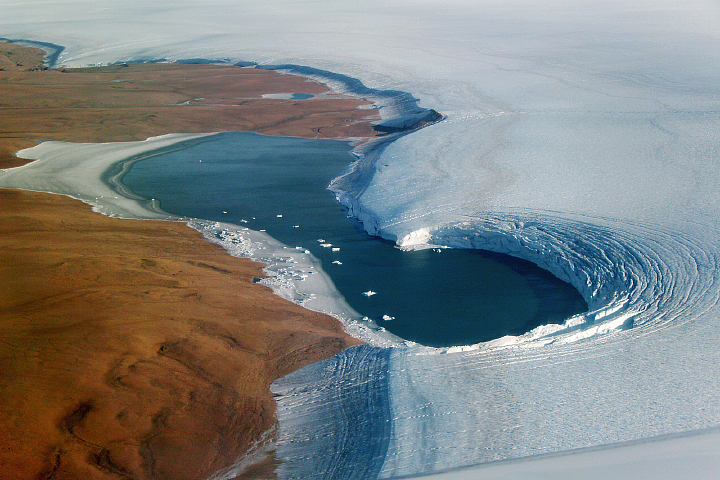
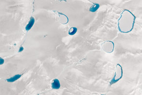
When satellites passed over on August 16, 2011, the Flade Isblink ice cap in northeast Greenland had a relatively smooth surface. By September 6—the next time that clouds parted long enough for another look—an impressive mitten-shaped basin had taken shape.
The feature was created when a lake beneath the ice—a “subglacial lake”—quickly emptied into a nearby fjord, notes Michael Willis, a glaciologist at Cornell University and lead author of a recent paper published in Nature. Water rushed from the lake at a rate of about 215 cubic meters per second and caused the ice surface to collapse, forming a 70-meter-deep basin.
“Serendipity in science is important,” Willis said. “I wasn't looking for this feature, and it was a surprise to see it.” According to NASA glaciologist Kelly Brunt, the drainage event “is perhaps the first recorded instance of a rapid drainage of a subglacial lake in Greenland.”
Researchers already knew that Greenland’s glacial plumbing system had drainage channels that can move meltwater from the surface, down through the ice, to the bedrock and to the ocean. Willis’ research confirmed that melt water can also be trapped and stored at the base of Greenland’s ice sheets and then quickly released. Moreover, the basin on Flade Isblink appears to be refilling.
The image at the top of this page shows the mitten-shaped basin on June 21, 2014—the summer solstice—as it appeared to the Operational Land Imager (OLI) on Landsat 8. In the two years prior to this image, the basin gained as much as 38 meters of elevation. The researchers attribute the uplift in part to meltwater from the surface flowing through crevasses and refilling the subglacial lake. The crevasses are just south of the basin, and happen to be covered with snow (not visible) in this image.
Snow and ice flow also contribute to elevation change by filling the basin at its surface. However, a preliminary look at data from summer 2014 indicates that water flow into nearby crevasses remains the primary cause of continued elevation gain, according to Willis. That means that the basin at the bottom of the ice cap still has some capacity available, he said.

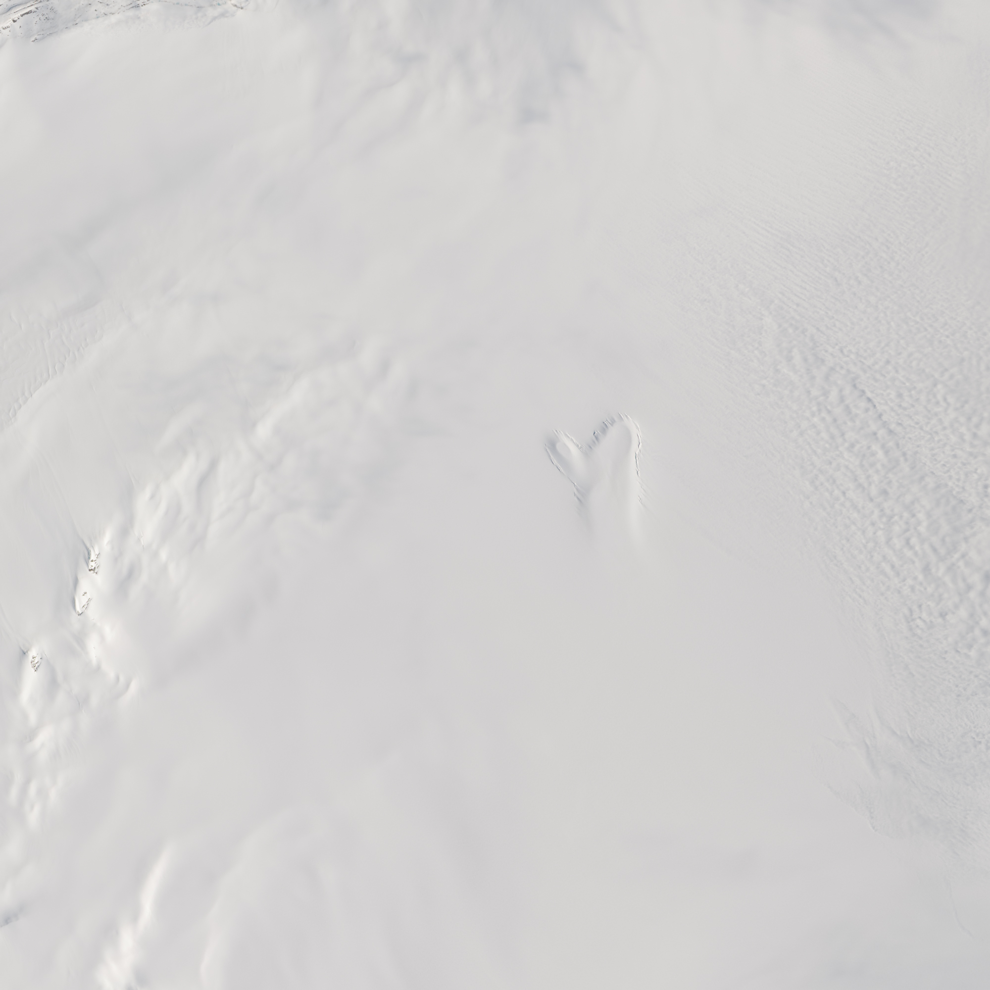
The photograph above was acquired on April 26, 2013, from a research flight during NASA’s Operation IceBridge mission. Data from the flights were used to show that the temperature below the ice was too cold for meltwater to form in the familiar way—from friction between the ice sheet and rock, or from the heat of the bedrock alone. The data supported the notion that something else, such as surface melt, was refilling the lake.
The phenomenon is important for trying to understand how ice sheets will respond to a warming climate, according to Willis. Warmth from meltwater trapped in subglacial lakes like “the mitten” could make the underside of the ice warmer and softer, promoting faster ice flow.
NASA Earth Observatory image (top) by Jesse Allen and Robert Simmon, using Landsat data from the U.S. Geological Survey and acquired by special request with the support of Theresa Arvidson (NASA/GSFC) and Eugene Fosnight (USGS/EDC). Photograph by Michael Studinger/NASA. Caption by Kathryn Hansen.